Le Pin-Murelet (Le Pin-Murelet)

- commune in Haute-Garonne, France
- Country:

- Postal Code: 31370
- Coordinates: 43° 24' 4" N, 1° 1' 4" E


- GPS tracks (wikiloc): [Link]
- Area: 12.04 sq km
- Population: 169
- Wikipedia en: wiki(en)
- Wikipedia: wiki(fr)
- Wikidata storage: Wikidata: Q1429112
- Wikipedia Commons Category: [Link]
- Freebase ID: [/m/03nt57h]
- Freebase ID: [/m/03nt57h]
- GeoNames ID: Alt: [6455855]
- GeoNames ID: Alt: [6455855]
- SIREN number: [213104193]
- SIREN number: [213104193]
- BnF ID: [152554147]
- BnF ID: [152554147]
- INSEE municipality code: 31419
- INSEE municipality code: 31419
Shares border with regions:
Montpézat
- commune in Gers, France
- Country:
- Postal Code: 32220
- Coordinates: 43° 23' 42" N, 0° 58' 4" E
- GPS tracks (wikiloc): [Link]
- Area: 15.64 sq km
- Population: 242


Laymont
- commune in Gers, France
- Country:
- Postal Code: 32220
- Coordinates: 43° 25' 22" N, 0° 59' 12" E
- GPS tracks (wikiloc): [Link]
- Area: 11.05 sq km
- Population: 208
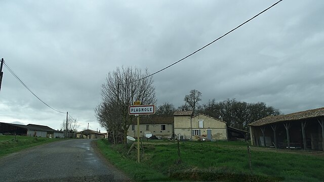
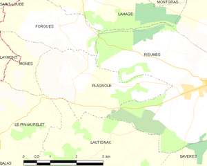
Plagnole
- commune in Haute-Garonne, France
- Country:
- Postal Code: 31370
- Coordinates: 43° 24' 49" N, 1° 3' 22" E
- GPS tracks (wikiloc): [Link]
- Area: 7.24 sq km
- Population: 307


Sajas
- commune in Haute-Garonne, France
- Country:
- Postal Code: 31370
- Coordinates: 43° 22' 35" N, 1° 1' 14" E
- GPS tracks (wikiloc): [Link]
- Area: 5 sq km
- Population: 118


Lautignac
- commune in Haute-Garonne, France
- Country:
- Postal Code: 31370
- Coordinates: 43° 22' 54" N, 1° 3' 27" E
- GPS tracks (wikiloc): [Link]
- Area: 17.77 sq km
- Population: 271

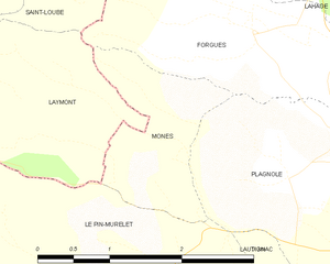
Monès
- commune in Haute-Garonne, France
- Country:
- Postal Code: 31370
- Coordinates: 43° 24' 54" N, 1° 2' 12" E
- GPS tracks (wikiloc): [Link]
- Area: 2.52 sq km
- Population: 90
- Web site: [Link]