Le Pompidou (Le Pompidou)

- commune in Lozère, France
- Country:

- Postal Code: 48110
- Coordinates: 44° 11' 43" N, 3° 39' 16" E


- GPS tracks (wikiloc): [Link]
- Area: 22.8 sq km
- Population: 166
- Wikipedia en: wiki(en)
- Wikipedia: wiki(fr)
- Wikidata storage: Wikidata: Q192059
- Wikipedia Commons Category: [Link]
- Freebase ID: [/m/02w96vf]
- Freebase ID: [/m/02w96vf]
- GeoNames ID: Alt: [6456050]
- GeoNames ID: Alt: [6456050]
- SIREN number: [214801151]
- SIREN number: [214801151]
- BnF ID: [15261520p]
- BnF ID: [15261520p]
- VIAF ID: Alt: [234313386]
- VIAF ID: Alt: [234313386]
- GND ID: Alt: [4399851-3]
- GND ID: Alt: [4399851-3]
- INSEE municipality code: 48115
- INSEE municipality code: 48115
Shares border with regions:

Molezon
- commune in Lozère, France
- Country:
- Postal Code: 48110
- Coordinates: 44° 12' 30" N, 3° 40' 53" E
- GPS tracks (wikiloc): [Link]
- Area: 14.76 sq km
- Population: 93

Barre-des-Cévennes
- commune in Lozère, France
- Country:
- Postal Code: 48400
- Coordinates: 44° 14' 41" N, 3° 39' 12" E
- GPS tracks (wikiloc): [Link]
- Area: 34.29 sq km
- Population: 199


Saint-André-de-Valborgne
- commune in Gard, France
- Country:
- Postal Code: 30940
- Coordinates: 44° 9' 22" N, 3° 40' 58" E
- GPS tracks (wikiloc): [Link]
- Area: 48.71 sq km
- Population: 411


Gabriac
- commune in Lozère, France
- Country:
- Postal Code: 48110
- Coordinates: 44° 32' 45" N, 3° 22' 25" E
- GPS tracks (wikiloc): [Link]
- Area: 8.44 sq km
- Population: 99

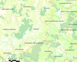
Vebron
- commune in Lozère, France
- Country:
- Postal Code: 48400
- Coordinates: 44° 14' 21" N, 3° 34' 40" E
- GPS tracks (wikiloc): [Link]
- Area: 69.66 sq km
- Population: 197
- Web site: [Link]

Bassurels
- commune in Lozère, France
- Country:
- Postal Code: 48400
- Coordinates: 44° 10' 45" N, 3° 37' 30" E
- GPS tracks (wikiloc): [Link]
- Area: 46.34 sq km
- Population: 62