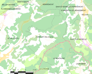
Le Val-d'Ajol (Le Val-d'Ajol)

- commune in Vosges, France
- Country:

- Postal Code: 88340
- Coordinates: 47° 55' 30" N, 6° 29' 0" E


- GPS tracks (wikiloc): [Link]
- Area: 73.33 sq km
- Population: 3896
- Web site: http://www.valdajol.fr
- Wikipedia en: wiki(en)
- Wikipedia: wiki(fr)
- Wikidata storage: Wikidata: Q192426
- Wikipedia Commons Category: [Link]
- Freebase ID: [/m/03qh8fg]
- Freebase ID: [/m/03qh8fg]
- GeoNames ID: Alt: [6456615]
- GeoNames ID: Alt: [6456615]
- SIREN number: [218804870]
- SIREN number: [218804870]
- BnF ID: [152794060]
- BnF ID: [152794060]
- VIAF ID: Alt: [155973550]
- VIAF ID: Alt: [155973550]
- Library of Congress authority ID: Alt: [n83032700]
- Library of Congress authority ID: Alt: [n83032700]
- MusicBrainz area ID: [03ebd363-9a3c-478c-98ae-ab4fc2435216]
- MusicBrainz area ID: [03ebd363-9a3c-478c-98ae-ab4fc2435216]
- INSEE municipality code: 88487
- INSEE municipality code: 88487
Shares border with regions:


Saint-Nabord
- commune in Vosges, France
- Country:
- Postal Code: 88200
- Coordinates: 48° 2' 58" N, 6° 34' 47" E
- GPS tracks (wikiloc): [Link]
- Area: 38.5 sq km
- Population: 4057
- Web site: [Link]


Saint-Étienne-lès-Remiremont
- commune in Vosges, France
- Country:
- Postal Code: 88200
- Coordinates: 48° 1' 25" N, 6° 36' 16" E
- GPS tracks (wikiloc): [Link]
- Area: 33.81 sq km
- Population: 3836
- Web site: [Link]


Remiremont
- commune in Vosges, France
- Country:
- Postal Code: 88200
- Coordinates: 48° 1' 1" N, 6° 35' 24" E
- GPS tracks (wikiloc): [Link]
- AboveSeaLevel: 400 м m
- Area: 18 sq km
- Population: 7741
- Web site: [Link]


Plombières-les-Bains
- commune in Vosges, France
- Country:
- Postal Code: 88370
- Coordinates: 47° 57' 59" N, 6° 27' 47" E
- GPS tracks (wikiloc): [Link]
- Area: 27.2 sq km
- Population: 1699
- Web site: [Link]

Girmont-Val-d'Ajol
- commune in Vosges, France
- Country:
- Postal Code: 88340
- Coordinates: 47° 57' 14" N, 6° 33' 41" E
- GPS tracks (wikiloc): [Link]
- Area: 16.67 sq km
- Population: 240

Saint-Bresson
- commune in Haute-Saône, France
- Country:
- Postal Code: 70280
- Coordinates: 47° 52' 13" N, 6° 30' 23" E
- GPS tracks (wikiloc): [Link]
- Area: 26.6 sq km
- Population: 450


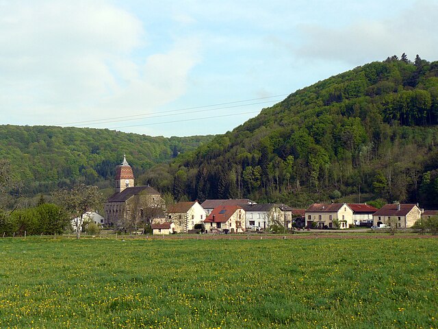
La Longine
- commune in Haute-Saône, France
- Country:
- Postal Code: 70310
- Coordinates: 47° 53' 1" N, 6° 35' 27" E
- GPS tracks (wikiloc): [Link]
- Area: 12.4 sq km
- Population: 230


Fougerolles
- commune in Haute-Saône, France
- Country:
- Postal Code: 70220
- Coordinates: 47° 53' 7" N, 6° 24' 10" E
- GPS tracks (wikiloc): [Link]
- Area: 51.12 sq km
- Population: 3670
- Web site: [Link]