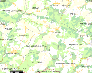
Plombières-les-Bains (Plombières-les-Bains)

- commune in Vosges, France
- Country:

- Postal Code: 88370
- Coordinates: 47° 57' 59" N, 6° 27' 47" E


- GPS tracks (wikiloc): [Link]
- Area: 27.2 sq km
- Population: 1699
- Web site: http://www.plombiereslesbains.fr
- Wikipedia en: wiki(en)
- Wikipedia: wiki(fr)
- Wikidata storage: Wikidata: Q632969
- Wikipedia Commons Category: [Link]
- Freebase ID: [/m/03cvwtn]
- Freebase ID: [/m/03cvwtn]
- GeoNames ID: Alt: [2986715]
- GeoNames ID: Alt: [2986715]
- SIREN number: [218803518]
- SIREN number: [218803518]
- BnF ID: [15279274x]
- BnF ID: [15279274x]
- VIAF ID: Alt: [139396878]
- VIAF ID: Alt: [139396878]
- Library of Congress authority ID: Alt: [n87151487]
- Library of Congress authority ID: Alt: [n87151487]
- PACTOLS thesaurus ID: [pcrtGIx0LEmthb]
- PACTOLS thesaurus ID: [pcrtGIx0LEmthb]
- MusicBrainz area ID: [ca314260-f20f-4bab-a06a-902657737efd]
- MusicBrainz area ID: [ca314260-f20f-4bab-a06a-902657737efd]
- WOEID: [616955]
- WOEID: [616955]
- Digital Atlas of the Roman Empire ID: [20759]
- Digital Atlas of the Roman Empire ID: [20759]
- ISNI: Alt: [0000 0001 2167 2402]
- ISNI: Alt: [0000 0001 2167 2402]
- INSEE municipality code: 88351
- INSEE municipality code: 88351
Shares border with regions:


Saint-Nabord
- commune in Vosges, France
- Country:
- Postal Code: 88200
- Coordinates: 48° 2' 58" N, 6° 34' 47" E
- GPS tracks (wikiloc): [Link]
- Area: 38.5 sq km
- Population: 4057
- Web site: [Link]


Le Val-d'Ajol
- commune in Vosges, France
- Country:
- Postal Code: 88340
- Coordinates: 47° 55' 30" N, 6° 29' 0" E
- GPS tracks (wikiloc): [Link]
- Area: 73.33 sq km
- Population: 3896
- Web site: [Link]


Aillevillers-et-Lyaumont
- commune in Haute-Saône, France
- Country:
- Postal Code: 70320
- Coordinates: 47° 55' 13" N, 6° 20' 9" E
- GPS tracks (wikiloc): [Link]
- Area: 36.3 sq km
- Population: 1584
- Web site: [Link]

Xertigny
- commune in Vosges, France
- Country:
- Postal Code: 88220
- Coordinates: 48° 2' 44" N, 6° 24' 22" E
- GPS tracks (wikiloc): [Link]
- Area: 50.25 sq km
- Population: 2631
- Web site: [Link]


Le Clerjus
- commune in Vosges, France
- Country:
- Postal Code: 88240
- Coordinates: 47° 57' 34" N, 6° 19' 17" E
- GPS tracks (wikiloc): [Link]
- Area: 32.93 sq km
- Population: 561


Bellefontaine
- commune in Vosges, France
- Country:
- Postal Code: 88370
- Coordinates: 48° 0' 47" N, 6° 26' 34" E
- GPS tracks (wikiloc): [Link]
- Area: 39.11 sq km
- Population: 997


Fougerolles
- commune in Haute-Saône, France
- Country:
- Postal Code: 70220
- Coordinates: 47° 53' 7" N, 6° 24' 10" E
- GPS tracks (wikiloc): [Link]
- Area: 51.12 sq km
- Population: 3670
- Web site: [Link]