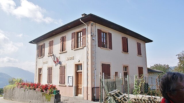
Le Verneil (Le Verneil)

- commune in Savoie, France
 Hiking in Le Verneil
Le Verneil, which is often associated with the Verneil massif in the French Alps, is a beautiful area for hiking enthusiasts. The region is known for its stunning alpine landscapes, with dramatic peaks, lush valleys, and crystal-clear lakes.
Key Highlights:
-
Scenic Trails: The Verneil massif offers a variety of hiking trails suitable for different skill levels—ranging from easy walks to challenging climbs. Popular routes often provide breathtaking views of the surrounding mountains.
-
Flora and Fauna: Hikers can immerse themselves in diverse ecosystems, encountering various species of wildflowers, trees, and wildlife, such as chamois and marmots.
-
Accessibility: Many trails are accessible from nearby villages and towns, making it easy to plan day hikes. Local tourism offices can provide maps and information on the best trails.
-
Seasonal Hiking: The best time to hike in this region is typically from late spring to early autumn, as winter conditions can be harsh. Be sure to check the weather and trail conditions before heading out.
-
Safety: As with any mountain hiking, it's vital to be prepared. Bring appropriate gear, sufficient water, snacks, and familiarize yourself with the terrain before starting your hike.
-
Local Culture: Hiking in Le Verneil also provides an opportunity to explore traditional alpine villages, where you can experience local cuisine and culture.
-
Guided Tours: For those new to the area or looking for a deeper understanding of the landscape, consider joining a guided hiking tour.
Tips:
- Always carry a map or a GPS device.
- Wear appropriate hiking footwear and clothing.
- Start hikes early to avoid afternoon thunderstorms, especially in summer.
- Respect local wildlife and adhere to Leave No Trace principles to preserve the natural beauty of the area.
Overall, hiking in Le Verneil offers a unique blend of natural beauty, adventure, and cultural experience, making it a fantastic destination for outdoor enthusiasts.
- Country:

- Postal Code: 73110
- Coordinates: 45° 27' 47" N, 6° 10' 0" E


- GPS tracks (wikiloc): [Link]
- Area: 7.52 sq km
- Population: 96
- Wikipedia en: wiki(en)
- Wikipedia: wiki(fr)
- Wikidata storage: Wikidata: Q1164415
- Wikipedia Commons Category: [Link]
- Freebase ID: [/m/03qln8s]
- GeoNames ID: Alt: [6442921]
- SIREN number: [217303114]
- BnF ID: [15274241r]
- INSEE municipality code: 73311
Shares border with regions:

Étable
- commune in Savoie, France
Hiking in Étable
Étable is a charming area often associated with beautiful landscapes, scenic trails, and diverse ecosystems that make it an attractive destination for hiking enthusiasts. However, since "Étable" refers to various locations in French-speaking regions, I'll provide a general overview of what to expect when hiking in regions that may have this name, such as Étable-sur-Montmel, located in France....
- Country:
- Postal Code: 73110
- Coordinates: 45° 27' 47" N, 6° 8' 29" E
- GPS tracks (wikiloc): [Link]
- Area: 2.7 sq km
- Population: 388
Presle
- commune in Savoie, France
Hiking in Presle
Presle, located in the Auvergne-Rhône-Alpes region of France, is a beautiful area known for its stunning landscapes and diverse hiking opportunities. Nestled near the Vercors Mountains, it offers a range of trails suitable for hikers of all skill levels, from leisurely walks to more challenging treks....
- Country:
- Postal Code: 73110
- Coordinates: 45° 27' 16" N, 6° 8' 18" E
- GPS tracks (wikiloc): [Link]
- Area: 11.58 sq km
- Population: 419


Saint-Alban-d'Hurtières
- commune in Savoie, France
Hiking in Saint-Alban-d'Hurtières
Saint-Alban-d'Hurtières, located in the Savoie region of the French Alps, is a hidden gem for hiking enthusiasts. The area offers a mix of stunning mountain landscapes, lush forests, and diverse wildlife, making it suitable for hikers of all levels. Here are some highlights about hiking in this region:...
- Country:
- Postal Code: 73220
- Coordinates: 45° 29' 0" N, 6° 16' 35" E
- GPS tracks (wikiloc): [Link]
- Area: 19.4 sq km
- Population: 337


La Table
- commune in Savoie, France
Hiking in La Table
La Table, located on the island of La Réunion in the Indian Ocean, is a prominent hiking destination known for its stunning landscapes, unique geological features, and rich biodiversity. Here’s what you need to know about hiking in La Table:...
- Country:
- Postal Code: 73110
- Coordinates: 45° 28' 48" N, 6° 10' 18" E
- GPS tracks (wikiloc): [Link]
- Area: 14.85 sq km
- Population: 475