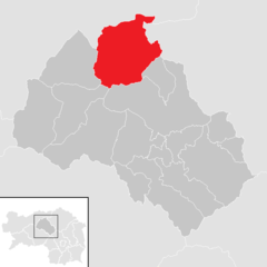
Leoben District (Bezirk Leoben)

- district of Austria
 Hiking in Leoben District
Leoben District, located in Styria, Austria, offers a variety of hiking opportunities for outdoor enthusiasts. The landscape is characterized by rolling hills, rugged mountains, lush forests, and beautiful valleys, making it a picturesque destination for hikers of all skill levels.
Popular Hiking Areas
-
Lebensraum Mur Valley: This region is known for its scenic trails along the Mur River. Hikers can enjoy pleasant walks, often combined with opportunities for birdwatching and enjoying the diverse flora and fauna.
-
Stuhleck Mountain: Located nearby, this area features well-marked trails leading to stunning vistas. The hike to the summit can be a rewarding experience, especially for those who enjoy panoramic views of the surrounding region.
-
Sierra of the Hochlantsch: This area provides more challenging hikes, suitable for experienced hikers. Trails here can lead to higher altitudes and offer breathtaking views of the surrounding Alps and valleys.
-
Trail of the Red Fox: A family-friendly hiking route designed to engage younger hikers with stories and educational elements. It's an excellent introduction to local wildlife and ecosystem.
Tips for Hiking in Leoben District
-
Best Time to Hike: Late spring to early autumn (May to September) is generally the best time for hiking due to favorable weather conditions and full access to the trails. However, some lower trails might still be accessible in early spring and late autumn.
-
Trail Difficulty: Trails vary from easy to challenging, so it's important to choose a route that matches your experience level. Make sure to carry a map or use GPS for navigation.
-
Equipment: Wear sturdy hiking boots, dress in layers, and carry enough water and snacks. A first-aid kit and a hiking pole can also be beneficial for longer hikes.
-
Respect Nature: Follow Leave No Trace principles to help preserve the natural beauty of the area. Stay on marked paths and avoid disturbing wildlife.
-
Local Amenities: The town of Leoben offers various accommodations, restaurants, and shops where you can rest and refuel after your hikes.
Whether you’re seeking a gentle stroll or a more demanding trek, Leoben District has something to offer for every hiker. Enjoy your exploration of this stunning region!
- Country:

- Capital: Leoben
- Coordinates: 47° 24' 36" N, 14° 58' 37" E


- GPS tracks (wikiloc): [Link]
- AboveSeaLevel: 849 м m
- Area: 1052 sq km
- Population: 61544
- Web site: http://www.bh-leoben.steiermark.at/
- Wikipedia en: wiki(en)
- Wikipedia: wiki(de)
- Wikidata storage: Wikidata: Q665720
- Wikipedia Commons Category: [Link]
- Wikipedia Commons Maps Category: [Link]
- Freebase ID: [/m/0dzvdl]
- GeoNames ID: Alt: [2772648]
- VIAF ID: Alt: [242977580]
- OSM relation ID: [49964]
- GND ID: Alt: [4035361-8]
- archINFORM location ID: [14695]
Includes regions:
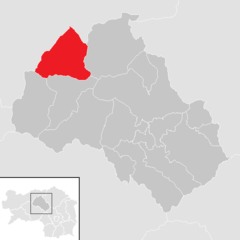
Mautern in Steiermark
- municipality in Austria
Hiking in Mautern in Steiermark
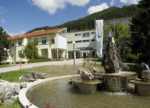
Mautern in Steiermark is a lovely destination for hiking enthusiasts, offering a range of trails that cater to different skill levels and providing beautiful views of the surrounding landscapes. The region is characterized by its rolling hills, lush forests, and picturesque valleys, making it ideal for both leisurely walks and more challenging hikes....
- Country:
- Postal Code: 8774
- Local Dialing Code: 03845
- Licence Plate Code: LN
- Coordinates: 47° 24' 0" N, 14° 50' 0" E
- GPS tracks (wikiloc): [Link]
- AboveSeaLevel: 713 м m
- Area: 108.7 sq km
- Population: 1766
- Web site: [Link]

Eisenerz
- municipality in Austria
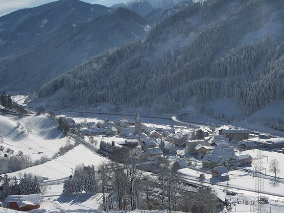
Hiking in Eisenerz
Eisenerz, located in Austria's Styria region, is a fantastic destination for hiking enthusiasts. Nestled in the foothills of the Alps, the area offers a stunning combination of mountainous landscapes, lush valleys, and rich cultural history. Here are some key highlights and tips for hiking in Eisenerz:...
- Country:
- Postal Code: 8790
- Local Dialing Code: 03848
- Licence Plate Code: LN
- Coordinates: 47° 33' 0" N, 14° 53' 0" E
- GPS tracks (wikiloc): [Link]
- AboveSeaLevel: 736 м m
- Area: 124 sq km
- Population: 4048
- Web site: [Link]


Leoben
- municipality in Austria
Hiking in Leoben
Leoben, located in the Styria region of Austria, is surrounded by beautiful natural landscapes that offer a variety of hiking opportunities. The region is characterized by rolling hills, forests, and mountainous terrains, making it a great destination for both casual hikers and those looking for more challenging trails....
- Country:
- Postal Code: 8792; 8700
- Local Dialing Code: 03842
- Licence Plate Code: LE
- Coordinates: 47° 22' 54" N, 15° 5' 50" E
- GPS tracks (wikiloc): [Link]
- AboveSeaLevel: 541 м m
- Area: 108 sq km
- Population: 24645
- Web site: [Link]
Proleb
- municipality in Austria
Hiking in Proleb
It seems like "Proleb" might refer to a specific location or hiking area that isn't widely recognized or documented in hiking resources as of my last update in October 2023. It's possible that it's a local term or a lesser-known trail....
- Country:
- Postal Code: 8712
- Local Dialing Code: 03842
- Licence Plate Code: LN
- Coordinates: 47° 24' 0" N, 15° 8' 0" E
- GPS tracks (wikiloc): [Link]
- AboveSeaLevel: 540 м m
- Area: 24.49 sq km
- Population: 1534
- Web site: [Link]

Radmer
- municipality in Austria
Hiking in Radmer
Radmer is a picturesque region located in Austria, known for its stunning landscapes and diverse hiking trails. Nestled in the Eastern Alps, Radmer offers hikers opportunities to explore lush forests, alpine meadows, and breathtaking mountain views. Here are some highlights of hiking in Radmer:...
- Country:
- Postal Code: 8795
- Local Dialing Code: 03635
- Licence Plate Code: LN
- Coordinates: 47° 32' 42" N, 14° 45' 28" E
- GPS tracks (wikiloc): [Link]
- AboveSeaLevel: 729 м m
- Area: 82.42 sq km
- Population: 559
- Web site: [Link]

Trofaiach
- municipality in Austria
Hiking in Trofaiach
Trofaiach, located in Austria’s Styria region, offers a range of hiking opportunities for both casual walkers and experienced trekkers. Nestled in the scenic Austrian Alps, the area provides stunning views, diverse landscapes, and well-marked trails, making it an attractive destination for outdoor enthusiasts....
- Country:
- Postal Code: 8793
- Local Dialing Code: 03847
- Licence Plate Code: LN
- Coordinates: 47° 25' 31" N, 15° 0' 25" E
- GPS tracks (wikiloc): [Link]
- AboveSeaLevel: 660 м m
- Area: 143.25 sq km
- Population: 11125
- Web site: [Link]
Kraubath an der Mur
- municipality in Austria
Hiking in Kraubath an der Mur
Kraubath an der Mur, located in Styria, Austria, offers a variety of hiking opportunities amid beautiful natural landscapes. The town is nestled along the Mur River, surrounded by rolling hills and forests, making it an excellent base for both leisurely walks and more challenging hikes....
- Country:
- Postal Code: 8714
- Local Dialing Code: 03832
- Licence Plate Code: LN
- Coordinates: 47° 18' 24" N, 14° 56' 9" E
- GPS tracks (wikiloc): [Link]
- AboveSeaLevel: 632 м m
- Area: 27.44 sq km
- Population: 1283
- Web site: [Link]


Sankt Stefan ob Leoben
- municipality in Austria
Hiking in Sankt Stefan ob Leoben
Sankt Stefan ob Leoben is a charming village located in Austria’s Styria region, surrounded by beautiful landscapes that are great for hiking enthusiasts. The area is characterized by rolling hills, forests, and scenic views, making it a perfect spot for both casual walks and more challenging hikes....
- Country:
- Postal Code: 8713
- Local Dialing Code: 03832
- Licence Plate Code: LN
- Coordinates: 47° 19' 11" N, 14° 58' 39" E
- GPS tracks (wikiloc): [Link]
- AboveSeaLevel: 588 м m
- Area: 78.72 sq km
- Population: 1930
- Web site: [Link]
Sankt Peter-Freienstein
- municipality in Austria
Hiking in Sankt Peter-Freienstein
Sankt Peter-Freienstein, located in Styria, Austria, offers a variety of hiking opportunities amidst beautiful landscapes and natural scenery. Here are some highlights and tips for hiking in the area:...
- Country:
- Postal Code: 8792
- Local Dialing Code: 03842
- Licence Plate Code: LN
- Coordinates: 47° 23' 56" N, 15° 1' 54" E
- GPS tracks (wikiloc): [Link]
- AboveSeaLevel: 600 м m
- Area: 27.35 sq km
- Population: 2383
- Web site: [Link]

Kammern im Liesingtal
- municipality in Austria
Hiking in Kammern im Liesingtal
Kammern im Liesingtal, located in Styria, Austria, offers some beautiful hiking opportunities for outdoor enthusiasts. The region is characterized by its stunning natural scenery, including lush valleys, gentle hills, and rocky mountain trails. Here are some highlights regarding hiking in Kammern im Liesingtal:...
- Country:
- Local Dialing Code: 03844
- Licence Plate Code: LN
- Coordinates: 47° 23' 31" N, 14° 54' 8" E
- GPS tracks (wikiloc): [Link]
- AboveSeaLevel: 664 м m
- Area: 58.66 sq km
- Population: 1600
- Web site: [Link]

Kalwang
- municipality in Austria
Hiking in Kalwang
Kalwang is a region in Nepal, primarily known for its stunning landscapes and diverse trekking routes. It's situated near the Langtang National Park, which offers a blend of natural beauty, cultural experiences, and wildlife watching opportunities. Here are some key details about hiking in Kalwang:...
- Country:
- Postal Code: 8775
- Local Dialing Code: 03846
- Licence Plate Code: LN
- Coordinates: 47° 25' 36" N, 14° 45' 23" E
- GPS tracks (wikiloc): [Link]
- AboveSeaLevel: 751 м m
- Area: 67.15 sq km
- Population: 988
- Web site: [Link]

Sankt Michael in Obersteiermark
- municipality in Austria
Hiking in Sankt Michael in Obersteiermark
Sankt Michael in Obersteiermark is a picturesque town located in the beautiful Austrian region of Styria. Known for its stunning natural landscapes, it's a great destination for hiking enthusiasts of all levels. Here are some highlights and considerations for hiking in this area:...
- Country:
- Local Dialing Code: 03843
- Licence Plate Code: LN
- Coordinates: 47° 20' 19" N, 15° 1' 6" E
- GPS tracks (wikiloc): [Link]
- AboveSeaLevel: 596 м m
- Area: 56 sq km
- Population: 3060
- Web site: [Link]

Niklasdorf
- municipality in Austria
Hiking in Niklasdorf
Niklasdorf is a small town located in Styria, Austria, known for its beautiful landscapes and access to the surrounding nature. Hiking in and around Niklasdorf is a delightful experience for both beginners and seasoned hikers. Here are some key points to consider when hiking in this region:...
- Country:
- Postal Code: 8712
- Local Dialing Code: 03842
- Licence Plate Code: LN
- Coordinates: 47° 23' 42" N, 15° 9' 25" E
- GPS tracks (wikiloc): [Link]
- AboveSeaLevel: 521 м m
- Area: 15.17 sq km
- Population: 2515
- Web site: [Link]

Hieflau
- former municipality in Austria
Hiking in Hieflau
Hieflau is a picturesque village located in the scenic region of Styria, Austria, surrounded by stunning mountainous landscapes that are perfect for hiking enthusiasts. The area is characterized by its lush forests, alpine meadows, and numerous trails that cater to various skill levels—from leisurely walks to challenging climbs....
- Country:
- Local Dialing Code: 03634
- Licence Plate Code: LN
- Coordinates: 47° 36' 0" N, 14° 45' 0" E
- GPS tracks (wikiloc): [Link]
- AboveSeaLevel: 503 м m
- Area: 46.97 sq km
- Population: 730
Traboch
- municipality in Austria
Hiking in Traboch
Traboch, a small locale in Austria, is often appreciated for its picturesque landscapes and quaint surroundings, making it a lovely destination for hiking enthusiasts. Although Traboch itself may not be widely recognized as a major hiking hub, its proximity to the larger mountainous areas in Styria provides access to various trails and outdoor activities....
- Country:
- Local Dialing Code: 03833
- Licence Plate Code: LN
- Coordinates: 47° 22' 38" N, 14° 59' 13" E
- GPS tracks (wikiloc): [Link]
- AboveSeaLevel: 622 м m
- Area: 12.52 sq km
- Population: 1384
- Web site: [Link]
Wald am Schoberpass
- municipality in Austria
Hiking in Wald am Schoberpass
Wald am Schoberpass, located in Austria, is a beautiful destination for hiking enthusiasts. Nestled in the Austrian Alps, this area offers a variety of trails suitable for different skill levels, from casual walkers to experienced hikers....
- Country:
- Postal Code: 8781
- Local Dialing Code: 03834
- Licence Plate Code: LN
- Coordinates: 47° 27' 10" N, 14° 40' 13" E
- GPS tracks (wikiloc): [Link]
- AboveSeaLevel: 849 м m
- Area: 90.43 sq km
- Population: 586
- Web site: [Link]
Vordernberg
- municipality in Austria
Hiking in Vordernberg
Vordernberg is a picturesque village located in the state of Styria, Austria, known for its stunning landscapes and outdoor activities, including hiking. Nestled in the Alps, it offers a variety of trails that cater to different skill levels, making it an excellent destination for both novice and experienced hikers....
- Country:
- Postal Code: 8794
- Local Dialing Code: 03849
- Licence Plate Code: LN
- Coordinates: 47° 29' 17" N, 14° 59' 36" E
- GPS tracks (wikiloc): [Link]
- AboveSeaLevel: 820 м m
- Area: 27.74 sq km
- Population: 1045
- Web site: [Link]
Shares border with regions:


Graz-Umgebung District
- district in Austria
Hiking in Graz-Umgebung District
Graz-Umgebung District, located around the city of Graz in Austria, offers a wide range of hiking opportunities, featuring scenic landscapes, lush forests, and picturesque hilltops. Here are some highlights and recommendations for hiking in this area:...
- Country:
- Capital: Graz
- Licence Plate Code: GU
- Coordinates: 47° 3' 43" N, 15° 24' 54" E
- GPS tracks (wikiloc): [Link]
- AboveSeaLevel: 522 м m
- Area: 1100.7 sq km
- Population: 148830
- Web site: [Link]