Les Clayes-sous-Bois (Les Clayes-sous-Bois)

- commune in Yvelines, France
- Country:

- Postal Code: 78340
- Coordinates: 48° 49' 14" N, 1° 59' 1" E


- GPS tracks (wikiloc): [Link]
- Area: 6.11 sq km
- Population: 17645
- Web site: http://www.lesclayessousbois.fr
- Wikipedia en: wiki(en)
- Wikipedia: wiki(fr)
- Wikidata storage: Wikidata: Q491948
- Wikipedia Commons Category: [Link]
- Freebase ID: [/m/0963nf]
- Freebase ID: [/m/0963nf]
- GeoNames ID: Alt: [3001402]
- GeoNames ID: Alt: [3001402]
- SIREN number: [217801653]
- SIREN number: [217801653]
- BnF ID: [152759339]
- BnF ID: [152759339]
- VIAF ID: Alt: [144060131]
- VIAF ID: Alt: [144060131]
- GND ID: Alt: [4321199-9]
- GND ID: Alt: [4321199-9]
- MusicBrainz area ID: [54d830aa-7661-4c4c-b12e-5216c311742c]
- MusicBrainz area ID: [54d830aa-7661-4c4c-b12e-5216c311742c]
- Quora topic ID: [Les-Clayes-sous-Bois]
- Quora topic ID: [Les-Clayes-sous-Bois]
- SUDOC authorities ID: [071339914]
- SUDOC authorities ID: [071339914]
- Twitter username: Alt: [clayessousbois]
- Twitter username: Alt: [clayessousbois]
- INSEE municipality code: 78165
- INSEE municipality code: 78165
Shares border with regions:


Chavenay
- commune in Yvelines, France
- Country:
- Postal Code: 78450
- Coordinates: 48° 51' 14" N, 1° 59' 11" E
- GPS tracks (wikiloc): [Link]
- Area: 6.03 sq km
- Population: 1818
- Web site: [Link]
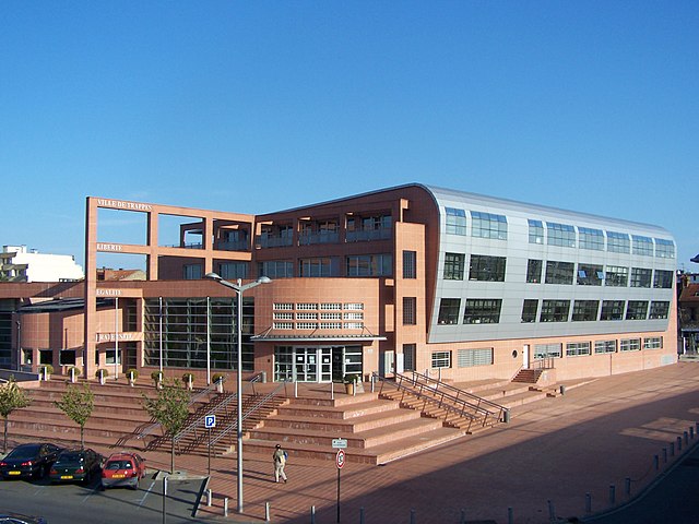

Trappes
- commune in Yvelines, France
- Country:
- Postal Code: 78190
- Coordinates: 48° 46' 36" N, 2° 0' 6" E
- GPS tracks (wikiloc): [Link]
- AboveSeaLevel: 168 м m
- Area: 13.47 sq km
- Population: 32346
- Web site: [Link]


Plaisir
- commune in Yvelines, France
- Country:
- Postal Code: 78370
- Coordinates: 48° 49' 4" N, 1° 56' 47" E
- GPS tracks (wikiloc): [Link]
- Area: 18.68 sq km
- Population: 31857
- Web site: [Link]


Villepreux
- commune in Yvelines, France
- Country:
- Postal Code: 78450
- Coordinates: 48° 49' 48" N, 2° 0' 8" E
- GPS tracks (wikiloc): [Link]
- Area: 10.4 sq km
- Population: 10000
- Web site: [Link]

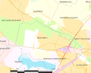
Bois-d'Arcy
- commune in Yvelines, France
- Country:
- Postal Code: 78390
- Coordinates: 48° 48' 5" N, 2° 1' 54" E
- GPS tracks (wikiloc): [Link]
- AboveSeaLevel: 190 м m
- Area: 5.48 sq km
- Population: 14299
- Web site: [Link]