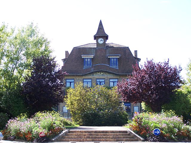
Trappes (Trappes)

- commune in Yvelines, France
- Country:

- Postal Code: 78190
- Coordinates: 48° 46' 36" N, 2° 0' 6" E


- GPS tracks (wikiloc): [Link]
- AboveSeaLevel: 168 м m
- Area: 13.47 sq km
- Population: 32346
- Web site: http://www.trappes.fr/
- Wikipedia en: wiki(en)
- Wikipedia: wiki(fr)
- Wikidata storage: Wikidata: Q363266
- Wikipedia Commons Category: [Link]
- Freebase ID: [/m/08sfmz]
- Freebase ID: [/m/08sfmz]
- GeoNames ID: Alt: [6444090]
- GeoNames ID: Alt: [6444090]
- SIREN number: [217806215]
- SIREN number: [217806215]
- BnF ID: [15276116r]
- BnF ID: [15276116r]
- VIAF ID: Alt: [235583218]
- VIAF ID: Alt: [235583218]
- GND ID: Alt: [4251432-0]
- GND ID: Alt: [4251432-0]
- archINFORM location ID: [4976]
- archINFORM location ID: [4976]
- MusicBrainz area ID: [9d835a83-9605-4537-b148-08af1a4afc6d]
- MusicBrainz area ID: [9d835a83-9605-4537-b148-08af1a4afc6d]
- Twitter username: Alt: [villedetrappes]
- Twitter username: Alt: [villedetrappes]
- INSEE municipality code: 78621
- INSEE municipality code: 78621
Shares border with regions:

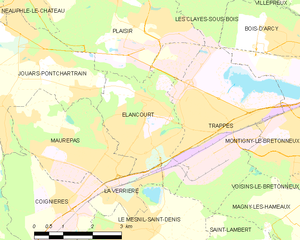
Élancourt
- commune in Yvelines, France
- Country:
- Postal Code: 78990
- Coordinates: 48° 46' 6" N, 1° 56' 58" E
- GPS tracks (wikiloc): [Link]
- Area: 8.51 sq km
- Population: 25504
- Web site: [Link]

Montigny-le-Bretonneux
- commune in Yvelines, France
- Country:
- Postal Code: 78180
- Coordinates: 48° 46' 14" N, 2° 1' 57" E
- GPS tracks (wikiloc): [Link]
- AboveSeaLevel: 171 м m
- Area: 11.65 sq km
- Population: 33123
- Web site: [Link]


Plaisir
- commune in Yvelines, France
- Country:
- Postal Code: 78370
- Coordinates: 48° 49' 4" N, 1° 56' 47" E
- GPS tracks (wikiloc): [Link]
- Area: 18.68 sq km
- Population: 31857
- Web site: [Link]

Les Clayes-sous-Bois
- commune in Yvelines, France
- Country:
- Postal Code: 78340
- Coordinates: 48° 49' 14" N, 1° 59' 1" E
- GPS tracks (wikiloc): [Link]
- Area: 6.11 sq km
- Population: 17645
- Web site: [Link]


Magny-les-Hameaux
- commune in Yvelines, France
- Country:
- Postal Code: 78114
- Coordinates: 48° 43' 26" N, 2° 5' 3" E
- GPS tracks (wikiloc): [Link]
- Area: 16.64 sq km
- Population: 9197
- Web site: [Link]


Le Mesnil-Saint-Denis
- commune in Yvelines, France
- Country:
- Postal Code: 78320
- Coordinates: 48° 44' 37" N, 1° 57' 47" E
- GPS tracks (wikiloc): [Link]
- Area: 8.95 sq km
- Population: 6714
- Web site: [Link]