Les Islettes (Les Islettes)

- commune in Meuse, France
- Country:

- Postal Code: 55120
- Coordinates: 49° 6' 38" N, 5° 0' 12" E


- GPS tracks (wikiloc): [Link]
- Area: 5.55 sq km
- Population: 767
- Wikipedia en: wiki(en)
- Wikipedia: wiki(fr)
- Wikidata storage: Wikidata: Q1613078
- Wikipedia Commons Category: [Link]
- Freebase ID: [/m/03qdrhg]
- GeoNames ID: Alt: [6456213]
- SIREN number: [215502535]
- BnF ID: [152649199]
- INSEE municipality code: 55253
Shares border with regions:
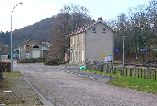

Clermont-en-Argonne
- commune in Meuse, France
- Country:
- Postal Code: 55120
- Coordinates: 49° 6' 22" N, 5° 4' 15" E
- GPS tracks (wikiloc): [Link]
- Area: 66.94 sq km
- Population: 1503
- Web site: [Link]

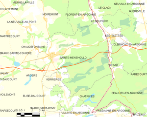
Sainte-Menehould
- commune in Marne, France
- Country:
- Postal Code: 51800
- Coordinates: 49° 5' 24" N, 4° 53' 50" E
- GPS tracks (wikiloc): [Link]
- AboveSeaLevel: 139 м m
- Area: 57.11 sq km
- Population: 4164
- Web site: [Link]


Le Neufour
- commune in Meuse, France
- Country:
- Postal Code: 55120
- Coordinates: 49° 7' 54" N, 4° 58' 55" E
- GPS tracks (wikiloc): [Link]
- Area: 0.92 sq km
- Population: 75


Futeau
- commune in Meuse, France
- Country:
- Postal Code: 55120
- Coordinates: 49° 4' 41" N, 5° 0' 9" E
- GPS tracks (wikiloc): [Link]
- Area: 1.73 sq km
- Population: 165