.JPG)
Sainte-Menehould (Sainte-Menehould)

- commune in Marne, France
- Country:

- Postal Code: 51800
- Coordinates: 49° 5' 24" N, 4° 53' 50" E


- GPS tracks (wikiloc): [Link]
- AboveSeaLevel: 139 м m
- Area: 57.11 sq km
- Population: 4164
- Web site: http://www.ville-sainte-menehould.fr
- Wikipedia en: wiki(en)
- Wikipedia: wiki(fr)
- Wikidata storage: Wikidata: Q213307
- Wikipedia Commons Category: [Link]
- Freebase ID: [/m/087gq6]
- GeoNames ID: Alt: [2980400]
- SIREN number: [215104712]
- BnF ID: [152631024]
- VIAF ID: Alt: [172261994]
- GND ID: Alt: [4251430-7]
- Library of Congress authority ID: Alt: [n86835781]
- MusicBrainz area ID: [880525e7-9710-4f37-9ab6-906b8b34b6f2]
- INSEE municipality code: 51507
Shares border with regions:


Châtrices
- commune in Marne, France
- Country:
- Postal Code: 51800
- Coordinates: 49° 2' 18" N, 4° 56' 17" E
- GPS tracks (wikiloc): [Link]
- Area: 19.53 sq km
- Population: 34


Chaudefontaine
- commune in Marne, France
- Country:
- Postal Code: 51800
- Coordinates: 49° 5' 57" N, 4° 52' 10" E
- GPS tracks (wikiloc): [Link]
- Area: 12.98 sq km
- Population: 328
Argers
- commune in Marne, France
- Country:
- Postal Code: 51800
- Coordinates: 49° 4' 7" N, 4° 51' 18" E
- GPS tracks (wikiloc): [Link]
- Area: 6.97 sq km
- Population: 114


Verrières
- commune in Marne, France
- Country:
- Postal Code: 51800
- Coordinates: 49° 3' 54" N, 4° 54' 29" E
- GPS tracks (wikiloc): [Link]
- AboveSeaLevel: 120 м m
- Area: 5.8 sq km
- Population: 421

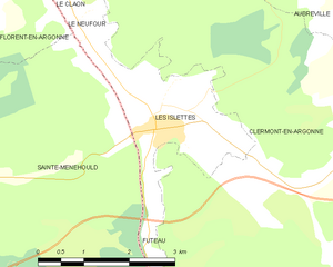
Les Islettes
- commune in Meuse, France
- Country:
- Postal Code: 55120
- Coordinates: 49° 6' 38" N, 5° 0' 12" E
- GPS tracks (wikiloc): [Link]
- Area: 5.55 sq km
- Population: 767


Le Neufour
- commune in Meuse, France
- Country:
- Postal Code: 55120
- Coordinates: 49° 7' 54" N, 4° 58' 55" E
- GPS tracks (wikiloc): [Link]
- Area: 0.92 sq km
- Population: 75


Florent-en-Argonne
- commune in Marne, France
- Country:
- Postal Code: 51800
- Coordinates: 49° 8' 6" N, 4° 57' 14" E
- GPS tracks (wikiloc): [Link]
- Area: 12.29 sq km
- Population: 251


Futeau
- commune in Meuse, France
- Country:
- Postal Code: 55120
- Coordinates: 49° 4' 41" N, 5° 0' 9" E
- GPS tracks (wikiloc): [Link]
- Area: 1.73 sq km
- Population: 165