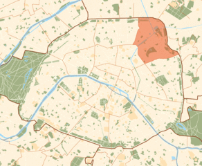
Les Lilas (Les Lilas)

- commune in Seine-Saint-Denis, France
- Country:

- Postal Code: 93260
- Coordinates: 48° 52' 48" N, 2° 25' 1" E


- GPS tracks (wikiloc): [Link]
- AboveSeaLevel: 126 м m
- Area: 1.26 sq km
- Population: 22964
- Web site: http://www.ville-leslilas.fr
- Wikipedia en: wiki(en)
- Wikipedia: wiki(fr)
- Wikidata storage: Wikidata: Q256004
- Wikipedia Commons Category: [Link]
- Wikipedia Commons Maps Category: [Link]
- Freebase ID: [/m/097_29]
- Freebase ID: [/m/097_29]
- GeoNames ID: Alt: [3000491]
- GeoNames ID: Alt: [3000491]
- SIREN number: [219300456]
- SIREN number: [219300456]
- BnF ID: [15280297m]
- BnF ID: [15280297m]
- VIAF ID: Alt: [138020779]
- VIAF ID: Alt: [138020779]
- GND ID: Alt: [4542159-6]
- GND ID: Alt: [4542159-6]
- Library of Congress authority ID: Alt: [no99009124]
- Library of Congress authority ID: Alt: [no99009124]
- MusicBrainz area ID: [bcd484fd-ce55-4b2d-8e04-e4dc38c2cab8]
- MusicBrainz area ID: [bcd484fd-ce55-4b2d-8e04-e4dc38c2cab8]
- Quora topic ID: [Les-Lilas]
- Quora topic ID: [Les-Lilas]
- data.gouv.fr org ID: [les-lilas]
- data.gouv.fr org ID: [les-lilas]
- INSEE municipality code: 93045
- INSEE municipality code: 93045
Shares border with regions:


Le Pré-Saint-Gervais
- commune in Seine-Saint-Denis, France
- Country:
- Postal Code: 93310
- Coordinates: 48° 53' 6" N, 2° 24' 14" E
- GPS tracks (wikiloc): [Link]
- AboveSeaLevel: 72 м m
- Area: 0.7 sq km
- Population: 17680
- Web site: [Link]

19th arrondissement of Paris
- one of the 20 administrative districts of Paris, France
- Country:
- Postal Code: 75019
- Coordinates: 48° 52' 56" N, 2° 22' 55" E
- GPS tracks (wikiloc): [Link]
- Area: 6.79 sq km
- Population: 185654
- Web site: [Link]


Bagnolet
- commune in Seine-Saint-Denis, France
- Country:
- Postal Code: 93170
- Coordinates: 48° 52' 1" N, 2° 25' 1" E
- GPS tracks (wikiloc): [Link]
- Area: 2.57 sq km
- Population: 35881
- Web site: [Link]


Pantin
- commune in Seine-Saint-Denis, France
- Country:
- Postal Code: 93500
- Coordinates: 48° 53' 53" N, 2° 24' 26" E
- GPS tracks (wikiloc): [Link]
- Area: 5.01 sq km
- Population: 55180
- Web site: [Link]


Romainville
- commune in Seine-Saint-Denis, France
- Country:
- Postal Code: 93230
- Coordinates: 48° 53' 1" N, 2° 26' 10" E
- GPS tracks (wikiloc): [Link]
- AboveSeaLevel: 117 м m
- Area: 3.44 sq km
- Population: 26031
- Web site: [Link]

Paris
- capital and largest city of France
- Country:
- Postal Code: 75020; 75019; 75018; 75017; 75016; 75015; 75014; 75013; 75012; 75011; 75010; 75009; 75008; 75007; 75006; 75005; 75004; 75003; 75002; 75001; 75116
- Local Dialing Code: 1
- Licence Plate Code: 75
- Coordinates: 48° 51' 24" N, 2° 21' 7" E
- GPS tracks (wikiloc): [Link]
- AboveSeaLevel: 28 м m
- Area: 105.4 sq km
- Population: 2206488
- Web site: [Link]