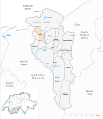
Leuk District (Bezirk Leuk)

- district of the canton of Valais, Switzerland
 Hiking in Leuk District
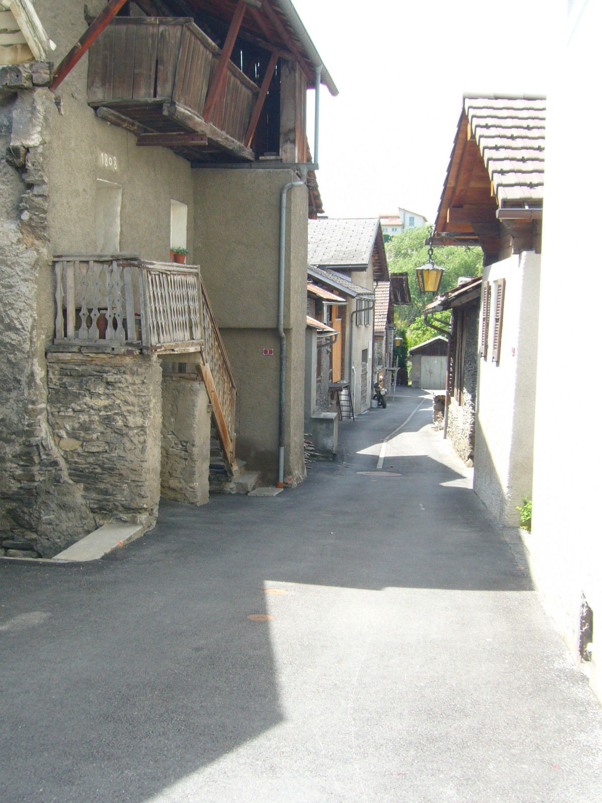
The Leuk District, located in the Valais canton of Switzerland, is a stunning hiking destination known for its diverse landscapes, charming villages, and a variety of trails suitable for all skill levels. Here are some key highlights to consider when planning a hiking trip in this region:
Scenic Landscapes
- Diverse Terrain: The area features picturesque alpine meadows, rugged mountains, and serene lakes. You can enjoy views of the majestic Pennine Alps and the Rhône valley.
- Flora and Fauna: The district is home to diverse plant life and wildlife. Keep an eye out for local species such as ibex or chamois.
Popular Hiking Trails
- Leukerbad to Albinen: A relatively easy trail that offers fantastic views and takes you through charming alpine villages.
- Gemmi Pass: Known for its breathtaking panoramas, this trail connects Leukerbad with Kandersteg and allows hikers to experience the high alpine scenery.
- Rinderhorn: For the more experienced hikers, the trail to Rinderhorn offers a challenging ascent but is rewarded with stunning views from the summit.
Local Tips
- Best Time to Hike: Late spring through early autumn is ideal for hiking, with trails accessible and wildflowers in bloom. Be aware that some high-altitude trails may still have snow in early spring.
- Guided Tours: Consider joining a guided hike for insights into the local geology, ecology, and history. Local guides can enhance your experience with their knowledge.
- Preparation: As with any mountain hiking, it’s crucial to wear appropriate footwear, carry sufficient water, and check weather conditions before heading out.
Amenities and Services
- Accommodations: Several villages in the district, including Leukerbad, offer a range of accommodations from hotels to mountain huts.
- Public Transport: The region is well-connected by public transport, making it easy to reach trailheads if you prefer not to drive.
- Food and Drink: Enjoy local Swiss cuisine in the villages or at mountain huts, where you can often find traditional dishes made from local ingredients.
Exploring the Leuk District on foot provides an amazing way to experience the natural beauty and cultural richness of this part of Switzerland. Make sure to plan your hikes based on your fitness level, and enjoy the stunning landscapes that this region has to offer!
- Country:

- Capital: Leuk
- Licence Plate Code: VS
- Coordinates: 46° 19' 5" N, 7° 38' 4" E


- GPS tracks (wikiloc): [Link]
- AboveSeaLevel: 957 м m
- Area: 335.9 sq km
- Wikipedia en: wiki(en)
- Wikipedia: wiki(de)
- Wikidata storage: Wikidata: Q661326
- Wikipedia Commons Category: [Link]
- Freebase ID: [/m/0dwqwy]
- GeoNames ID: Alt: [6458753]
- archINFORM location ID: [45093]
- HDS ID: [8401]
Includes regions:


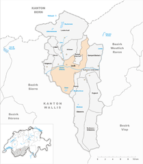
Turtmann-Unterems
- municipality in Switzerland
Hiking in Turtmann-Unterems
Turtmann-Unterems is a picturesque region located in the Valais canton of Switzerland, known for its stunning alpine landscapes and hiking opportunities. Here are some highlights to consider if you're planning a hike in this area:...
- Country:
- Postal Code: 3946, 3948
- Licence Plate Code: VS
- Coordinates: 46° 18' 7" N, 7° 42' 14" E
- GPS tracks (wikiloc): [Link]
- AboveSeaLevel: 640 м m
- Area: 42.42 sq km
- Population: 1106
- Web site: [Link]
Agarn
- municipality in Switzerland
Hiking in Agarn
Agarn is a small village located in the Valais region of Switzerland, known for its stunning alpine scenery and access to numerous hiking trails. This area offers a mix of both easy and more challenging hikes, making it suitable for hikers of all levels....
- Country:
- Local Dialing Code: 027
- Licence Plate Code: VS
- Coordinates: 46° 17' 0" N, 7° 39' 0" E
- GPS tracks (wikiloc): [Link]
- AboveSeaLevel: 628 м m
- Area: 7.6 sq km
- Population: 763
- Web site: [Link]

Oberems
- municipality in Switzerland
Hiking in Oberems
Oberems is a picturesque village located in the Pennine Alps of Switzerland, known for its stunning natural beauty and excellent hiking opportunities. Here are some key points about hiking in Oberems:...
- Country:
- Postal Code: 3948
- Local Dialing Code: 027
- Licence Plate Code: VS
- Coordinates: 46° 12' 55" N, 7° 41' 2" E
- GPS tracks (wikiloc): [Link]
- AboveSeaLevel: 2437 м m
- Area: 84.6 sq km
- Population: 124
- Web site: [Link]


Varen
- municipality in Switzerland
Hiking in Varen
Varen, a picturesque village in the Valais region of Switzerland, offers some beautiful hiking opportunities that cater to a range of skill levels. Nestled in the foothills of the Alps and overlooking the Rhone Valley, Varen is known for its breathtaking landscapes, vineyards, and stunning views of the surrounding mountains....
- Country:
- Postal Code: 3953
- Local Dialing Code: 027
- Licence Plate Code: VS
- Coordinates: 46° 19' 0" N, 7° 36' 0" E
- GPS tracks (wikiloc): [Link]
- AboveSeaLevel: 759 м m
- Area: 12.8 sq km
- Population: 625
- Web site: [Link]
Inden
- municipality in Switzerland
Hiking in Inden
Inden, a small village in Switzerland, offers a beautiful setting for hiking enthusiasts. While it may not be as well-known as some of the larger Swiss hiking destinations, it provides a wonderful opportunity to experience the stunning landscapes, tranquil forests, and fresh alpine air that Switzerland is famous for....
- Country:
- Postal Code: 3953
- Local Dialing Code: 027
- Licence Plate Code: VS
- Coordinates: 46° 20' 0" N, 7° 37' 0" E
- GPS tracks (wikiloc): [Link]
- AboveSeaLevel: 1138 м m
- Area: 9.9 sq km
- Population: 107
- Web site: [Link]


Ergisch
- municipality in Switzerland
Hiking in Ergisch
Ergisch is a picturesque area located in the Swiss Alps, known for its stunning landscapes, diverse flora and fauna, and well-marked hiking trails. Hiking in Ergisch offers a range of experiences suitable for all levels of hikers, from beginners to experienced trekkers. Here are some highlights and tips for hiking in Ergisch:...
- Country:
- Postal Code: 3947
- Local Dialing Code: 027
- Licence Plate Code: VS
- Coordinates: 46° 17' 0" N, 7° 42' 0" E
- GPS tracks (wikiloc): [Link]
- AboveSeaLevel: 1090 м m
- Area: 29.8 sq km
- Population: 188
- Web site: [Link]


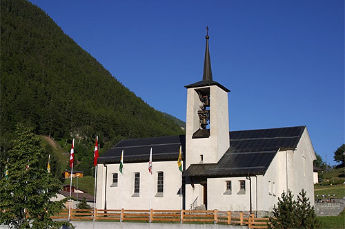
Leukerbad
- municipality in Valais, Switzerland
Hiking in Leukerbad
Leukerbad, located in the Swiss Alps, is a fantastic destination for hiking enthusiasts. Known for its stunning scenery, thermal baths, and an array of hiking trails, it offers something for everyone, from beginners to experienced hikers. Here are some key points about hiking in the area:...
- Country:
- Postal Code: 3954
- Local Dialing Code: 027
- Licence Plate Code: VS
- Coordinates: 46° 23' 0" N, 7° 38' 0" E
- GPS tracks (wikiloc): [Link]
- AboveSeaLevel: 1402 м m
- Area: 67.32 sq km
- Population: 1413
- Web site: [Link]

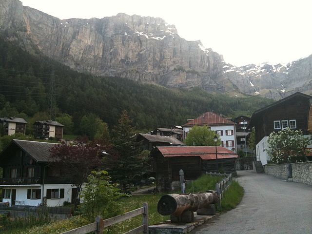
Leuk
- municipality in Switzerland
Hiking in Leuk
Leuk, located in the Valais region of Switzerland, offers a variety of hiking opportunities for all skill levels. The area is renowned for its breathtaking landscapes, including alpine meadows, mountain villages, and stunning views of the surrounding peaks....
- Country:
- Postal Code: 3953, 3957
- Local Dialing Code: 027
- Licence Plate Code: VS
- Coordinates: 46° 19' 0" N, 7° 38' 0" E
- GPS tracks (wikiloc): [Link]
- AboveSeaLevel: 731 м m
- Area: 44.1 sq km
- Population: 3926
- Web site: [Link]


Albinen
- municipality in Switzerland
Hiking in Albinen
Albinen is a charming village located in the Valais region of Switzerland, known for its stunning views of the surrounding mountains and valleys. Hiking in Albinen offers a unique experience, combining natural beauty with cultural charm. Here are some highlights of hiking in this area:...
- Country:
- Postal Code: 3955
- Local Dialing Code: 027
- Licence Plate Code: VS
- Coordinates: 46° 20' 0" N, 7° 38' 0" E
- GPS tracks (wikiloc): [Link]
- AboveSeaLevel: 1289 м m
- Area: 15.5 sq km
- Population: 243
- Web site: [Link]
Guttet-Feschel
- municipality in Switzerland
Hiking in Guttet-Feschel
Guttet-Feschel is a charming municipality located in the Valais region of Switzerland, known for its stunning landscapes and excellent hiking opportunities. The area offers a mix of trails suitable for various skill levels, making it a great destination for both novice and experienced hikers....
- Country:
- Postal Code: 3956
- Local Dialing Code: 027
- Licence Plate Code: VS
- Coordinates: 46° 19' 0" N, 7° 39' 0" E
- GPS tracks (wikiloc): [Link]
- AboveSeaLevel: 1345 м m
- Area: 10.5 sq km
- Population: 418
- Web site: [Link]

Salgesch
- municipality in Switzerland
Hiking in Salgesch
Salgesch is a charming village located in the Valais region of Switzerland, known for its stunning landscapes, vineyards, and proximity to the majestic Alps. Hiking in and around Salgesch offers a variety of trails suitable for different skill levels and interests....
- Country:
- Postal Code: 3970
- Local Dialing Code: 027
- Licence Plate Code: VS
- Coordinates: 46° 18' 0" N, 7° 34' 0" E
- GPS tracks (wikiloc): [Link]
- AboveSeaLevel: 580 м m
- Area: 11.4 sq km
- Population: 1511
- Web site: [Link]


Gampel-Bratsch
- municipality in Switzerland
Hiking in Gampel-Bratsch
Gampel-Bratsch is a picturesque region located in the Valais canton of Switzerland, known for its stunning landscapes, hiking trails, and opportunities to explore nature. Here’s an overview of what you can expect when hiking in this area:...
- Country:
- Postal Code: 3945
- Local Dialing Code: 027
- Licence Plate Code: VS
- Coordinates: 46° 19' 0" N, 7° 45' 0" E
- GPS tracks (wikiloc): [Link]
- AboveSeaLevel: 634 м m
- Area: 23.1 sq km
- Population: 1964
- Web site: [Link]
Shares border with regions:


Sierre District
- district of the canton of Valais, Switzerland
Hiking in Sierre District
The Sierre District is located in the Valais (Wallis) region of Switzerland, and it's known for its stunning landscapes, diverse terrain, and a variety of hiking trails suitable for all levels of hikers. Here are some key highlights about hiking in the Sierre District:...
- Country:
- Capital: Sierre
- Licence Plate Code: VS
- Coordinates: 46° 16' 14" N, 7° 30' 57" E
- GPS tracks (wikiloc): [Link]
- AboveSeaLevel: 515 м m
- Area: 397.0 sq km


Visp District
- district of the canton of Valais, Switzerland
Hiking in Visp District
The Visp District, located in the Valais canton of Switzerland, is an excellent destination for hiking enthusiasts. Surrounded by stunning Alpine scenery, it offers a variety of trails suitable for different skill levels, from beginners to experienced hikers. Here are some highlights and key points regarding hiking in the Visp District:...
- Country:
- Capital: Visp
- Licence Plate Code: VS
- Coordinates: 46° 17' 0" N, 7° 52' 0" E
- GPS tracks (wikiloc): [Link]
- AboveSeaLevel: 2758 м m
- Area: 863.8 sq km

Westlich Raron District
- district of the canton of Valais, Switzerland
Hiking in Westlich Raron District
Westlich Raron is a beautiful area located in the Swiss Alps, specifically in the Valais region of Switzerland. It's known for its stunning landscapes, diverse trails, and the picturesque views of the surrounding mountains. Here are some key points to consider if you're planning to hike in this region:...
- Country:
- Capital: Raron
- Licence Plate Code: VS
- Coordinates: 46° 18' 0" N, 8° 48' 0" E
- GPS tracks (wikiloc): [Link]
- Area: 270.87 sq km