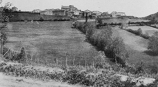
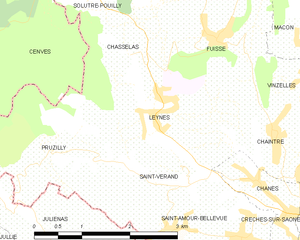
Leynes (Leynes)
- commune in Saône-et-Loire, France
- Country:

- Postal Code: 71570
- Coordinates: 46° 16' 8" N, 4° 43' 42" E


- GPS tracks (wikiloc): [Link]
- Area: 4.83 sq km
- Population: 530
- Web site: http://www.leynes.fr
- Wikipedia en: wiki(en)
- Wikipedia: wiki(fr)
- Wikidata storage: Wikidata: Q1467614
- Wikipedia Commons Category: [Link]
- Wikipedia Commons Maps Category: [Link]
- Freebase ID: [/m/03qgkv_]
- Freebase ID: [/m/03qgkv_]
- GeoNames ID: Alt: [6442297]
- GeoNames ID: Alt: [6442297]
- SIREN number: [217102581]
- SIREN number: [217102581]
- BnF ID: [15273230v]
- BnF ID: [15273230v]
- INSEE municipality code: 71258
- INSEE municipality code: 71258
Shares border with regions:


Chaintré
- commune in Saône-et-Loire, France
- Country:

- Postal Code: 71570
- Coordinates: 46° 15' 38" N, 4° 45' 33" E


- GPS tracks (wikiloc): [Link]
- Area: 3.31 sq km
- Population: 563
- Web site: [Link]


Chânes
- commune in Saône-et-Loire, France
- Country:

- Postal Code: 71570
- Coordinates: 46° 15' 7" N, 4° 45' 16" E


- GPS tracks (wikiloc): [Link]
- Area: 2.24 sq km
- Population: 559
- Web site: [Link]

Saint-Vérand
- commune in Saône-et-Loire, France
- Country:

- Postal Code: 71570
- Coordinates: 46° 15' 16" N, 4° 44' 8" E


- GPS tracks (wikiloc): [Link]
- AboveSeaLevel: 350 м m
- Area: 2.45 sq km
- Population: 171


Cenves
- commune in Rhône, France
- Country:

- Postal Code: 69840
- Coordinates: 46° 16' 5" N, 4° 38' 59" E


- GPS tracks (wikiloc): [Link]
- Area: 26.48 sq km
- Population: 407
- Web site: [Link]


Pruzilly
- commune in Saône-et-Loire, France
- Country:

- Postal Code: 71570
- Coordinates: 46° 15' 32" N, 4° 41' 52" E


- GPS tracks (wikiloc): [Link]
- Area: 4.29 sq km
- Population: 315
- Web site: [Link]


Chasselas
- commune in Saône-et-Loire, France
- Country:

- Postal Code: 71570
- Coordinates: 46° 16' 34" N, 4° 43' 10" E


- GPS tracks (wikiloc): [Link]
- Area: 2.56 sq km
- Population: 176
- Web site: [Link]


Fuissé
- commune in Saône-et-Loire, France
- Country:

- Postal Code: 71960
- Coordinates: 46° 16' 49" N, 4° 44' 36" E


- GPS tracks (wikiloc): [Link]
- Area: 4.86 sq km
- Population: 381
