Lignol-le-Château (Lignol-le-Château)

- commune in Aube, France
- Country:

- Postal Code: 10200
- Coordinates: 48° 13' 25" N, 4° 48' 27" E


- GPS tracks (wikiloc): [Link]
- Area: 21.85 sq km
- Population: 198
- Wikipedia en: wiki(en)
- Wikipedia: wiki(fr)
- Wikidata storage: Wikidata: Q677436
- Wikipedia Commons Category: [Link]
- Freebase ID: [/m/03m8smg]
- GeoNames ID: Alt: [6426438]
- SIREN number: [211001904]
- BnF ID: [15246289m]
- TGN ID: [7029491]
- INSEE municipality code: 10197
Shares border with regions:

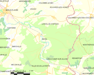
Bayel
- commune in Aube, France
- Country:
- Postal Code: 10310
- Coordinates: 48° 11' 56" N, 4° 46' 31" E
- GPS tracks (wikiloc): [Link]
- Area: 23 sq km
- Population: 772
Rennepont
- commune in Haute-Marne, France
- Country:
- Postal Code: 52370
- Coordinates: 48° 8' 52" N, 4° 51' 18" E
- GPS tracks (wikiloc): [Link]
- Area: 11.98 sq km
- Population: 143


Colombey-les-Deux-Églises
- former commune in Haute-Marne, France
- Country:
- Postal Code: 52330
- Coordinates: 48° 13' 24" N, 4° 53' 9" E
- GPS tracks (wikiloc): [Link]
- AboveSeaLevel: 360 м m
- Area: 73.63 sq km
- Population: 358
- Web site: [Link]

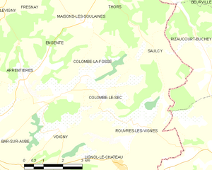
Colombé-le-Sec
- commune in Aube, France
- Country:
- Postal Code: 10200
- Coordinates: 48° 15' 17" N, 4° 47' 48" E
- GPS tracks (wikiloc): [Link]
- Area: 8.78 sq km
- Population: 151


Voigny
- commune in Aube, France
- Country:
- Postal Code: 10200
- Coordinates: 48° 14' 27" N, 4° 46' 5" E
- GPS tracks (wikiloc): [Link]
- Area: 7.09 sq km
- Population: 164


Rouvres-les-Vignes
- commune in Aube, France
- Country:
- Postal Code: 10200
- Coordinates: 48° 14' 27" N, 4° 49' 22" E
- GPS tracks (wikiloc): [Link]
- Area: 8.28 sq km
- Population: 108