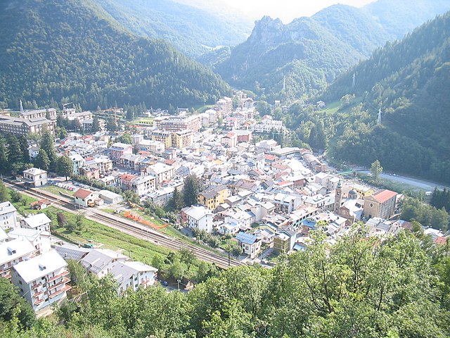
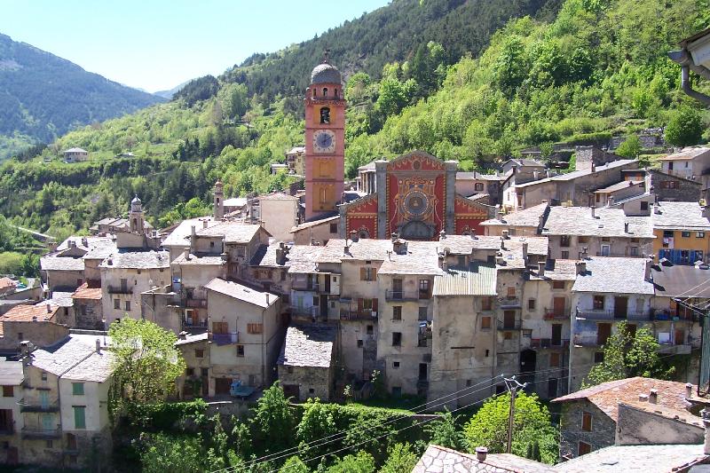
Limone Piemonte (Limone Piemonte)
- comune in Italy
Limone Piemonte is a charming alpine resort located in the Piedmont region of Italy, nestled in the Maritime Alps, near the border with France. It offers a range of hiking opportunities that cater to different skill levels, from casual walks to more challenging treks. Here are some key highlights about hiking in Limone Piemonte:
Scenic Trails
- Varied Terrain: The area features a mix of forested paths, alpine meadows, and rocky trails, providing stunning views of the surrounding mountains and valleys.
- Lago delle Piane: A popular hiking destination is the trail leading to Lago delle Piane, a beautiful alpine lake surrounded by picturesque landscapes.
- Colle di Tenda: This mountain pass offers various hiking routes with breathtaking panoramas and the chance to see diverse flora and fauna.
Difficulty Levels
- Easy Trails: There are several easier trails suitable for families and beginners, often well-marked and accessible.
- Moderate to Difficult Routes: For experienced hikers, there are more demanding routes that require proper gear and preparation, often leading to higher altitudes and more rugged terrain.
Seasonal Activities
- Summer Hiking: Summer is the peak season for hiking in Limone Piemonte. The weather is generally mild, making it perfect for outdoor activities.
- Winter Hiking: In winter, some trails may be available for snowshoeing, and the area transforms into a winter sports destination, offering skiing as well.
Wildlife and Nature
- Hikers can enjoy a diverse range of wildlife, including various bird species and local fauna. The area is known for its biodiversity, especially in the summer months when wildflowers are in bloom.
Practical Tips
- Maps and Guides: It's advisable to carry a detailed map or digital navigation tools. Local guides and ranger services can also provide valuable information about trail conditions and safety.
- Weather Awareness: Mountain weather can change rapidly, so it's important to check forecasts and be prepared for varying conditions.
- Leave No Trace: As with any hiking destination, follow Leave No Trace principles to preserve the natural beauty of the area.
Conclusion
Hiking in Limone Piemonte offers a unique blend of natural beauty, diverse trails, and the opportunity to experience the cultural heritage of the Piedmont region. Whether you're a seasoned hiker or new to the sport, Limone Piemonte has something to offer for everyone who wishes to explore its stunning landscapes.
- Country:

- Postal Code: 12015
- Local Dialing Code: 0171
- Licence Plate Code: CN
- Coordinates: 44° 12' 0" N, 7° 34' 0" E


- GPS tracks (wikiloc): [Link]
- AboveSeaLevel: 1010 м m
- Area: 70.81 sq km
- Population: 1466
- Web site: http://www.limonepiemonte.it
- Wikipedia en: wiki(en)
- Wikipedia: wiki(it)
- Wikidata storage: Wikidata: Q20120
- Wikipedia Commons Category: [Link]
- Freebase ID: [/m/0drrhh]
- GeoNames ID: Alt: [6539577]
- VIAF ID: Alt: [124486808]
- OSM relation ID: [42909]
- WOEID: [12679965]
- Quora topic ID: [Limone-Piemonte]
- TGN ID: [1045097]
- ISTAT ID: 004110
- Italian cadastre code: E597
Shares border with regions:

Borgo San Dalmazzo
- Italian comune
Borgo San Dalmazzo, located in the Piedmont region of Italy, is a charming town situated near the foothills of the Alps. It serves as a great base for outdoor activities, including hiking, due to its picturesque landscapes and proximity to the Maritime Alps. Here are some highlights about hiking in this area:...
- Country:

- Postal Code: 12011
- Local Dialing Code: 0171
- Licence Plate Code: CN
- Coordinates: 44° 20' 0" N, 7° 29' 0" E


- GPS tracks (wikiloc): [Link]
- AboveSeaLevel: 645 м m
- Area: 22.34 sq km
- Population: 12492
- Web site: [Link]
Boves
- Italian comune
Boves, located in the Piedmont region of northwestern Italy, is an excellent destination for hiking enthusiasts. Nestled amidst the stunning Alps, Boves offers a variety of hiking trails that cater to different skill levels, from beginner to advanced. Here’s an overview of what you can expect when hiking in and around Boves:...
- Country:

- Postal Code: 12012
- Local Dialing Code: 0171
- Licence Plate Code: CN
- Coordinates: 44° 20' 0" N, 7° 33' 0" E


- GPS tracks (wikiloc): [Link]
- AboveSeaLevel: 542 м m
- Area: 50.95 sq km
- Population: 9788
- Web site: [Link]

Briga Alta
- Italian comune
Briga Alta is a charming town located in the Piedmont region of northern Italy, known for its beautiful landscapes, historical significance, and excellent hiking opportunities. If you're considering hiking in that area, here are some details to keep in mind:...
- Country:

- Postal Code: 18025
- Local Dialing Code: 0174
- Licence Plate Code: CN
- Coordinates: 44° 4' 53" N, 7° 44' 27" E


- GPS tracks (wikiloc): [Link]
- AboveSeaLevel: 1310 м m
- Area: 52.18 sq km
- Population: 40
- Web site: [Link]

Chiusa di Pesio
- Italian comune
Chiusa di Pesio is a beautiful area located in the Piedmont region of Italy, renowned for its stunning natural landscapes and excellent hiking opportunities. Nestled in the heart of the Maritime Alps, Chiusa di Pesio offers a variety of trails that cater to different skill levels, making it an appealing destination for both casual walkers and experienced hikers....
- Country:

- Postal Code: 12013
- Local Dialing Code: 0171
- Licence Plate Code: CN
- Coordinates: 44° 19' 0" N, 7° 41' 0" E


- GPS tracks (wikiloc): [Link]
- AboveSeaLevel: 575 м m
- Area: 95.02 sq km
- Population: 3653
- Web site: [Link]

Entracque
- Italian comune
Entracque is a picturesque village located in the Piedmont region of Italy, nestled in the stunning Maritime Alps. It's an excellent destination for hiking enthusiasts, offering a range of trails that cater to various skill levels, from beginners to advanced hikers. Here are some highlights of hiking in Entracque:...
- Country:

- Postal Code: 12010
- Local Dialing Code: 0171
- Licence Plate Code: CN
- Coordinates: 44° 14' 33" N, 7° 24' 0" E


- GPS tracks (wikiloc): [Link]
- AboveSeaLevel: 894 м m
- Area: 160.73 sq km
- Population: 848
- Web site: [Link]

Peveragno
- Italian comune
Peveragno is a charming village located in the Piedmont region of Italy, close to the Cuneo province and nestled in a picturesque setting at the base of the Alps. It offers numerous hiking opportunities, showcasing stunning landscapes, rich biodiversity, and cultural landmarks. Here’s what you need to know about hiking in the area:...
- Country:

- Postal Code: 12016
- Local Dialing Code: 0171
- Licence Plate Code: CN
- Coordinates: 44° 20' 0" N, 7° 37' 0" E


- GPS tracks (wikiloc): [Link]
- AboveSeaLevel: 575 м m
- Area: 67.92 sq km
- Population: 5561
- Web site: [Link]
Robilante
- Italian comune
Robilante is a charming municipality located in the Piedmont region of northern Italy, near the Alps. It offers a range of hiking opportunities perfect for outdoor enthusiasts, surrounded by picturesque landscapes, lush forests, and stunning mountain views. Here are some aspects to consider for hiking in Robilante:...
- Country:

- Postal Code: 12017
- Local Dialing Code: 0171
- Licence Plate Code: CN
- Coordinates: 44° 18' 0" N, 7° 31' 0" E


- GPS tracks (wikiloc): [Link]
- AboveSeaLevel: 678 м m
- Area: 25 sq km
- Population: 2285
- Web site: [Link]

Roccavione
- Italian comune
Roccavione is a small town located in the Piedmont region of northern Italy, nestled near the Cottian Alps. While it might not be as widely known as some other hiking destinations in Italy, it offers some beautiful trails and stunning natural scenery....
- Country:

- Postal Code: 12018
- Local Dialing Code: 0171
- Licence Plate Code: CN
- Coordinates: 44° 19' 0" N, 7° 29' 0" E


- GPS tracks (wikiloc): [Link]
- AboveSeaLevel: 646 м m
- Area: 19.15 sq km
- Population: 2648
- Web site: [Link]

Vernante
- Italian comune
Vernante is a charming village located in the Piedmont region of Italy, nestled in the Maritime Alps. It’s known for its stunning natural landscapes, rich cultural heritage, and a variety of hiking opportunities that cater to all levels of hikers....
- Country:

- Postal Code: 12019
- Local Dialing Code: 0171
- Licence Plate Code: CN
- Coordinates: 44° 15' 0" N, 7° 32' 0" E


- GPS tracks (wikiloc): [Link]
- AboveSeaLevel: 800 м m
- Area: 62.06 sq km
- Population: 1143
- Web site: [Link]


Tende
- commune in Alpes-Maritimes, France
Tende is a picturesque commune located in the Alpes-Maritimes department in the Provence-Alpes-Côte d'Azur region of southeastern France. Nestled in the Maritime Alps, it's an excellent destination for hiking enthusiasts, offering stunning landscapes, varied terrains, and rich natural and cultural heritage....
- Country:

- Postal Code: 06430
- Coordinates: 44° 5' 16" N, 7° 35' 37" E


- GPS tracks (wikiloc): [Link]
- AboveSeaLevel: 816 м m
- Area: 177.47 sq km
- Population: 2174
- Web site: [Link]


La Brigue
- commune in Alpes-Maritimes, France
La Brigue is a beautiful commune in the Alpes-Maritimes department of southeastern France, located near the Italian border. Nestled in the Mercantour National Park, it offers stunning landscapes, diverse flora and fauna, and various hiking trails suitable for all levels of hikers. Here are some highlights about hiking in La Brigue:...
- Country:

- Postal Code: 06430
- Coordinates: 44° 3' 45" N, 7° 36' 59" E


- GPS tracks (wikiloc): [Link]
- AboveSeaLevel: 748 м m
- Area: 91.77 sq km
- Population: 706
- Web site: [Link]
