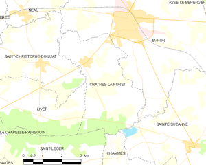
Livet (Livet)
- commune in Mayenne, France
- Country:

- Postal Code: 53150
- Coordinates: 48° 6' 29" N, 0° 27' 41" E


- GPS tracks (wikiloc): [Link]
- Area: 11.16 sq km
- Population: 147
- Web site: http://mairie.livet.free.fr
- Wikipedia en: wiki(en)
- Wikipedia: wiki(fr)
- Wikidata storage: Wikidata: Q748887
- Wikipedia Commons Category: [Link]
- Freebase ID: [/m/03qddm2]
- GeoNames ID: Alt: [6617028]
- SIREN number: [215301342]
- BnF ID: [15263927p]
- INSEE municipality code: 53134
Shares border with regions:


Châtres-la-Forêt
- commune in Mayenne, France
- Country:

- Postal Code: 53600
- Coordinates: 48° 8' 1" N, 0° 25' 54" E


- GPS tracks (wikiloc): [Link]
- Area: 13.6 sq km
- Population: 787
- Web site: [Link]


Saint-Léger
- commune in Mayenne, France
- Country:

- Postal Code: 53480
- Coordinates: 48° 4' 57" N, 0° 27' 21" E


- GPS tracks (wikiloc): [Link]
- AboveSeaLevel: 112 м m
- Area: 17.22 sq km
- Population: 309


Saint-Christophe-du-Luat
- commune in Mayenne, France
- Country:

- Postal Code: 53150
- Coordinates: 48° 8' 1" N, 0° 27' 40" E


- GPS tracks (wikiloc): [Link]
- Area: 19.12 sq km
- Population: 779
- Web site: [Link]


La Chapelle-Rainsouin
- commune in Mayenne, France
- Country:

- Postal Code: 53150
- Coordinates: 48° 5' 55" N, 0° 31' 12" E


- GPS tracks (wikiloc): [Link]
- Area: 18.05 sq km
- Population: 417
