Lombriasco (Lombriasco)

- Italian comune
 Hiking in Lombriasco
Lombriasco is a small town located in the Piedmont region of northern Italy, near Turin. While it's not as well-known for hiking as some other areas in the region, it does offer opportunities for outdoor activities and exploration. Here are some insights into hiking in and around Lombriasco:
Local Trails
-
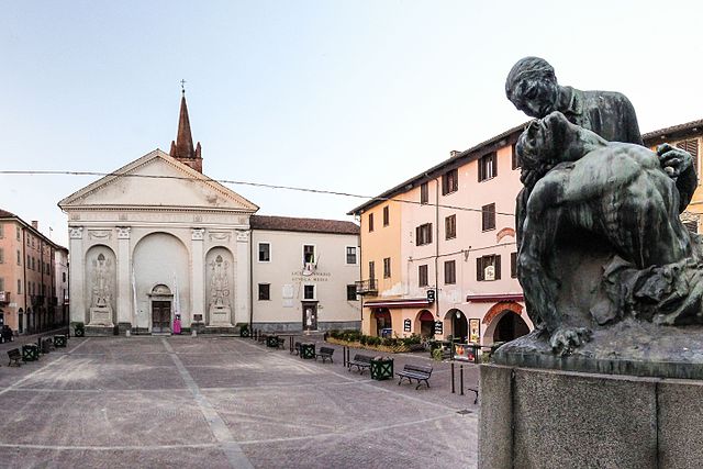
Surrounding Countryside: Lombriasco is surrounded by beautiful landscapes typical of the Piedmont countryside, with rolling hills, vineyards, and agricultural fields. You can find various paths that lead through these idyllic settings.
-
Natural Parks: Nearby natural parks, such as the Parco Naturale del Monviso, although a bit farther away, provide excellent hiking options. The area features trails for varying skill levels, offering panoramic views and the chance to see local wildlife.
-
Historical Routes: Explore historical routes that showcase the region's rich cultural heritage. Some trails may lead to old churches, castles, or rural villages that reflect the traditional lifestyle of the area.
Hiking Recommendations
- Trail Maps: To ensure you stay on track, it’s beneficial to have a local trail map or a hiking app. Local tourist information centers can provide guidance on marked trails.
- Local Guidance: Consider joining a local guided hike if you're unfamiliar with the area. Experienced guides can offer insights into the geography and ecology.
- Be Prepared: Bring sufficient water, snacks, and gear appropriate for the weather, as well as a first-aid kit in case of emergencies.
Best Time to Hike
- Spring and Fall: These seasons are ideal for hiking in Lombriasco, as the temperatures are moderate, and the landscapes are vibrant and colorful. Springtime in particular offers blooming wildflowers and lush greenery.
- Summer Hiking: Be cautious during the peak of summer, as temperatures can rise, making longer hikes more challenging.
Conclusion
While Lombriasco may not be a major hiking destination, its picturesque surroundings and proximity to more developed hiking areas make it a charming place for outdoor enthusiasts. Always remember to check local conditions and trail accessibility before setting out. Enjoy your hikes!
- Country:

- Postal Code: 10040
- Local Dialing Code: 011
- Licence Plate Code: TO
- Coordinates: 44° 51' 0" N, 7° 38' 0" E


- GPS tracks (wikiloc): [Link]
- AboveSeaLevel: 241 м m
- Area: 7.21 sq km
- Population: 1035
- Web site: http://www.comune.lombriasco.to.it/
- Wikipedia en: wiki(en)
- Wikipedia: wiki(it)
- Wikidata storage: Wikidata: Q9432
- Wikipedia Commons Category: [Link]
- Freebase ID: [/m/0g6w_7]
- GeoNames ID: Alt: [6543779]
- OSM relation ID: [43669]
- ISTAT ID: 001136
- Italian cadastre code: E661
Shares border with regions:
Casalgrasso
- Italian comune
Hiking in Casalgrasso
Casalgrasso is a small town in the Piedmont region of Italy, near Turin. While it may not be a major hiking destination like some larger national parks or mountainous areas, there are still opportunities for outdoor activities in and around the region....
- Country:
- Postal Code: 12030
- Local Dialing Code: 011
- Licence Plate Code: CN
- Coordinates: 44° 49' 0" N, 7° 38' 0" E
- GPS tracks (wikiloc): [Link]
- AboveSeaLevel: 240 м m
- Area: 17.81 sq km
- Population: 1444
- Web site: [Link]

Racconigi
- Italian comune
Hiking in Racconigi
Racconigi, a charming town in the province of Cuneo, Piedmont, Italy, offers a variety of hiking opportunities in its beautiful natural surroundings. Here are some insights to help you plan your hiking experience in the area:...
- Country:
- Postal Code: 12035
- Local Dialing Code: 0172
- Licence Plate Code: CN
- Coordinates: 44° 46' 0" N, 7° 41' 0" E
- GPS tracks (wikiloc): [Link]
- AboveSeaLevel: 260 м m
- Area: 48.06 sq km
- Population: 9958
- Web site: [Link]

Carignano
- Italian comune
Hiking in Carignano
Carignano, a charming town located in the Piedmont region of Italy, offers a variety of hiking opportunities that showcase its beautiful landscapes and rich history. Here are some highlights for hiking enthusiasts looking to explore the area:...
- Country:
- Postal Code: 10041
- Local Dialing Code: 011
- Licence Plate Code: TO
- Coordinates: 44° 54' 21" N, 7° 40' 21" E
- GPS tracks (wikiloc): [Link]
- Area: 50.68 sq km
- Population: 9334
- Web site: [Link]

Carmagnola
- Italian comune
Hiking in Carmagnola
Carmagnola is a charming town located in the Piedmont region of Italy, known for its agricultural background and beautiful landscapes. Although it may not be the first destination that comes to mind for hiking, there are several outdoor opportunities in and around the area....
- Country:
- Postal Code: 10022
- Local Dialing Code: 011
- Licence Plate Code: TO
- Coordinates: 44° 51' 0" N, 7° 43' 0" E
- GPS tracks (wikiloc): [Link]
- AboveSeaLevel: 240 м m
- Area: 95.72 sq km
- Population: 28976
- Web site: [Link]


Osasio
- Italian comune
Hiking in Osasio
Osasio is not a prominent hiking destination I am familiar with as of my last update in October 2023. It’s possible that you might be referring to a specific area or a local region that might vary in hiking opportunities....
- Country:
- Postal Code: 10040
- Local Dialing Code: 011
- Licence Plate Code: TO
- Coordinates: 44° 52' 0" N, 7° 36' 0" E
- GPS tracks (wikiloc): [Link]
- AboveSeaLevel: 241 м m
- Area: 4.58 sq km
- Population: 927
- Web site: [Link]


Pancalieri
- Italian comune
Hiking in Pancalieri
Pancalieri is a charming town located in the Piedmont region of Italy, surrounded by picturesque landscapes that make it an appealing destination for hikers. The area is characterized by rolling hills, vast agricultural fields, and scenic views of the nearby mountains....
- Country:
- Postal Code: 10060
- Local Dialing Code: 011
- Licence Plate Code: TO
- Coordinates: 44° 50' 0" N, 7° 35' 0" E
- GPS tracks (wikiloc): [Link]
- AboveSeaLevel: 243 м m
- Area: 15.89 sq km
- Population: 2066
- Web site: [Link]