Longeaux (Longeaux)

- commune in Meuse, France
- Country:

- Postal Code: 55500
- Coordinates: 48° 38' 48" N, 5° 20' 25" E


- GPS tracks (wikiloc): [Link]
- Area: 7.49 sq km
- Population: 230
- Wikipedia en: wiki(en)
- Wikipedia: wiki(fr)
- Wikidata storage: Wikidata: Q1159509
- Wikipedia Commons Category: [Link]
- Freebase ID: [/m/03qds0n]
- GeoNames ID: Alt: [6437081]
- SIREN number: [215503004]
- BnF ID: [15264965g]
- INSEE municipality code: 55300
Shares border with regions:

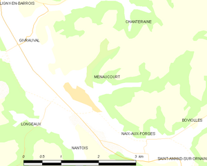
Menaucourt
- commune in Meuse, France
- Country:
- Postal Code: 55500
- Coordinates: 48° 39' 2" N, 5° 21' 17" E
- GPS tracks (wikiloc): [Link]
- Area: 6.3 sq km
- Population: 236
- Web site: [Link]

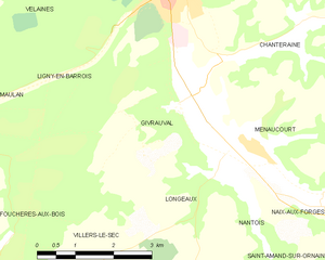
Givrauval
- commune in Meuse, France
- Country:
- Postal Code: 55500
- Coordinates: 48° 39' 41" N, 5° 19' 28" E
- GPS tracks (wikiloc): [Link]
- Area: 9.69 sq km
- Population: 321
Villers-le-Sec
- commune in Meuse, France
- Country:
- Postal Code: 55500
- Coordinates: 48° 37' 15" N, 5° 17' 48" E
- GPS tracks (wikiloc): [Link]
- Area: 6.99 sq km
- Population: 127
Nantois
- commune in Meuse, France
- Country:
- Postal Code: 55500
- Coordinates: 48° 38' 15" N, 5° 21' 5" E
- GPS tracks (wikiloc): [Link]
- Area: 6.05 sq km
- Population: 80