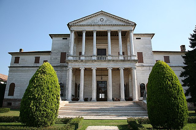
Loreggia (Loreggia)
- Italian comune
Loreggia, located in the province of Treviso in the Veneto region of Italy, is not as widely known for hiking as some larger national parks or mountainous regions, but it offers a charming landscape for walking and exploring the outdoors. The area is mainly characterized by the beautiful countryside, rural paths, and vineyards.
Here are some points to consider if you’re looking to hike in and around Loreggia:
-
Terrain: The terrain is generally flat and suitable for easy walks. It's perfect for those looking for a gentle hike rather than challenging trails.
-
Scenic Views: While the elevation is minimal, the charm of the countryside, with its vineyards, farmlands, and quaint villages, can make for a pleasant hiking experience.
-
Nature Reserves and Parks: While Loreggia itself may not have designated hiking trails, you can explore nature reserves and parks in the surrounding areas. The nearby River Brenta, for example, has pathways that offer nice views and tranquil settings.
-
Cultural Aspects: Hiking in this area can also be combined with cultural visits. You can stop by local wineries, historical buildings, and small towns to enrich your experience.
-
Seasonal Hiking: Spring and fall offer the most comfortable temperatures for hiking, while summer can get quite hot, and winter may present challenges depending on weather conditions.
-
Local Advice: It might be helpful to connect with local hiking groups or tourism information centers for the best routes and up-to-date information on trail conditions.
If you’re seeking a hike that combines an appreciation for nature with cultural exploration, Loreggia and its surroundings can provide a delightful experience. Just be sure to plan your route, pack water and snacks, and enjoy the beautiful Venetian countryside!
- Country:

- Postal Code: 35010
- Local Dialing Code: 049
- Licence Plate Code: PD
- Coordinates: 45° 36' 0" N, 11° 57' 0" E


- GPS tracks (wikiloc): [Link]
- AboveSeaLevel: 26 м m
- Area: 19.12 sq km
- Population: 7708
- Web site: http://www.comune.loreggia.pd.it/
- Wikipedia en: wiki(en)
- Wikipedia: wiki(it)
- Wikidata storage: Wikidata: Q34373
- Wikipedia Commons Category: [Link]
- Freebase ID: [/m/0gk4m0]
- GeoNames ID: Alt: [6541823]
- VIAF ID: Alt: [246287778]
- OSM relation ID: [45472]
- UN/LOCODE: [ITLRG]
- ISTAT ID: 028046
- Italian cadastre code: E684
Shares border with regions:


Castelfranco Veneto
- Italian comune
Castelfranco Veneto, located in the Veneto region of Italy, is a charming town known for its historical architecture and beautiful countryside. While it may not be a traditional hiking destination, there are several pleasant trails and opportunities for outdoor activities in and around the area....
- Country:

- Postal Code: 31033
- Local Dialing Code: 0423
- Licence Plate Code: TV
- Coordinates: 45° 40' 0" N, 11° 56' 0" E


- GPS tracks (wikiloc): [Link]
- AboveSeaLevel: 42 м m
- Area: 51.61 sq km
- Population: 33435
- Web site: [Link]
San Martino di Lupari
- Italian comune
 Hiking in San Martino di Lupari
San Martino di Lupari is a charming town located in the Veneto region of Italy, surrounded by picturesque landscapes and a network of trails suitable for hiking enthusiasts. Here are some highlights and tips for hiking in and around San Martino di Lupari:...
- Country:

- Postal Code: 35018
- Local Dialing Code: 049
- Licence Plate Code: PD
- Coordinates: 45° 39' 21" N, 11° 51' 34" E


- GPS tracks (wikiloc): [Link]
- AboveSeaLevel: 40 м m
- Area: 24.27 sq km
- Population: 13104
- Web site: [Link]


Piombino Dese
- Italian comune
Piombino Dese, located in the province of Padua in the Veneto region of Italy, is not typically recognized as a major hiking destination, but it offers some opportunities for walking and exploring the beautiful countryside of northern Italy....
- Country:

- Postal Code: 35017
- Local Dialing Code: 049
- Licence Plate Code: PD
- Coordinates: 45° 36' 0" N, 11° 56' 0" E


- GPS tracks (wikiloc): [Link]
- AboveSeaLevel: 24 м m
- Area: 29.63 sq km
- Population: 9539
- Web site: [Link]
Santa Giustina in Colle
- Italian comune
 Hiking in Santa Giustina in Colle
Santa Giustina in Colle is a charming village located in the province of Padua, in the Veneto region of Italy. While it is not as widely known for hiking as some other locations in Italy, it offers access to various trails and the beautiful natural surroundings of the Euganean Hills (Colli Euganei) nearby....
- Country:

- Postal Code: 35010
- Local Dialing Code: 049
- Licence Plate Code: PD
- Coordinates: 45° 34' 0" N, 11° 54' 0" E


- GPS tracks (wikiloc): [Link]
- AboveSeaLevel: 24 м m
- Area: 17.97 sq km
- Population: 7269
- Web site: [Link]


Camposampiero
- Italian comune
Camposampiero, located in the Veneto region of Italy, is not as widely recognized for hiking as some of the more mountainous areas of the country, but it does offer some opportunities for outdoor enthusiasts to explore its countryside and nearby natural areas....
- Country:

- Postal Code: 35012
- Local Dialing Code: 049
- Licence Plate Code: PD
- Coordinates: 45° 34' 0" N, 11° 56' 0" E


- GPS tracks (wikiloc): [Link]
- AboveSeaLevel: 24 м m
- Area: 21.12 sq km
- Population: 12043
- Web site: [Link]
Resana
- Italian comune
Resana is a charming municipality located in the Province of Treviso in northern Italy. While it may not be as famous for hiking as other regions in Italy, it and its surrounding areas offer beautiful landscapes and opportunities for outdoor activities....
- Country:

- Postal Code: 31023
- Local Dialing Code: 0423
- Licence Plate Code: TV
- Coordinates: 45° 38' 0" N, 11° 57' 0" E


- GPS tracks (wikiloc): [Link]
- AboveSeaLevel: 31 м m
- Area: 24.89 sq km
- Population: 9509
- Web site: [Link]
