Verbandsgemeinde Loreley (Verbandsgemeinde Loreley)
- Verbandsgemeinde in Rhineland-Palatinate, Germany
 Hiking in Verbandsgemeinde Loreley
Loreley, located in the Verbandsgemeinde of Loreley in Germany, is situated along the picturesque Rhine River and is renowned for its stunning landscapes and rich cultural history. The area is particularly popular among hikers due to its scenic views, charming villages, and well-maintained trails. Here’s an overview of what you can expect when hiking in Loreley:
Scenic Trails
-
Rheinsteig Trail: The Rheinsteig is a long-distance hiking trail that runs along the left bank of the Rhine River from Bonn to Wiesbaden. In the Loreley region, this trail offers breathtaking views of the river and nearby vineyards. Hiking this route allows you to experience the natural beauty and cultural heritage of the area.
-
Loreley Plateau: The Loreley Rock is a famous landmark with a viewing platform that provides stunning panoramic views of the Rhine Valley. There are various hiking paths that lead to this plateau, where you can enjoy the scenery and take in the legend of the Loreley.
-
Local Trails: In addition to the Rheinsteig, there are several smaller local hiking trails that explore the surrounding forests and hills. These trails often lead to charming villages, historic sites, and vineyards.
Flora and Fauna
The region is home to a diverse range of plant and animal species. While hiking, you may encounter wildflowers, various bird species, and potentially see deer or other wildlife in the forests and fields.
Historical Significance
Hiking in Loreley also means exploring the rich history of the area. You'll find numerous historical sites, including castles and ruins along the Rhine, like Schloss Rheinfels. The hiking trails often weave through these historical landmarks, providing a cultural context to your outdoor experience.
Preparation and Tips
- Footwear: Proper hiking boots are recommended due to the sometimes rugged terrain.
- Weather: Check the weather forecast before heading out, as conditions can change rapidly.
- Hydration and Snacks: Bring plenty of water and snacks, especially on longer hikes.
- Maps and Guides: Local maps or hiking guides can greatly enhance your experience by pointing out points of interest.
Conclusion
Hiking in Loreley offers a mix of natural beauty, cultural heritage, and recreational activities, making it an excellent destination for both seasoned hikers and those looking for a leisurely stroll. Whether you choose to tackle the longer trails like the Rheinsteig or explore local paths, this region has something to offer for everyone!
- Country:

- Capital: Sankt Goarshausen
- Coordinates: 50° 9' 11" N, 7° 43' 10" E


- GPS tracks (wikiloc): [Link]
- Web site: http://www.loreley.info/
- Wikipedia en: wiki(en)
- Wikipedia: wiki(de)
- Wikidata storage: Wikidata: Q179594
- Freebase ID: [/m/0bt4y0]
- GND ID: Alt: [1031247432]
- German regional key: 071415009
Includes regions:

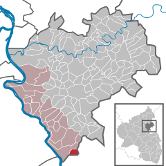
Sauerthal
- municipality of Germany
Sauerthal, located in the picturesque Rhine valley of Germany, is a fantastic destination for hikers looking for scenic views and varied terrain. The region is known for its lush vineyards, charming villages, and beautiful landscapes, making it an ideal place for both leisurely walks and more challenging hikes....
- Country:

- Postal Code: 65391
- Local Dialing Code: 06726
- Licence Plate Code: EMS
- Coordinates: 50° 5' 9" N, 7° 49' 18" E


- GPS tracks (wikiloc): [Link]
- AboveSeaLevel: 208 м m
- Area: 3.57 sq km
- Population: 154
- Web site: [Link]


Braubach
- municipality of Germany
Braubach is a charming town in Germany located along the Rhine River, famous for its picturesque landscapes, wine culture, and historic sites, including the imposing Marksburg Castle. Hiking in and around Braubach offers stunning views, rich history, and the opportunity to explore the natural beauty of the Rhine Valley....
- Country:

- Postal Code: 56338
- Local Dialing Code: 02627
- Licence Plate Code: EMS
- Coordinates: 50° 16' 29" N, 7° 38' 46" E


- GPS tracks (wikiloc): [Link]
- AboveSeaLevel: 72 м m
- Area: 20.26 sq km
- Population: 3093
- Web site: [Link]


Kaub
- municipality of Germany
Kaub is a charming town located along the Rhine River in Germany, particularly known for its picturesque landscape, historic buildings, and vineyards. Hiking in and around Kaub offers a variety of scenic trails that showcase the natural beauty and cultural heritage of the region. Here are some highlights and tips for hiking in Kaub:...
- Country:

- Postal Code: 56349
- Local Dialing Code: 06774
- Licence Plate Code: EMS
- Coordinates: 50° 5' 17" N, 7° 45' 45" E


- GPS tracks (wikiloc): [Link]
- AboveSeaLevel: 74 м m
- Area: 12.98 sq km
- Population: 856
- Web site: [Link]
Auel
- municipality of Germany
It seems like you might be referring to Auel in France, or you could be thinking of a specific hiking location or trail name that sounds similar. However, "Auel" isn't a widely recognized hiking destination. If you meant Auel in a broader sense related to outdoor activities or locations, here’s what I can share:...
- Country:

- Postal Code: 56357
- Local Dialing Code: 06771
- Licence Plate Code: EMS
- Coordinates: 50° 10' 16" N, 7° 45' 59" E


- GPS tracks (wikiloc): [Link]
- AboveSeaLevel: 275 м m
- Area: 2.65 sq km
- Population: 186
- Web site: [Link]


Kestert
- municipality of Germany
Kestert is a picturesque village located in the Rhine Valley of Germany, known for its beautiful landscapes and quaint charm. Hiking around Kestert offers an opportunity to explore the stunning natural beauty of the Rhine region, including vineyards, forests, and dramatic river views....
- Country:

- Postal Code: 56348
- Local Dialing Code: 06773
- Licence Plate Code: EMS
- Coordinates: 50° 11' 8" N, 7° 39' 0" E


- GPS tracks (wikiloc): [Link]
- AboveSeaLevel: 70 м m
- Area: 6.90 sq km
- Population: 581
- Web site: [Link]


Lykershausen
- municipality of Germany
Lykershausen is a charming area located in the picturesque landscapes of Germany, particularly within the context of the beautiful region of Rhineland-Palatinate. While not as widely known as some other hiking destinations, Lykershausen offers a range of trails that cater to various skill levels, allowing hikers to experience stunning views of the surrounding countryside, forests, and possibly even vineyards....
- Country:

- Postal Code: 56346
- Local Dialing Code: 06773
- Licence Plate Code: EMS
- Coordinates: 50° 12' 21" N, 7° 39' 59" E


- GPS tracks (wikiloc): [Link]
- AboveSeaLevel: 351 м m
- Area: 3.35 sq km
- Population: 219
- Web site: [Link]
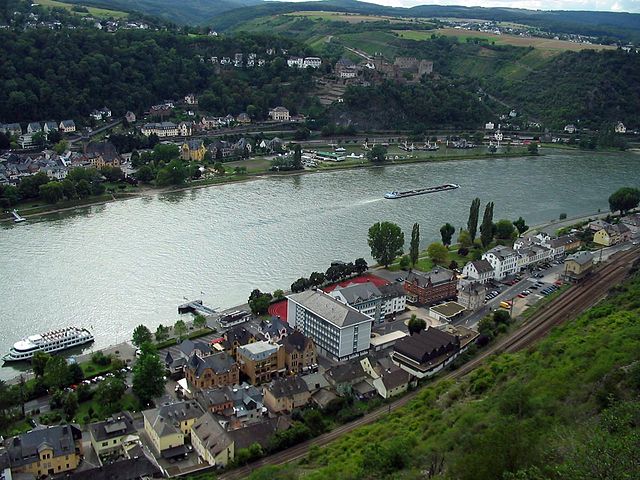

Sankt Goarshausen
- town in Germany
Sankt Goarshausen is a charming village located on the banks of the Rhine River in Germany, known for its stunning landscapes, rich history, and outdoor activities, making it a wonderful destination for hiking enthusiasts....
- Country:

- Postal Code: 56346; 5422
- Local Dialing Code: 06771
- Coordinates: 50° 9' 17" N, 7° 42' 59" E


- GPS tracks (wikiloc): [Link]
- AboveSeaLevel: 100 м m
- Area: 7.00 sq km
- Population: 1302
- Web site: [Link]
Reitzenhain
- municipality of Germany
Reitzenhain is a charming little village located in the Saxon Switzerland region of Germany, near the border with the Czech Republic. It's an excellent destination for hiking, offering a variety of trails that showcase the natural beauty of the surrounding landscape. Here are some key points to consider when planning your hiking adventure in Reitzenhain:...
- Country:

- Postal Code: 56357
- Local Dialing Code: 06771
- Licence Plate Code: EMS
- Coordinates: 50° 9' 20" N, 7° 47' 12" E


- GPS tracks (wikiloc): [Link]
- AboveSeaLevel: 300 м m
- Area: 5.66 sq km
- Population: 329
- Web site: [Link]


Dörscheid
- municipality of Germany
Dörscheid is a small village located in the picturesque region of Rhineland-Palatinate, Germany, known for its beautiful landscapes and outdoor activities. Hiking in and around Dörscheid offers a unique experience for nature lovers and outdoor enthusiasts....
- Country:

- Postal Code: 56348
- Local Dialing Code: 06774
- Licence Plate Code: EMS
- Coordinates: 50° 6' 25" N, 7° 45' 31" E


- GPS tracks (wikiloc): [Link]
- AboveSeaLevel: 340 м m
- Area: 8.65 sq km
- Population: 388
- Web site: [Link]


Weisel
- municipality of Germany
Weisel, located in Pennsylvania, is a great spot for hiking enthusiasts. It offers a variety of trails that cater to different experience levels, allowing both beginners and advanced hikers to enjoy the beauty of the natural landscape....
- Country:

- Postal Code: 56348
- Local Dialing Code: 06774
- Licence Plate Code: EMS
- Coordinates: 50° 7' 12" N, 7° 48' 5" E


- GPS tracks (wikiloc): [Link]
- AboveSeaLevel: 395 м m
- Area: 13.06 sq km
- Population: 1053
- Web site: [Link]
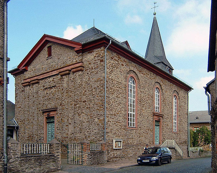
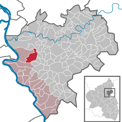
Dachsenhausen
- municipality of Germany
Dachsenhausen, located in Germany's Rhineland-Palatinate region, is surrounded by beautiful landscapes perfect for hiking enthusiasts. The area features a mix of history, nature, and scenic views, making it an attractive destination for hikers of all levels....
- Country:

- Postal Code: 56340
- Local Dialing Code: 06776
- Licence Plate Code: EMS
- Coordinates: 50° 15' 15" N, 7° 43' 36" E


- GPS tracks (wikiloc): [Link]
- AboveSeaLevel: 380 м m
- Area: 10.17 sq km
- Population: 1010
- Web site: [Link]

Kamp-Bornhofen
- municipality of Germany
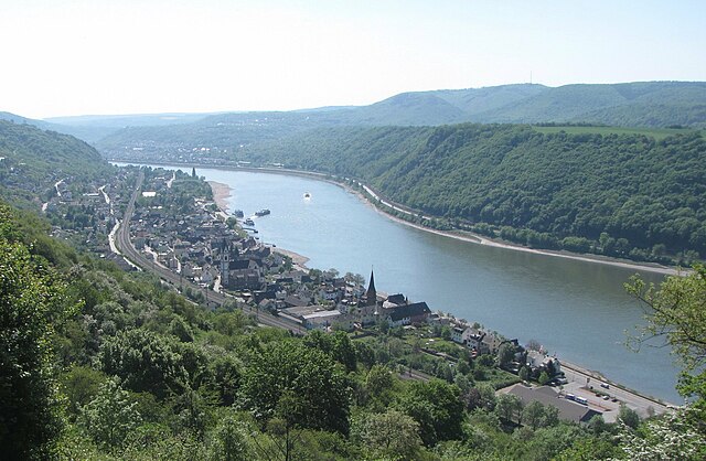
Kamp-Bornhofen is a picturesque village located in the Rhine Valley in Germany, known for its stunning landscapes along the Rhine River and its historical significance. It's surrounded by beautiful nature, including hills, forests, and the Rhine itself, making it a great spot for hiking enthusiasts....
- Country:

- Postal Code: 56341
- Local Dialing Code: 06773
- Licence Plate Code: EMS
- Coordinates: 50° 13' 30" N, 7° 37' 20" E


- GPS tracks (wikiloc): [Link]
- AboveSeaLevel: 69 м m
- Area: 11.37 sq km
- Population: 1593
- Web site: [Link]
Prath, Germany
- municipality of Germany
Prath, a charming village in Germany, is often overlooked in favor of more popular hiking destinations. However, it offers fantastic opportunities for outdoor enthusiasts. Situated in a picturesque region, Prath provides access to scenic trails that showcase the beauty of the surrounding landscapes, including forests, hills, and rivers....
- Country:

- Postal Code: 56346
- Local Dialing Code: 06771
- Licence Plate Code: EMS
- Coordinates: 50° 11' 49" N, 7° 41' 10" E


- GPS tracks (wikiloc): [Link]
- AboveSeaLevel: 280 м m
- Area: 4.33 sq km
- Population: 289
- Web site: [Link]


Bornich
- municipality of Germany
Bornich is a small village located in the Rhine Valley in Germany, known for its scenic landscapes, charming architecture, and proximity to various hiking trails. The area around Bornich offers excellent opportunities for hiking enthusiasts of all skill levels, with trails that take you through vineyards, along the Rhine River, and into the surrounding forests....
- Country:

- Postal Code: 56348
- Local Dialing Code: 06771
- Licence Plate Code: EMS
- Coordinates: 50° 7' 43" N, 7° 46' 9" E


- GPS tracks (wikiloc): [Link]
- AboveSeaLevel: 300 м m
- Area: 12.00 sq km
- Population: 935
- Web site: [Link]

Patersberg
- municipality of Germany
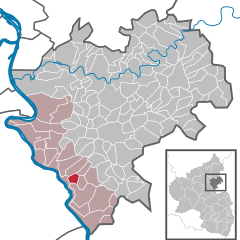
Patersberg, a picturesque village located in the scenic region of Germany, offers a serene environment ideal for hiking enthusiasts. Nestled in the Rheinland-Palatinate area, it serves as a gateway to various beautiful trails and natural attractions. Here are some highlights about hiking in and around Patersberg:...
- Country:

- Postal Code: 56348
- Local Dialing Code: 06771
- Licence Plate Code: EMS
- Coordinates: 50° 9' 28" N, 7° 44' 10" E


- GPS tracks (wikiloc): [Link]
- AboveSeaLevel: 242 м m
- Area: 2.65 sq km
- Population: 380
- Web site: [Link]
Lierschied
- municipality of Germany
Lierschied is a quaint village in Germany, located within the picturesque region of the Rhein-Lahn-Kreis in Rhineland-Palatinate. The area offers a range of hiking opportunities, set against the backdrop of lush forests, rolling hills, and beautiful views of the surrounding countryside and the Rhine River....
- Country:

- Postal Code: 56357
- Local Dialing Code: 06771
- Licence Plate Code: EMS
- Coordinates: 50° 10' 17" N, 7° 44' 49" E


- GPS tracks (wikiloc): [Link]
- AboveSeaLevel: 250 м m
- Area: 5.93 sq km
- Population: 472
- Web site: [Link]


Osterspai
- municipality of Germany
Osterspai is a picturesque village located in the Rhine Valley in Germany, known for its beautiful landscapes, historic sites, and access to various hiking trails. This region is characterized by stunning views of the Rhine River, vineyards, and charming half-timbered houses. Here are some key points about hiking in and around Osterspai:...
- Country:

- Postal Code: 56340
- Local Dialing Code: 02627
- Licence Plate Code: EMS
- Coordinates: 50° 14' 44" N, 7° 36' 58" E


- GPS tracks (wikiloc): [Link]
- AboveSeaLevel: 65 м m
- Area: 13.00 sq km
- Population: 1249
- Web site: [Link]
Dahlheim
- municipality of Germany
Dahlheim, a picturesque village located in Germany, offers a variety of hiking opportunities for outdoor enthusiasts. Nestled in the scenic landscapes of the Rhineland-Palatinate region, hikers can explore charming trails that are surrounded by lush forests, rolling hills, and vineyards....
- Country:

- Postal Code: 56348
- Local Dialing Code: 06771
- Licence Plate Code: EMS
- Coordinates: 50° 12' 37" N, 7° 41' 40" E


- GPS tracks (wikiloc): [Link]
- AboveSeaLevel: 260 м m
- Area: 6.82 sq km
- Population: 824
- Web site: [Link]

Nochern
- municipality of Germany
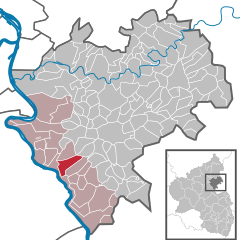
Nochern is a beautiful region that offers a variety of hiking opportunities, characterized by its stunning landscapes, diverse ecosystems, and well-marked trails. While specific details about Nochern might not be widely documented, here are some general tips and information that can help you make the most of your hiking experience in any mountainous or natural area:...
- Country:

- Postal Code: 56357
- Local Dialing Code: 06771
- Licence Plate Code: EMS
- Coordinates: 50° 10' 39" N, 7° 43' 28" E


- GPS tracks (wikiloc): [Link]
- AboveSeaLevel: 250 м m
- Area: 7.11 sq km
- Population: 507
- Web site: [Link]

Weyer
- municipality of Germany
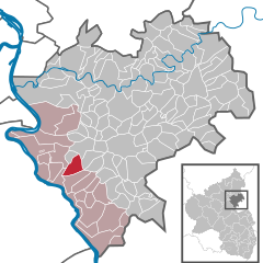
Weyer, located in the beautiful region of Bavaria, Germany, offers a range of hiking opportunities suitable for different skill levels. Nestled amidst stunning landscapes, it provides access to diverse trails that showcase natural beauty, from lush forests to scenic viewpoints....
- Country:

- Postal Code: 56357
- Local Dialing Code: 06771
- Licence Plate Code: EMS
- Coordinates: 50° 11' 47" N, 7° 43' 31" E


- GPS tracks (wikiloc): [Link]
- AboveSeaLevel: 280 м m
- Area: 6.00 sq km
- Population: 467
- Web site: [Link]


Filsen
- municipality of Germany
Filsen is a picturesque village located in the Rhine Valley of Germany, known for its stunning landscapes and proximity to the Rhine River. When it comes to hiking in this region, there are numerous opportunities to explore the beautiful nature and enjoy the scenic views....
- Country:

- Postal Code: 56341
- Local Dialing Code: 06773
- Licence Plate Code: EMS
- Coordinates: 50° 14' 23" N, 7° 35' 2" E


- GPS tracks (wikiloc): [Link]
- AboveSeaLevel: 75 м m
- Area: 1.88 sq km
- Population: 643
- Web site: [Link]


Reichenberg
- municipality of Germany
Reichenberg, located in Rhineland-Palatinate, Germany, offers a beautiful landscape ideal for hiking enthusiasts. Nestled near the borders of the Palatinate Forest Nature Park, this area is characterized by its rolling hills, dense forests, and scenic views. Here are some highlights and tips for hiking in and around Reichenberg:...
- Country:

- Postal Code: 56357
- Local Dialing Code: 06771
- Licence Plate Code: EMS
- Coordinates: 50° 9' 31" N, 7° 45' 35" E


- GPS tracks (wikiloc): [Link]
- AboveSeaLevel: 190 м m
- Area: 3.23 sq km
- Population: 172
- Web site: [Link]
