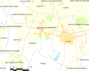
Luçon (Luçon)

- commune in Vendée, France
- Country:

- Postal Code: 85400
- Coordinates: 46° 27' 17" N, 1° 9' 57" E


- GPS tracks (wikiloc): [Link]
- Area: 31.52 sq km
- Population: 9394
- Web site: http://www.lucon.fr
- Wikipedia en: wiki(en)
- Wikipedia: wiki(fr)
- Wikidata storage: Wikidata: Q185352
- Wikipedia Commons Category: [Link]
- Freebase ID: [/m/08t0fc]
- GeoNames ID: Alt: [6445138]
- SIREN number: [218501286]
- BnF ID: [152782542]
- VIAF ID: Alt: [248629664]
- GND ID: Alt: [4247549-1]
- archINFORM location ID: [9289]
- MusicBrainz area ID: [4148e0a1-3ec9-4b2f-8e0a-e2b32f7a42ba]
- Twitter username: Alt: [villedelucon]
- INSEE municipality code: 85128
Shares border with regions:


Corpe
- commune in Vendée, France
- Country:
- Postal Code: 85320
- Coordinates: 46° 30' 19" N, 1° 10' 56" E
- GPS tracks (wikiloc): [Link]
- Area: 17.1 sq km
- Population: 1070


Champagné-les-Marais
- commune in Vendée, France
- Country:
- Postal Code: 85450
- Coordinates: 46° 22' 52" N, 1° 7' 26" E
- GPS tracks (wikiloc): [Link]
- Area: 49.82 sq km
- Population: 1757
- Web site: [Link]

Les Magnils-Reigniers
- commune in Vendée, France
- Country:
- Postal Code: 85400
- Coordinates: 46° 28' 44" N, 1° 13' 13" E
- GPS tracks (wikiloc): [Link]
- AboveSeaLevel: 12 м m
- Area: 17.96 sq km
- Population: 1609
- Web site: [Link]

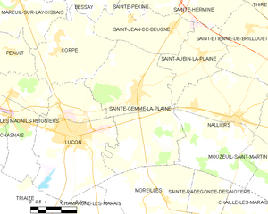
Sainte-Gemme-la-Plaine
- commune in Vendée, France
- Country:
- Postal Code: 85400
- Coordinates: 46° 29' 2" N, 1° 6' 42" E
- GPS tracks (wikiloc): [Link]
- Area: 35.52 sq km
- Population: 2054
- Web site: [Link]


Triaize
- commune in Vendée, France
- Country:
- Postal Code: 85580
- Coordinates: 46° 23' 34" N, 1° 11' 52" E
- GPS tracks (wikiloc): [Link]
- Area: 58.8 sq km
- Population: 1041
- Web site: [Link]


Moreilles
- commune in Vendée, France
- Country:
- Postal Code: 85450
- Coordinates: 46° 25' 16" N, 1° 5' 5" E
- GPS tracks (wikiloc): [Link]
- Area: 19.68 sq km
- Population: 387