Lucéram (Lucéram)

- commune in Alpes-Maritimes, France
 Hiking in Lucéram
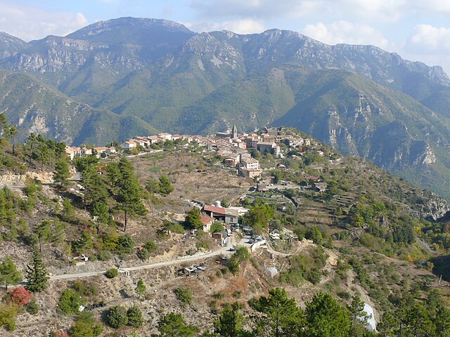
Lucéram is a picturesque village located in the Alpes-Maritimes department of France, nestled in the hills of Provence near the French Riviera. The area surrounding Lucéram offers a variety of hiking opportunities, showcasing stunning landscapes, rich flora, and charming rural architecture.
Hiking Trails in and Around Lucéram
-
Sentier de la Chapelle Saint-Roch: A relatively easy trail that leads you to the picturesque Chapel of Saint Roch. The path offers beautiful views of the surrounding hills and valleys, making it a great hike for families and beginners.
-
GR5 Trail: Lucéram is part of the long-distance GR5 trail, which runs from the Netherlands down to the Mediterranean. You can access this trail from various points around Lucéram, offering a chance to explore both the coastal and mountainous regions.
-
Mont Agel: For those looking for a more challenging hike, this trail takes you up to Mont Agel, providing stunning panoramic views of the coastline and the surrounding mountains. The terrain can be more rugged, so it’s essential to have proper hiking gear.
-
The Gorges de L'Escarène: This trail leads through beautiful gorges and is excellent for those looking to combine hiking with a bit of nature exploration. The gentle sound of flowing water enhances the hiking experience.
Hiking Tips
-
Best Time to Hike: Late spring (May to June) and early autumn (September to October) are ideal for hiking in Lucéram, as the weather is mild and the trails are less crowded.
-
Prepare for Varying Terrain: Trails can vary greatly in difficulty. Be sure to review trail conditions and maps, and choose routes that fit your experience level.
-
Bring Essentials: Always carry enough water, snacks, a first-aid kit, and sun protection. A map or GPS device is also advised for navigation.
-
Local Regulations: Respect the local wildlife and avoid straying off marked trails to help preserve the natural environment.
Getting There
Lucéram is accessible by car, and there are local buses from Nice that connect to the village. Once in Lucéram, many trails are within walking distance.
Enjoying the Experience
After your hike, take some time to explore the village itself. Lucéram is known for its medieval streets, charming stone houses, and the famous “Nativity Trail,” which features numerous nativity scenes displayed throughout the village during the Christmas season.
Happy hiking! If you have any other questions or need guidance on specific trails or preparations, feel free to ask.
- Country:

- Postal Code: 06440
- Coordinates: 43° 52' 57" N, 7° 21' 38" E


- GPS tracks (wikiloc): [Link]
- Area: 65.52 sq km
- Population: 1261
- Wikipedia en: wiki(en)
- Wikipedia: wiki(fr)
- Wikidata storage: Wikidata: Q866296
- Wikipedia Commons Category: [Link]
- Freebase ID: [/m/03m4_5x]
- Freebase ID: [/m/03m4_5x]
- GeoNames ID: Alt: [2997234]
- GeoNames ID: Alt: [2997234]
- SIREN number: [210600771]
- SIREN number: [210600771]
- BnF ID: [13332115h]
- BnF ID: [13332115h]
- VIAF ID: Alt: [243874168]
- VIAF ID: Alt: [243874168]
- PACTOLS thesaurus ID: [pcrtrSbcmh6Mhg]
- PACTOLS thesaurus ID: [pcrtrSbcmh6Mhg]
- WOEID: [608902]
- WOEID: [608902]
- INSEE municipality code: 06077
- INSEE municipality code: 06077
Shares border with regions:


L'Escarène
- commune in Alpes-Maritimes, France
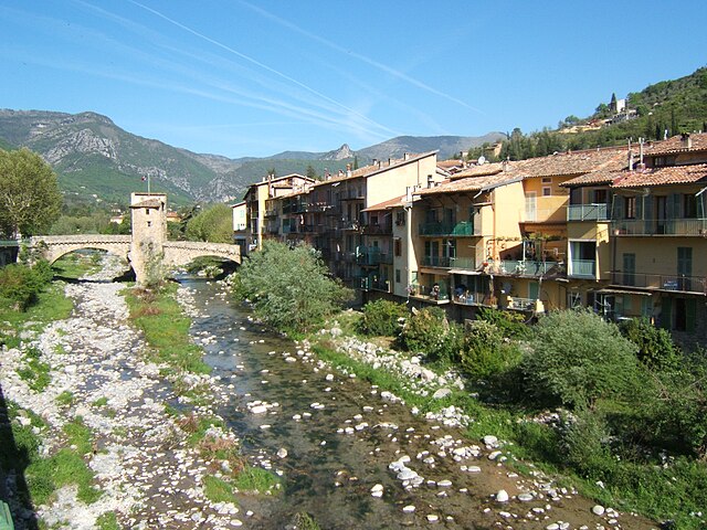
Hiking in L'Escarène
L'Escarène is a charming village located in the Alpes-Maritimes department in southeastern France, nestled in the beautiful hills of the Côte d'Azur. The area around L'Escarène offers a variety of hiking opportunities, characterized by its picturesque landscapes, stunning views of the surrounding hills and valleys, and proximity to the Mediterranean coastline....
- Country:
- Postal Code: 06440
- Coordinates: 43° 50' 4" N, 7° 21' 24" E
- GPS tracks (wikiloc): [Link]
- Area: 10.67 sq km
- Population: 2507

Utelle
- commune in Alpes-Maritimes, France
Hiking in Utelle
Utelle is a charming village in the Alpes-Maritimes department of the French Riviera, surrounded by stunning natural landscapes, making it an excellent destination for hiking enthusiasts. Here are some highlights about hiking in and around Utelle:...
- Country:
- Postal Code: 06450
- Coordinates: 43° 55' 9" N, 7° 15' 51" E
- GPS tracks (wikiloc): [Link]
- Area: 67.97 sq km
- Population: 832


Lantosque
- commune in Alpes-Maritimes, France
Hiking in Lantosque
Lantosque is a charming commune located in the Alpes-Maritimes department in the Provence-Alpes-Côte d'Azur region of southeastern France. It offers a range of hiking opportunities set against the stunning backdrop of the French Alps and the nearby Mercantour National Park....
- Country:
- Postal Code: 06450
- Coordinates: 43° 58' 24" N, 7° 18' 45" E
- GPS tracks (wikiloc): [Link]
- Area: 44.76 sq km
- Population: 1314
- Web site: [Link]

Sospel
- commune in Alpes-Maritimes, France
Hiking in Sospel
Sospel is a charming village located in the Alpes-Maritimes department of France, nestled in the scenic hills near the Italian border. It's an excellent base for hikers, offering a variety of trails that showcase the stunning natural beauty of the region. Here are some highlights of hiking in Sospel:...
- Country:
- Postal Code: 06380
- Coordinates: 43° 52' 37" N, 7° 26' 54" E
- GPS tracks (wikiloc): [Link]
- AboveSeaLevel: 348 м m
- Area: 62.39 sq km
- Population: 3782
- Web site: [Link]

Touët-de-l'Escarène
- commune in Alpes-Maritimes, France
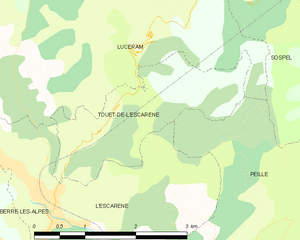
Hiking in Touët-de-l'Escarène
Touët-de-l'Escarène is a charming village located in the Alpes-Maritimes department of France, not far from Nice. It serves as a great base for hiking enthusiasts looking to explore the scenic beauty of the surrounding regions. Here’s what you should know about hiking around Touët-de-l'Escarène:...
- Country:
- Postal Code: 06440
- Coordinates: 43° 50' 51" N, 7° 21' 54" E
- GPS tracks (wikiloc): [Link]
- AboveSeaLevel: 415 м m
- Area: 4.57 sq km
- Population: 289

Duranus
- commune in Alpes-Maritimes, France
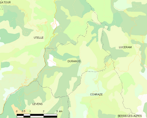
Hiking in Duranus
Duranus is a beautiful area located in the Alpes-Maritimes department of France, known for its stunning landscapes and rich natural scenery. Hiking in this region offers various trails that cater to different skill levels, making it an excellent destination for both beginners and experienced hikers....
- Country:
- Postal Code: 06670
- Coordinates: 43° 53' 36" N, 7° 15' 33" E
- GPS tracks (wikiloc): [Link]
- Area: 16.1 sq km
- Population: 138

Moulinet
- commune in Alpes-Maritimes, France
Hiking in Moulinet
Moulinet is a charming village located in the Alpes-Maritimes region of France, nestled in the foothills of the Alps and close to the stunning Mercantour National Park. The area is known for its beautiful landscapes, diverse flora and fauna, and numerous hiking trails suited for various skill levels. Here’s what you need to know about hiking in Moulinet:...
- Country:
- Postal Code: 06380
- Coordinates: 43° 56' 27" N, 7° 24' 46" E
- GPS tracks (wikiloc): [Link]
- Area: 41.07 sq km
- Population: 274

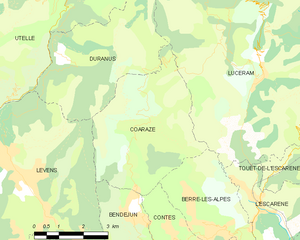
Coaraze
- commune in Alpes-Maritimes, France
Hiking in Coaraze
Coaraze, a charming village located in the Alpes-Maritimes region of France, offers beautiful hiking opportunities in a stunning natural environment. Nestled in the hills above Nice, this picturesque spot provides both scenic views and a glimpse into traditional Provencal life....
- Country:
- Postal Code: 06390
- Coordinates: 43° 51' 51" N, 7° 17' 42" E
- GPS tracks (wikiloc): [Link]
- Area: 17.14 sq km
- Population: 843


Berre-les-Alpes
- commune in Alpes-Maritimes, France
Hiking in Berre-les-Alpes
Berre-les-Alpes is a charming village located in the hills near Nice in the French Riviera, offering stunning views and diverse hiking opportunities. Here are some key points about hiking in and around Berre-les-Alpes:...
- Country:
- Postal Code: 06390
- Coordinates: 43° 49' 49" N, 7° 19' 44" E
- GPS tracks (wikiloc): [Link]
- Area: 9.58 sq km
- Population: 1270

Peille
- commune in Alpes-Maritimes, France
Hiking in Peille
Peille is a charming village located in the Alpes-Maritimes department in the Provence-Alpes-Côte d'Azur region of France. Nestled in the hills above the Mediterranean, it offers a variety of hiking opportunities with stunning views, lush vegetation, and a rich history....
- Country:
- Postal Code: 06440
- Coordinates: 43° 48' 9" N, 7° 24' 6" E
- GPS tracks (wikiloc): [Link]
- Area: 43.16 sq km
- Population: 2353
- Web site: [Link]