Utelle (Utelle)

- commune in Alpes-Maritimes, France
 Hiking in Utelle
Utelle is a charming village in the Alpes-Maritimes department of the French Riviera, surrounded by stunning natural landscapes, making it an excellent destination for hiking enthusiasts. Here are some highlights about hiking in and around Utelle:
Scenic Trails
- Variety of Trails: The area offers a range of trails suitable for different skill levels, from easy walks to more challenging hikes.
- Mountain Views: Many trails provide breathtaking views of the surrounding mountains and valleys, including the nearby Mercantour National Park.
- Cultural Exploration: Hiking in Utelle can also involve discovering historical sites, such as ancient chapels and ruins, which add cultural value to your outdoor experience.
Wildlife and Flora
- Biodiversity: The region is home to diverse flora and fauna. Keep an eye out for unique plant species and local wildlife, which can be especially vibrant in spring and summer.
- Birdwatching: Birdwatchers may also enjoy spotting various species that inhabit these mountainous regions.
Practical Tips
- Weather Preparedness: Always check the weather forecast before heading out, as conditions can change rapidly in the mountains.
- Stay Hydrated: Carry sufficient water and snacks, especially on longer hikes, to keep your energy levels up.
- Map and Navigation: Make sure to have a detailed map of the trails, or consider using a reliable GPS app, as some paths can be less marked.
Guided Tours
- Local Guides: If you're unfamiliar with the area or prefer a guided experience, consider hiring a local guide who can provide valuable insights on the trails and surrounding nature.
Accessibility
- Transportation: Utelle is accessible by car from Nice and other major cities along the Côte d'Azur, making it an easy day trip for hikers staying in the region.
Seasonal Hiking
- Spring and Summer: Ideal for hiking due to mild temperatures and blooming wildlife.
- Autumn: Offers beautiful fall colors but be cautious of rain and slippery trails.
- Winter: Some areas might be suitable for snowshoeing or winter hiking, but check trail conditions beforehand.
Whether you are a seasoned hiker or a beginner, Utelle provides a tranquil setting and beautiful scenery for a memorable hiking experience. Always remember to follow Leave No Trace principles and respect the local environment.
- Country:

- Postal Code: 06450
- Coordinates: 43° 55' 9" N, 7° 15' 51" E


- GPS tracks (wikiloc): [Link]
- Area: 67.97 sq km
- Population: 832
- Wikipedia en: wiki(en)
- Wikipedia: wiki(fr)
- Wikidata storage: Wikidata: Q1018235
- Wikipedia Commons Category: [Link]
- Freebase ID: [/m/05j_3p]
- Freebase ID: [/m/05j_3p]
- GeoNames ID: Alt: [2971283]
- GeoNames ID: Alt: [2971283]
- SIREN number: [210601514]
- SIREN number: [210601514]
- BnF ID: [11942471s]
- BnF ID: [11942471s]
- VIAF ID: Alt: [152467622]
- VIAF ID: Alt: [152467622]
- Library of Congress authority ID: Alt: [n82098731]
- Library of Congress authority ID: Alt: [n82098731]
- Encyclopædia Britannica Online ID: [place/Utelle]
- Encyclopædia Britannica Online ID: [place/Utelle]
- INSEE municipality code: 06151
- INSEE municipality code: 06151
Shares border with regions:


Malaussène
- commune in Alpes-Maritimes, France
Hiking in Malaussène
Malaussène is a charming area located in the French region of Occitanie, known for its beautiful landscapes and hiking opportunities. While not as famous as some other hiking destinations in France, it offers a variety of trails suitable for all skill levels....
- Country:
- Postal Code: 06710
- Coordinates: 43° 55' 47" N, 7° 7' 41" E
- GPS tracks (wikiloc): [Link]
- Area: 19.48 sq km
- Population: 305
- Web site: [Link]

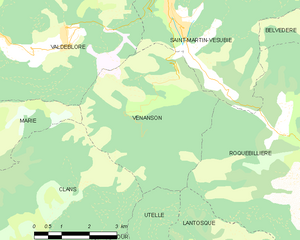
Venanson
- commune in Alpes-Maritimes, France
Hiking in Venanson
Venanson is a charming village located in the Alpes-Maritimes region of France, nestled in the heart of the Mercantour National Park. It offers breathtaking landscapes and a variety of hiking trails that cater to different skill levels. Here are some highlights for hiking in Venanson:...
- Country:
- Postal Code: 06450
- Coordinates: 44° 3' 11" N, 7° 15' 11" E
- GPS tracks (wikiloc): [Link]
- Area: 17.98 sq km
- Population: 155
- Web site: [Link]


La Tour
- commune in Alpes-Maritimes, France
Hiking in La Tour
La Tour, located in the Alpes-Maritimes region of France, is a picturesque spot for hiking enthusiasts. Nestled in the southern French Alps, the area offers stunning views, diverse landscapes, and a variety of trails suitable for different skill levels. Here are some highlights and considerations for hiking in this region:...
- Country:
- Postal Code: 06710
- Coordinates: 43° 56' 49" N, 7° 11' 3" E
- GPS tracks (wikiloc): [Link]
- AboveSeaLevel: 620 м m
- Area: 36.7 sq km
- Population: 579


Levens
- commune in Alpes-Maritimes, France
Hiking in Levens
Levens, a small commune in the Alpes-Maritimes department in the Provence-Alpes-Côte d'Azur region of France, offers beautiful hiking opportunities surrounded by picturesque landscapes, including mountains and valleys. Here are some key highlights about hiking in and around Levens:...
- Country:
- Postal Code: 06670
- Coordinates: 43° 51' 39" N, 7° 13' 28" E
- GPS tracks (wikiloc): [Link]
- Area: 29.85 sq km
- Population: 4741


Lantosque
- commune in Alpes-Maritimes, France
Hiking in Lantosque
Lantosque is a charming commune located in the Alpes-Maritimes department in the Provence-Alpes-Côte d'Azur region of southeastern France. It offers a range of hiking opportunities set against the stunning backdrop of the French Alps and the nearby Mercantour National Park....
- Country:
- Postal Code: 06450
- Coordinates: 43° 58' 24" N, 7° 18' 45" E
- GPS tracks (wikiloc): [Link]
- Area: 44.76 sq km
- Population: 1314
- Web site: [Link]

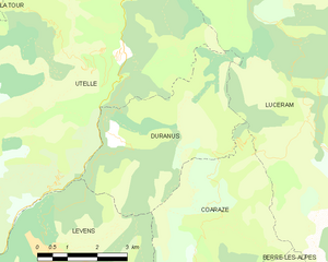
Duranus
- commune in Alpes-Maritimes, France
Hiking in Duranus
Duranus is a beautiful area located in the Alpes-Maritimes department of France, known for its stunning landscapes and rich natural scenery. Hiking in this region offers various trails that cater to different skill levels, making it an excellent destination for both beginners and experienced hikers....
- Country:
- Postal Code: 06670
- Coordinates: 43° 53' 36" N, 7° 15' 33" E
- GPS tracks (wikiloc): [Link]
- Area: 16.1 sq km
- Population: 138

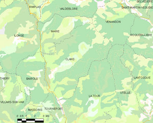
Clans
- commune in Alpes-Maritimes, France
Hiking in Clans
Clans, a picturesque village located in the Alpes-Maritimes department of the French Riviera, offers a unique hiking experience for outdoor enthusiasts. Nestled in the foothills of the Alps, Clans is surrounded by stunning mountainous landscapes, lush vegetation, and breathtaking views—perfect for nature lovers and hikers of all skill levels....
- Country:
- Postal Code: 06420
- Coordinates: 43° 59' 42" N, 7° 8' 52" E
- GPS tracks (wikiloc): [Link]
- Area: 37.79 sq km
- Population: 589


Bonson
- commune in Alpes-Maritimes, France
Hiking in Bonson
Bonson, located in the Alpes-Maritimes department of the Provence-Alpes-Côte d'Azur region in France, offers a beautiful setting for hiking enthusiasts. Nestled in the hills above the Var River, this charming village is surrounded by stunning natural landscapes and offers a variety of trails that cater to different skill levels....
- Country:
- Postal Code: 06830
- Coordinates: 43° 51' 46" N, 7° 11' 24" E
- GPS tracks (wikiloc): [Link]
- Area: 6.72 sq km
- Population: 737
- Web site: [Link]

Revest-les-Roches
- commune in Alpes-Maritimes, France
Hiking in Revest-les-Roches
Revest-les-Roches, located in the Provence-Alpes-Côte d'Azur region of France, is a charming destination for hikers, offering stunning landscapes, natural beauty, and rich history. Nestled in the hills near the city of Toulon, it features a mix of rugged terrain, scenic trails, and panoramic views of the surrounding countryside and the Mediterranean Sea....
- Country:
- Postal Code: 06830
- Coordinates: 43° 52' 50" N, 7° 9' 26" E
- GPS tracks (wikiloc): [Link]
- Area: 8.61 sq km
- Population: 230


Lucéram
- commune in Alpes-Maritimes, France
Hiking in Lucéram
Lucéram is a picturesque village located in the Alpes-Maritimes department of France, nestled in the hills of Provence near the French Riviera. The area surrounding Lucéram offers a variety of hiking opportunities, showcasing stunning landscapes, rich flora, and charming rural architecture....
- Country:
- Postal Code: 06440
- Coordinates: 43° 52' 57" N, 7° 21' 38" E
- GPS tracks (wikiloc): [Link]
- Area: 65.52 sq km
- Population: 1261


Tournefort
- commune in Alpes-Maritimes, France
Hiking in Tournefort
Tournefort, located in the Alpes-Maritimes region of France, is a small village that offers access to beautiful hiking opportunities in the surrounding natural environment. The Alpes-Maritimes is known for its stunning landscapes, with a mix of mountains, hills, and Mediterranean coastlines....
- Country:
- Postal Code: 06420
- Coordinates: 43° 56' 48" N, 7° 9' 4" E
- GPS tracks (wikiloc): [Link]
- Area: 10.13 sq km
- Population: 162