Lugagnac (Lugagnac)

- commune in Lot, France
- Country:

- Postal Code: 46260
- Coordinates: 44° 24' 31" N, 1° 44' 9" E


- GPS tracks (wikiloc): [Link]
- Area: 15.81 sq km
- Population: 126
- Wikipedia en: wiki(en)
- Wikipedia: wiki(fr)
- Wikidata storage: Wikidata: Q1322015
- Wikipedia Commons Category: [Link]
- Freebase ID: [/m/03nwnnb]
- GeoNames ID: Alt: [6434827]
- SIREN number: [214601791]
- BnF ID: [15260920j]
- PACTOLS thesaurus ID: [pcrttYyqmpf39A]
- INSEE municipality code: 46179
Shares border with regions:

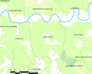
Cénevières
- commune in Lot, France
- Country:
- Postal Code: 46330
- Coordinates: 44° 27' 45" N, 1° 44' 49" E
- GPS tracks (wikiloc): [Link]
- Area: 15.69 sq km
- Population: 165


Crégols
- commune in Lot, France
- Country:
- Postal Code: 46330
- Coordinates: 44° 27' 22" N, 1° 42' 3" E
- GPS tracks (wikiloc): [Link]
- Area: 18.35 sq km
- Population: 82
Limogne-en-Quercy
- commune in Lot, France
- Country:
- Postal Code: 46260
- Coordinates: 44° 23' 51" N, 1° 46' 13" E
- GPS tracks (wikiloc): [Link]
- Area: 32.31 sq km
- Population: 771
- Web site: [Link]

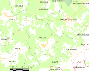
Varaire
- commune in Lot, France
- Country:
- Postal Code: 46260
- Coordinates: 44° 21' 28" N, 1° 43' 26" E
- GPS tracks (wikiloc): [Link]
- Area: 25.52 sq km
- Population: 311
Concots
- commune in Lot, France
- Country:
- Postal Code: 46260
- Coordinates: 44° 24' 6" N, 1° 38' 39" E
- GPS tracks (wikiloc): [Link]
- Area: 26.02 sq km
- Population: 419