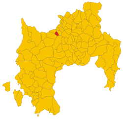
Lunamatrona (Lunamatrona)
%20-%202016.svg)
- Italian comune
 Hiking in Lunamatrona
Lunamatrona is a small town located in the province of Medio Campidano in Sardinia, Italy. While it might not be as famous as other hiking destinations, it offers unique opportunities for outdoor enthusiasts to explore the beautiful Sardinian landscape.
Hiking Opportunities in Lunamatrona
-
Scenic Trails: The area around Lunamatrona features rolling hills, rugged terrain, and scenic views of the Sardinian countryside. Trails traverse through a combination of forests, agricultural land, and ancient ruins.
-
Cultural Exploration: Hiking in the region can lead you to interesting archaeological sites, including remnants of Nuragic culture, the ancient civilization that thrived in Sardinia. Keep an eye out for ancient stone structures and nuraghi (tower-like stone edifices).
-
Wildlife Observation: The varied ecosystems around Lunamatrona are home to diverse flora and fauna, providing opportunities for bird watching and observing local wildlife. Look for endemic species and enjoy the natural beauty of the area.
-
Local Gastronomy: After a day of hiking, you can explore local cuisine. Sardinian food is rich in flavor, and sampling traditional dishes can be a rewarding way to cap off your hiking experience.
-
Nearby Hiking Routes: If you're willing to venture slightly further, you can explore routes in the surrounding areas, such as the Gennargentu National Park, which offers more challenging hikes with rewarding views.
Practical Tips
- Maps and Guides: Acquaint yourself with the local trails by using detailed maps or hiring a local guide to ensure safe navigation of the region’s paths.
- Weather Considerations: The best months for hiking are generally spring (April to June) and fall (September to October) when the weather is mild. Summer can be hot, and winter may bring rain.
- Gear: Make sure to wear appropriate footwear and carry water, snacks, sun protection, and a first-aid kit.
Conclusion
Hiking in Lunamatrona and its surroundings can provide a refreshing escape into nature, with a blend of cultural experiences. Whether you're interested in casual walks or more strenuous hikes, be sure to respect the environment and follow local trail guidelines for an enjoyable experience.
- Country:

- Postal Code: 09022
- Local Dialing Code: 070
- Licence Plate Code: SU
- Coordinates: 39° 38' 49" N, 8° 54' 1" E


- GPS tracks (wikiloc): [Link]
- AboveSeaLevel: 180 м m
- Area: 20.59 sq km
- Population: 1705
- Web site: http://www.comune.lunamatrona.ca.it
- Wikipedia en: wiki(en)
- Wikipedia: wiki(it)
- Wikidata storage: Wikidata: Q287856
- Wikipedia Commons Category: [Link]
- Freebase ID: [/m/0gqxj7]
- Freebase ID: [/m/0gqxj7]
- GeoNames ID: Alt: [6539288]
- GeoNames ID: Alt: [6539288]
- OSM relation ID: [40006]
- OSM relation ID: [40006]
- WOEID: [717502]
- WOEID: [717502]
- ISTAT ID: 111038
- ISTAT ID: 111038
- Italian cadastre code: E742
- Italian cadastre code: E742
Shares border with regions:


Sanluri
- Italian comune
Hiking in Sanluri
Sanluri is a small town located in the province of South Sardinia, Italy. While not widely known as a prime hiking destination compared to other parts of Sardinia, it offers opportunities to explore the surrounding natural landscapes and the rich history of the region. Here are some highlights for hiking in and around Sanluri:...
- Country:
- Postal Code: 09025
- Local Dialing Code: 070
- Licence Plate Code: SU
- Coordinates: 39° 33' 40" N, 8° 54' 0" E
- GPS tracks (wikiloc): [Link]
- AboveSeaLevel: 633 м m
- Area: 84.23 sq km
- Population: 8464
- Web site: [Link]


Collinas
- Italian comune
Hiking in Collinas
It looks like you may be referring to the Collinas region, which could indicate several places, as "Collinas" might refer to a general term for "hills" in Spanish or Italian, or it may refer to a specific area, such as the Collinas area in Sardinia, Italy. However, since you didn’t specify a location, I'll share general tips and information about hiking in hilly or mountainous regions....
- Country:
- Postal Code: 09020
- Local Dialing Code: 070
- Licence Plate Code: SU
- Coordinates: 39° 38' 26" N, 8° 50' 24" E
- GPS tracks (wikiloc): [Link]
- AboveSeaLevel: 249 м m
- Area: 20.83 sq km
- Population: 829
- Web site: [Link]


Pauli Arbarei
- Italian comune
Hiking in Pauli Arbarei
Pauli Arbarei, located in Sardinia, Italy, is a fantastic destination for hikers looking to experience stunning natural landscapes and diverse terrains. Here are some key points about hiking in this area:...
- Country:
- Postal Code: 09020
- Local Dialing Code: 070
- Licence Plate Code: SU
- Coordinates: 39° 39' 40" N, 8° 55' 19" E
- GPS tracks (wikiloc): [Link]
- AboveSeaLevel: 136 м m
- Area: 15.14 sq km
- Population: 603
- Web site: [Link]


Siddi, Sardinia
- Italian comune
Hiking in Siddi, Sardinia
Hiking in Siddi, located in the province of Southern Sardinia, offers a unique blend of natural beauty, historical significance, and cultural experiences. Here’s an overview of what you can expect when hiking in this region:...
- Country:
- Postal Code: 09020
- Local Dialing Code: 070
- Licence Plate Code: SU
- Coordinates: 39° 40' 22" N, 8° 53' 18" E
- GPS tracks (wikiloc): [Link]
- AboveSeaLevel: 187 м m
- Area: 11.02 sq km
- Population: 648
- Web site: [Link]
Villamar
- Italian comune
Hiking in Villamar
Villamar, located in the province of Cagliari on the island of Sardinia, Italy, offers stunning landscapes and opportunities for hiking enthusiasts. Here are some highlights and tips for hiking in and around Villamar:...
- Country:
- Postal Code: 09020
- Local Dialing Code: 070
- Licence Plate Code: SU
- Coordinates: 39° 37' 12" N, 8° 57' 36" E
- GPS tracks (wikiloc): [Link]
- AboveSeaLevel: 108 м m
- Area: 38.53 sq km
- Population: 2660
- Web site: [Link]

Villanovaforru
- Italian comune
Hiking in Villanovaforru
Villanovaforru is located in the province of Medio Campidano in Sardinia, Italy, and is surrounded by breathtaking natural landscapes, making it a unique destination for hiking enthusiasts. The area is characterized by rolling hills, ancient rock formations, and rich Mediterranean vegetation, offering a variety of trails for different skill levels....
- Country:
- Postal Code: 09020
- Local Dialing Code: 070
- Licence Plate Code: SU
- Coordinates: 39° 37' 56" N, 8° 52' 9" E
- GPS tracks (wikiloc): [Link]
- AboveSeaLevel: 324 м m
- Area: 10.93 sq km
- Population: 705
- Web site: [Link]