
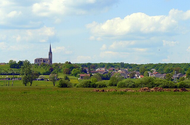
Luxeuil-les-Bains (Luxeuil-les-Bains)

- commune in Haute-Saône, France
- Country:

- Postal Code: 70300
- Coordinates: 47° 48' 58" N, 6° 22' 51" E


- GPS tracks (wikiloc): [Link]
- AboveSeaLevel: 294 м m
- Area: 21.81 sq km
- Population: 6821
- Web site: http://www.luxeuil.fr/
- Wikipedia en: wiki(en)
- Wikipedia: wiki(fr)
- Wikidata storage: Wikidata: Q634124
- Wikipedia Commons Category: [Link]
- Freebase ID: [/m/012g1k]
- GeoNames ID: Alt: [2996995]
- SIREN number: [217003110]
- BnF ID: [152727033]
- VIAF ID: Alt: [155629701]
- OSM relation ID: [1592502]
- GND ID: Alt: [4244108-0]
- Library of Congress authority ID: Alt: [n82106934]
- PACTOLS thesaurus ID: [pcrt99oaWaP057]
- MusicBrainz area ID: [91b9d3e1-2b0a-4e17-8ab2-9f99c7b896bf]
- SUDOC authorities ID: [031013694]
- HDS ID: [15459]
- Trismegistos Geo ID: [3238]
- INSEE municipality code: 70311
- US National Archives Identifier: 10046203
Shares border with regions:

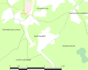
Saint-Valbert
- commune in Haute-Saône, France
- Country:
- Postal Code: 70300
- Coordinates: 47° 51' 9" N, 6° 23' 45" E
- GPS tracks (wikiloc): [Link]
- Area: 3.9 sq km
- Population: 245
- Web site: [Link]

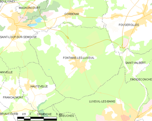
Fontaine-lès-Luxeuil
- commune in Haute-Saône, France
- Country:
- Postal Code: 70800
- Coordinates: 47° 51' 20" N, 6° 20' 5" E
- GPS tracks (wikiloc): [Link]
- Area: 27.73 sq km
- Population: 1379


Breuches
- commune in Haute-Saône, France
- Country:
- Postal Code: 70300
- Coordinates: 47° 47' 53" N, 6° 19' 49" E
- GPS tracks (wikiloc): [Link]
- AboveSeaLevel: 279 м m
- Area: 9.12 sq km
- Population: 701

Hautevelle
- commune in Haute-Saône, France
- Country:
- Postal Code: 70800
- Coordinates: 47° 50' 34" N, 6° 17' 2" E
- GPS tracks (wikiloc): [Link]
- Area: 7.78 sq km
- Population: 263


Froideconche
- commune in Haute-Saône, France
- Country:
- Postal Code: 70300
- Coordinates: 47° 49' 14" N, 6° 24' 58" E
- GPS tracks (wikiloc): [Link]
- Area: 16.04 sq km
- Population: 1987
- Web site: [Link]
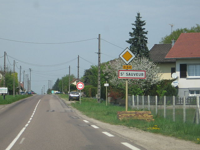

Saint-Sauveur
- commune in Haute-Saône, France
- Country:
- Postal Code: 70300
- Coordinates: 47° 48' 14" N, 6° 23' 5" E
- GPS tracks (wikiloc): [Link]
- Area: 12.02 sq km
- Population: 1917
- Web site: [Link]