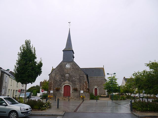
Mésanger (Mésanger)

- commune in Loire-Atlantique, France
- Country:

- Postal Code: 44522
- Coordinates: 47° 25' 59" N, 1° 13' 53" E


- GPS tracks (wikiloc): [Link]
- Area: 49.75 sq km
- Population: 4665
- Web site: http://www.mesanger.fr
- Wikipedia en: wiki(en)
- Wikipedia: wiki(fr)
- Wikidata storage: Wikidata: Q1165037
- Wikipedia Commons Category: [Link]
- Freebase ID: [/m/03nwd2f]
- Freebase ID: [/m/03nwd2f]
- GeoNames ID: Alt: [2994280]
- GeoNames ID: Alt: [2994280]
- SIREN number: [214400962]
- SIREN number: [214400962]
- BnF ID: [15260265k]
- BnF ID: [15260265k]
- VIAF ID: Alt: [144302568]
- VIAF ID: Alt: [144302568]
- Library of Congress authority ID: Alt: [n84223858]
- Library of Congress authority ID: Alt: [n84223858]
- Quora topic ID: [Mesanger]
- Quora topic ID: [Mesanger]
- INSEE municipality code: 44096
- INSEE municipality code: 44096
Shares border with regions:

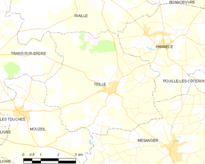
Teillé
- commune in Loire-Atlantique, France
- Country:
- Postal Code: 44440
- Coordinates: 47° 27' 42" N, 1° 16' 47" E
- GPS tracks (wikiloc): [Link]
- AboveSeaLevel: 58 м m
- Area: 28.55 sq km
- Population: 1779
- Web site: [Link]

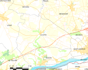
Couffé
- commune in Loire-Atlantique, France
- Country:
- Postal Code: 44521
- Coordinates: 47° 23' 29" N, 1° 17' 34" E
- GPS tracks (wikiloc): [Link]
- Area: 39.97 sq km
- Population: 2518
- Web site: [Link]


Ancenis
- commune in Loire-Atlantique, France
- Country:
- Postal Code: 44150
- Coordinates: 47° 22' 22" N, 1° 10' 42" E
- GPS tracks (wikiloc): [Link]
- Area: 20.07 sq km
- Population: 7510
- Web site: [Link]


La Roche-Blanche
- commune in Loire-Atlantique, France
- Country:
- Postal Code: 44522
- Coordinates: 47° 26' 27" N, 1° 8' 26" E
- GPS tracks (wikiloc): [Link]
- Area: 14.82 sq km
- Population: 1180
- Web site: [Link]

Mouzeil
- commune in Loire-Atlantique, France
- Country:
- Postal Code: 44850
- Coordinates: 47° 26' 53" N, 1° 20' 53" E
- GPS tracks (wikiloc): [Link]
- Area: 18.87 sq km
- Population: 1887
- Web site: [Link]


Pouillé-les-Côteaux
- commune in Loire-Atlantique, France
- Country:
- Postal Code: 44522
- Coordinates: 47° 27' 19" N, 1° 9' 44" E
- GPS tracks (wikiloc): [Link]
- Area: 11.72 sq km
- Population: 1000
- Web site: [Link]


Pannecé
- commune in Loire-Atlantique, France
- Country:
- Postal Code: 44440
- Coordinates: 47° 29' 10" N, 1° 14' 22" E
- GPS tracks (wikiloc): [Link]
- Area: 30.59 sq km
- Population: 1340
- Web site: [Link]