
Maincy (Maincy)

- commune in Seine-et-Marne, France
- Country:

- Postal Code: 77950
- Coordinates: 48° 32' 59" N, 2° 42' 7" E


- GPS tracks (wikiloc): [Link]
- Area: 10.19 sq km
- Population: 1699
- Web site: http://www.maincy.fr
- Wikipedia en: wiki(en)
- Wikipedia: wiki(fr)
- Wikidata storage: Wikidata: Q845829
- Wikipedia Commons Category: [Link]
- Freebase ID: [/m/02qyshl]
- Freebase ID: [/m/02qyshl]
- GeoNames ID: Alt: [6443722]
- GeoNames ID: Alt: [6443722]
- SIREN number: [217702695]
- SIREN number: [217702695]
- BnF ID: [15275609m]
- BnF ID: [15275609m]
- VIAF ID: Alt: [247399306]
- VIAF ID: Alt: [247399306]
- OSM relation ID: [1229363]
- OSM relation ID: [1229363]
- archINFORM location ID: [3818]
- archINFORM location ID: [3818]
- INSEE municipality code: 77269
- INSEE municipality code: 77269
Shares border with regions:


Saint-Germain-Laxis
- commune in Seine-et-Marne, France
- Country:
- Postal Code: 77950
- Coordinates: 48° 34' 54" N, 2° 42' 40" E
- GPS tracks (wikiloc): [Link]
- Area: 7.18 sq km
- Population: 728
- Web site: [Link]


Moisenay
- commune in Seine-et-Marne, France
- Country:
- Postal Code: 77950
- Coordinates: 48° 33' 46" N, 2° 44' 9" E
- GPS tracks (wikiloc): [Link]
- Area: 8.72 sq km
- Population: 1352
- Web site: [Link]


Vaux-le-Pénil
- commune in Seine-et-Marne, France
- Country:
- Postal Code: 77000
- Coordinates: 48° 31' 35" N, 2° 40' 56" E
- GPS tracks (wikiloc): [Link]
- Area: 11.64 sq km
- Population: 11039


Sivry-Courtry
- commune in Seine-et-Marne, France
- Country:
- Postal Code: 77115
- Coordinates: 48° 31' 41" N, 2° 45' 17" E
- GPS tracks (wikiloc): [Link]
- Area: 22.47 sq km
- Population: 1235
- Web site: [Link]


Melun
- commune in Seine-et-Marne, France
- Country:
- Postal Code: 77000
- Coordinates: 48° 32' 23" N, 2° 39' 33" E
- GPS tracks (wikiloc): [Link]
- AboveSeaLevel: 54 м m
- Area: 8.04 sq km
- Population: 39914
- Web site: [Link]
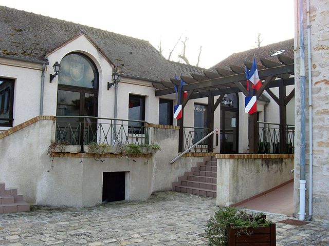
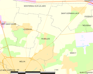
Rubelles
- commune in Seine-et-Marne, France
- Country:
- Postal Code: 77950
- Coordinates: 48° 33' 35" N, 2° 40' 49" E
- GPS tracks (wikiloc): [Link]
- Area: 3.91 sq km
- Population: 2121
- Web site: [Link]