Malbouzon (Malbouzon)

- former commune in Lozère, France
- Country:

- Postal Code: 48270
- Coordinates: 44° 42' 4" N, 3° 8' 6" E


- GPS tracks (wikiloc): [Link]
- Area: 14.26 sq km
- Population: 131
- Wikipedia en: wiki(en)
- Wikipedia: wiki(fr)
- Wikidata storage: Wikidata: Q192663
- Wikipedia Commons Category: [Link]
- Freebase ID: [/m/02z0y4v]
- Freebase ID: [/m/02z0y4v]
- GeoNames ID: Alt: [6449380]
- GeoNames ID: Alt: [6449380]
- BnF ID: [15261493m]
- BnF ID: [15261493m]
- WOEID: [12666082]
- WOEID: [12666082]
- INSEE municipality code: 48087
- INSEE municipality code: 48087
Shares border with regions:

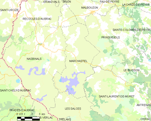
Marchastel
- commune in Lozère, France
- Country:
- Postal Code: 48260
- Coordinates: 44° 39' 4" N, 3° 6' 25" E
- GPS tracks (wikiloc): [Link]
- Area: 34.87 sq km
- Population: 56
La Fage-Montivernoux
- commune in Lozère, France
- Country:
- Postal Code: 48310
- Coordinates: 44° 45' 29" N, 3° 9' 9" E
- GPS tracks (wikiloc): [Link]
- Area: 37.77 sq km
- Population: 159


Nasbinals
- commune in Lozère, France
- Country:
- Postal Code: 48260
- Coordinates: 44° 39' 44" N, 3° 2' 47" E
- GPS tracks (wikiloc): [Link]
- Area: 63.34 sq km
- Population: 512
- Web site: [Link]


Fau-de-Peyre
- former commune in Lozère, France
- Country:
- Postal Code: 48130
- Coordinates: 44° 44' 54" N, 3° 13' 23" E
- GPS tracks (wikiloc): [Link]
- Area: 26.72 sq km
- Population: 186
- Web site: [Link]
Brion
- commune in Lozère, France
- Country:
- Postal Code: 48310
- Coordinates: 44° 45' 16" N, 3° 4' 15" E
- GPS tracks (wikiloc): [Link]
- Area: 22.11 sq km
- Population: 84
- Web site: [Link]

Prinsuéjols
- former commune in Lozère, France
- Country:
- Postal Code: 48100
- Coordinates: 44° 40' 28" N, 3° 10' 7" E
- GPS tracks (wikiloc): [Link]
- Area: 42.96 sq km
- Population: 154