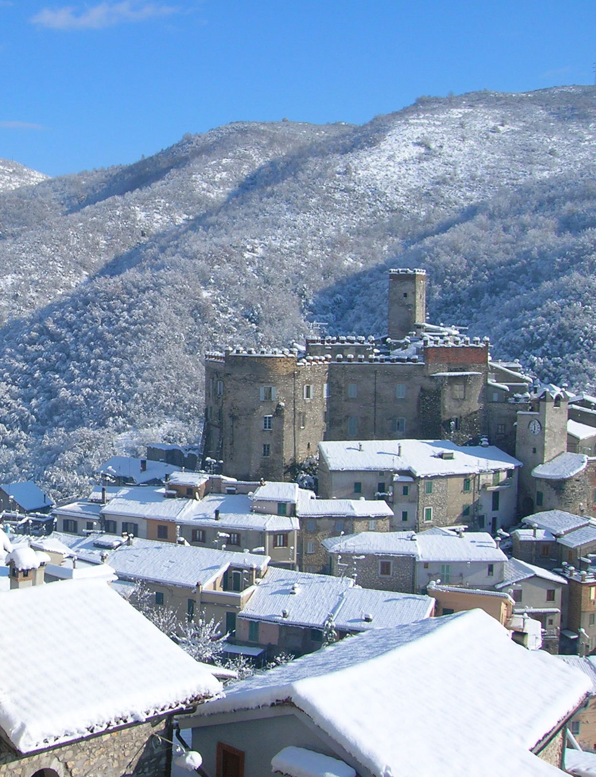
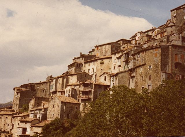
Mandela, Lazio (Mandela)
.svg)
- Italian comune
 Hiking in Mandela, Lazio
Mandela is a charming village situated in the Lazio region of Italy, near the region's eastern edge. It is surrounded by stunning natural landscapes, making it an excellent destination for hiking enthusiasts. Here are some key points to consider when hiking in and around Mandela:
Hiking Trails
-
Local Trails: There are several local trails that can be explored, offering varying levels of difficulty. As you hike, you can enjoy beautiful vistas of the surrounding hills and valleys.
-
Natural Parks: Mandela is close to the Monti Simbruini National Park, which offers a more extensive network of trails. This park is known for its rich biodiversity, stunning landscapes, and historic sites.
Scenic Views
- The area is characterized by picturesque views, including rolling hills, ancient forests, and valleys that can provide breathtaking backdrops for your hike.
Flora and Fauna
- While hiking, you'll have the opportunity to see a variety of plant species and possibly encounter some local wildlife. Be sure to keep an eye out for birds and other animals native to the region.
Tips for Hiking in Mandela
-
Seasonal Considerations: Spring and fall are ideal seasons for hiking in Lazio due to mild temperatures and pleasant weather. Summers can be hot, so be prepared with plenty of water and sun protection.
-
Trail Maps: It’s advisable to have local trail maps or guide services as some paths may be less marked. Consider checking with local tourist offices for the best routes.
-
Gear Up: Wear appropriate hiking boots and dress in layers so you can adjust to changing temperatures during your hike. Always carry sufficient water and snacks.
-
Stay Safe: Make sure to inform someone about your hiking plans and estimated return time, especially if hiking in less populated areas.
-
Respect Nature: Follow Leave No Trace principles to minimize your impact on the environment. Stick to designated trails and avoid disturbing wildlife.
Conclusion
Hiking in Mandela, Lazio, offers a unique opportunity to experience the beauty of Italy's countryside. With its scenic views, diverse trails, and proximity to Monti Simbruini National Park, it is a memorable experience for both novice and experienced hikers. Always prioritize safety and preparation to ensure a rewarding hiking adventure.
- Country:

- Postal Code: 00020
- Local Dialing Code: 0774
- Licence Plate Code: RM
- Coordinates: 42° 1' 48" N, 12° 55' 23" E


- GPS tracks (wikiloc): [Link]
- AboveSeaLevel: 487 м m
- Area: 13.72 sq km
- Population: 912
- Web site: http://www.comune.mandela.roma.it/
- Wikipedia en: wiki(en)
- Wikipedia: wiki(it)
- Wikidata storage: Wikidata: Q242878
- Wikipedia Commons Category: [Link]
- Freebase ID: [/m/0gm7kr]
- GeoNames ID: Alt: [6538678]
- VIAF ID: Alt: [234330792]
- OSM relation ID: [41729]
- WOEID: [717778]
- ISTAT ID: 058053
- Italian cadastre code: B632
Shares border with regions:

Cineto Romano
- Italian comune
Hiking in Cineto Romano
Cineto Romano is a charming village located in the Lazio region of Italy, not far from Rome. Nestled in the Sabine Hills, it's an excellent destination for hiking enthusiasts, offering a blend of natural beauty, historical sites, and cultural experiences....
- Country:
- Postal Code: 00020
- Local Dialing Code: 0774
- Licence Plate Code: RM
- Coordinates: 42° 3' 1" N, 12° 57' 54" E
- GPS tracks (wikiloc): [Link]
- AboveSeaLevel: 519 м m
- Area: 10.37 sq km
- Population: 586
- Web site: [Link]

Anticoli Corrado
- Italian comune
Hiking in Anticoli Corrado
Anticoli Corrado is a charming village located in the Lazio region of Italy, nestled in the Aniene Valley and surrounded by the stunning scenery of the Simbruini Mountains. Hiking in this area offers a range of experiences from leisurely walks to more challenging treks, suitable for various skill levels....
- Country:
- Postal Code: 00022
- Local Dialing Code: 0774
- Licence Plate Code: ROMA
- Coordinates: 42° 1' 0" N, 12° 59' 0" E
- GPS tracks (wikiloc): [Link]
- AboveSeaLevel: 508 м m
- Area: 16.22 sq km
- Population: 896
- Web site: [Link]


Licenza
- Italian comune
Hiking in Licenza
Licenza is a charming town located in the province of Rome, Italy, known for its stunning landscapes, historical sites, and relatively mild climate. Hiking in and around Licenza can be an enjoyable experience, offering a mix of natural beauty and cultural exploration....
- Country:
- Postal Code: 00026
- Local Dialing Code: 0774
- Licence Plate Code: RM
- Coordinates: 42° 4' 27" N, 12° 54' 6" E
- GPS tracks (wikiloc): [Link]
- AboveSeaLevel: 475 м m
- Area: 17.99 sq km
- Population: 950
- Web site: [Link]


Percile
- Italian comune
Hiking in Percile
Percile is a beautiful area located in the region of Lazio, Italy, known for its picturesque landscapes, rich history, and numerous hiking opportunities. Situated near the Aniene Valley and surrounded by the Simbruini Mountains, it offers a variety of trails suitable for different skill levels. Here are some key points about hiking in Percile:...
- Country:
- Postal Code: 00020
- Local Dialing Code: 0774
- Licence Plate Code: RM
- Coordinates: 42° 5' 41" N, 12° 54' 31" E
- GPS tracks (wikiloc): [Link]
- AboveSeaLevel: 575 м m
- Area: 17.76 sq km
- Population: 233
- Web site: [Link]


Roccagiovine
- Italian comune
Hiking in Roccagiovine
Roccagiovine is a small village located in the Lazio region of Italy, nestled in the Sabine Hills. It is an excellent destination for hiking enthusiasts looking to explore picturesque landscapes, rich history, and serene natural surroundings. Here are some key points to consider when planning a hiking trip to Roccagiovine:...
- Country:
- Postal Code: 00020
- Local Dialing Code: 0774
- Licence Plate Code: RM
- Coordinates: 42° 3' 0" N, 12° 54' 0" E
- GPS tracks (wikiloc): [Link]
- AboveSeaLevel: 520 м m
- Area: 8.41 sq km
- Population: 260
- Web site: [Link]


Roviano
- Italian comune
Hiking in Roviano
Roviano, located in the province of Rome, Italy, is a picturesque town surrounded by the Monti Lucretili regional park. This area offers various hiking opportunities for outdoor enthusiasts, with trails that showcase the natural beauty of the region, including lush forests, stunning views, and charming rural landscapes....
- Country:
- Postal Code: 00027
- Local Dialing Code: 0774
- Licence Plate Code: ROMA
- Coordinates: 42° 1' 33" N, 12° 59' 40" E
- GPS tracks (wikiloc): [Link]
- AboveSeaLevel: 523 м m
- Area: 8.5 sq km
- Population: 1341
- Web site: [Link]
Saracinesco
- Italian comune
Hiking in Saracinesco
Saracinesco is a picturesque small village nestled in the Apennine Mountains of Italy, in the province of Rome. It's an excellent destination for hiking enthusiasts, offering a blend of beautiful landscapes, charming historical sites, and a taste of authentic Italian culture. Here are some key points to consider when hiking in Saracinesco:...
- Country:
- Postal Code: 00020
- Local Dialing Code: 0774
- Licence Plate Code: ROMA
- Coordinates: 42° 0' 0" N, 12° 57' 0" E
- GPS tracks (wikiloc): [Link]
- AboveSeaLevel: 908 м m
- Area: 11.16 sq km
- Population: 175
- Web site: [Link]

Vicovaro
- Italian comune
Hiking in Vicovaro
Vicovaro is a charming town located in the province of Rome, Italy, nestled in the beautiful countryside of the Lazio region. It's a great destination for hiking enthusiasts due to its picturesque landscapes, rich history, and numerous trails that cater to various skill levels. Here are some highlights to consider if you're planning to hike in and around Vicovaro:...
- Country:
- Postal Code: 00029
- Local Dialing Code: 0774
- Licence Plate Code: RM
- Coordinates: 42° 1' 4" N, 12° 53' 49" E
- GPS tracks (wikiloc): [Link]
- AboveSeaLevel: 300 м m
- Area: 35.94 sq km
- Population: 3968
- Web site: [Link]