Maniago (Maniago)
- Italian comune
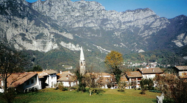
Maniago, located in the Friuli Venezia Giulia region of Italy, is a charming town surrounded by beautiful natural landscapes, making it an excellent destination for hiking enthusiasts. Here are some key points about hiking in and around Maniago:
Scenic Trails
-
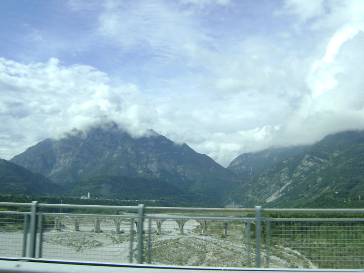
Natural Surroundings: The area around Maniago is characterized by rolling hills, lush forests, and stunning views of the surrounding mountains, particularly the Carnic Alps and the Friulian Dolomites.
-
Variety of Trails: There are numerous trails suitable for different skill levels, ranging from easy walks for beginners to more challenging hikes for experienced trekkers. Trails vary in length and terrain.
Notable Hiking Routes
-
The Path of the Gods: This is a well-known hiking route that offers spectacular views and passes through picturesque villages and natural landmarks.
-
Sorgente del Cosa: A shorter hike that takes you to the source of the Cosa River, offering a tranquil setting ideal for nature lovers.
-
E-Bike and Hiking Combination Routes: If you're interested, some trails accommodate mountain biking, allowing for a combination of hiking and biking in the beautiful landscape.
Local Attractions
-
Historic Sites: As you hike, you may encounter various historical and cultural sites, including ancient churches and ruins that reflect the area’s rich history.
-
Gastronomy: After a hike, you can enjoy local Friulian cuisine in Maniago, which is known for its hearty dishes and local wines.
Hiking Tips
-
Prepare Properly: Always wear appropriate footwear and bring enough water and snacks. The weather can change quickly in mountainous regions, so dress in layers.
-
Respect Nature: Follow the principles of Leave No Trace to preserve the beauty of the trails for future hikers.
-
Guided Tours: If you are unfamiliar with the area, consider joining a guided hike to enhance your experience and safety. Local guides can offer insights into the flora, fauna, and history of the region.
-
Seasonal Considerations: While hiking can be enjoyed in different seasons, spring and autumn are particularly beautiful times to hike in Maniago due to mild weather and vibrant scenery.
In summary, Maniago is an excellent base for exploring the natural beauty of the Friuli Venezia Giulia region through its various hiking trails, each offering unique experiences and stunning vistas.
- Country:

- Postal Code: 33085
- Local Dialing Code: 0427
- Licence Plate Code: PN
- Coordinates: 46° 10' 0" N, 12° 43' 0" E


- GPS tracks (wikiloc): [Link]
- AboveSeaLevel: 283 м m
- Area: 69.46 sq km
- Population: 11746
- Web site: http://www.comune.maniago.pn.it
- Wikipedia en: wiki(en)
- Wikipedia: wiki(it)
- Wikidata storage: Wikidata: Q53174
- Wikipedia Commons Category: [Link]
- Freebase ID: [/m/0d1xt8]
- GeoNames ID: Alt: [3174085]
- VIAF ID: Alt: [141912533]
- OSM relation ID: [79264]
- MusicBrainz area ID: [8514a078-3c6d-4390-bd51-3af5874cb7d6]
- TGN ID: [7052449]
- UN/LOCODE: [ITMIO]
- ISTAT ID: 093025
- Italian cadastre code: E889
Shares border with regions:
Andreis
- Propiedad de andreys Calderón
Andreis is a picturesque village located in the Friuli Venezia Giulia region of northeastern Italy. Surrounded by stunning landscapes, it offers a variety of hiking opportunities for both beginners and experienced adventurers. Here are some highlights and tips for hiking in and around Andreis:...
- Country:

- Postal Code: 33080
- Local Dialing Code: 0427
- Licence Plate Code: PN
- Coordinates: 46° 12' 0" N, 12° 37' 0" E


- GPS tracks (wikiloc): [Link]
- AboveSeaLevel: 455 м m
- Area: 26.95 sq km
- Population: 248
- Web site: [Link]
Arba, Friuli-Venezia Giulia
- Italian comune
 Hiking in Arba, Friuli-Venezia Giulia
Arba, located in the Friuli-Venezia Giulia region of northeastern Italy, is surrounded by stunning landscapes and offers various hiking opportunities suitable for different skill levels. This area is known for its beautiful natural scenery, including mountains, hills, forests, and rivers, making it an appealing destination for outdoor enthusiasts....
- Country:

- Postal Code: 33090
- Local Dialing Code: 0427
- Licence Plate Code: PN
- Coordinates: 46° 9' 0" N, 12° 47' 0" E


- GPS tracks (wikiloc): [Link]
- AboveSeaLevel: 210 м m
- Area: 15.31 sq km
- Population: 1278
- Web site: [Link]


Fanna
- Italian comune
Fanna is a picturesque area in the region of Friuli Venezia Giulia in northeastern Italy, known for its stunning landscapes and rich biodiversity. Hiking in Fanna offers a variety of trails suitable for different skill levels, allowing you to explore its mountainous terrain, lush forests, and serene valleys....
- Country:

- Postal Code: 33092
- Local Dialing Code: 0427
- Licence Plate Code: PN
- Coordinates: 46° 11' 0" N, 12° 45' 0" E


- GPS tracks (wikiloc): [Link]
- AboveSeaLevel: 274 м m
- Area: 10.26 sq km
- Population: 1554
- Web site: [Link]


Frisanco
- Italian comune
Frisanco, located in the province of Pordenone in the Friuli Venezia Giulia region of Italy, offers a delightful experience for hikers of all levels. The area is surrounded by the beautiful Friulian Dolomites, providing stunning landscapes, varying terrains, and rich natural biodiversity....
- Country:

- Postal Code: 33080
- Local Dialing Code: 0427
- Licence Plate Code: PN
- Coordinates: 46° 13' 0" N, 12° 44' 0" E


- GPS tracks (wikiloc): [Link]
- AboveSeaLevel: 500 м m
- Area: 60.99 sq km
- Population: 600
- Web site: [Link]


Montereale Valcellina
- Italian comune
 Hiking in Montereale Valcellina
Montereale Valcellina, located in the Friuli Venezia Giulia region of Italy, offers stunning landscapes and a variety of hiking opportunities for outdoor enthusiasts. The area is known for its rugged mountains, lush forests, and the picturesque Valcellina valley, making it a hidden gem for hikers....
- Country:

- Postal Code: 33086
- Local Dialing Code: 0427
- Licence Plate Code: PN
- Coordinates: 46° 10' 0" N, 12° 40' 0" E


- GPS tracks (wikiloc): [Link]
- AboveSeaLevel: 317 м m
- Area: 67.88 sq km
- Population: 4365
- Web site: [Link]
San Quirino
- Italian comune
San Quirino is a charming municipality located in the Friuli Venezia Giulia region of northeastern Italy. Nestled at the foothills of the Julian Alps, it offers a variety of hiking opportunities suitable for different skill levels. Here are some highlights:...
- Country:

- Postal Code: 33080
- Local Dialing Code: 0434
- Licence Plate Code: PN
- Coordinates: 46° 2' 3" N, 12° 40' 42" E


- GPS tracks (wikiloc): [Link]
- AboveSeaLevel: 116 м m
- Area: 51.76 sq km
- Population: 4328
- Web site: [Link]


Vajont
- Italian comune
Hiking in the Vajont area, located in northeastern Italy, offers stunning views and diverse landscapes, making it a popular destination for outdoor enthusiasts. Here are some key points about hiking in Vajont:...
- Country:

- Postal Code: 33080
- Local Dialing Code: 0427
- Licence Plate Code: PN
- Coordinates: 46° 8' 50" N, 12° 41' 46" E


- GPS tracks (wikiloc): [Link]
- AboveSeaLevel: 287 м m
- Area: 1.59 sq km
- Population: 1677
- Web site: [Link]
Vivaro
- Italian comune
Vivaro, located in the Province of Pordenone in the Friuli Venezia Giulia region of Italy, is a beautiful area that offers a variety of hiking opportunities. The surrounding landscapes are characterized by lush forests, rolling hills, and stunning mountain vistas, making it an attractive destination for both casual walkers and experienced hikers....
- Country:

- Postal Code: 33099
- Local Dialing Code: 0427
- Licence Plate Code: PN
- Coordinates: 46° 4' 36" N, 12° 46' 45" E


- GPS tracks (wikiloc): [Link]
- AboveSeaLevel: 96 м m
- Area: 37.68 sq km
- Population: 1343
- Web site: [Link]
