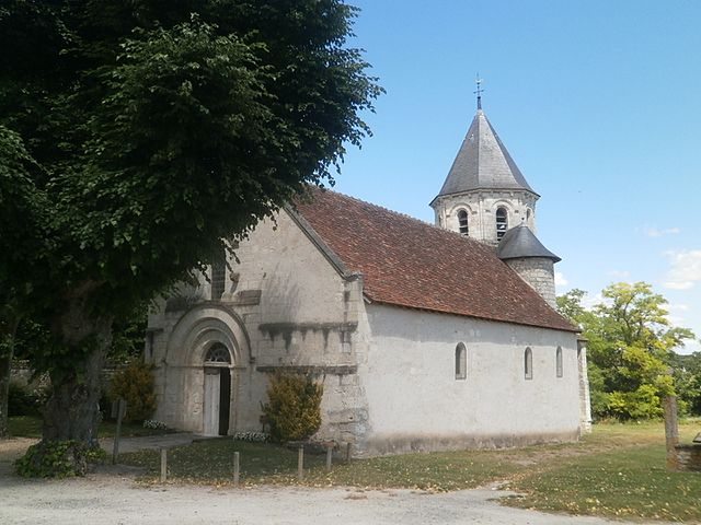
Marigny-Marmande (Marigny-Marmande)

- commune in Indre-et-Loire, France
- Country:

- Postal Code: 37120
- Coordinates: 46° 58' 51" N, 0° 29' 21" E


- GPS tracks (wikiloc): [Link]
- Area: 30.83 sq km
- Population: 581
- Web site: http://www.marigny-marmande.fr/
- Wikipedia en: wiki(en)
- Wikipedia: wiki(fr)
- Wikidata storage: Wikidata: Q750527
- Wikipedia Commons Category: [Link]
- Freebase ID: [/m/03nvcnf]
- GeoNames ID: Alt: [6433053]
- SIREN number: [213701485]
- BnF ID: [15257699g]
- PACTOLS thesaurus ID: [pcrtL3JHW7lwRD]
- INSEE municipality code: 37148
Shares border with regions:
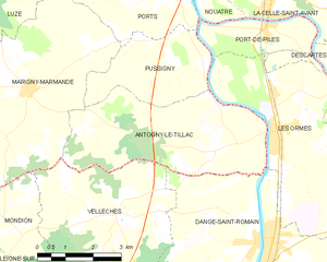
Antogny-le-Tillac
- commune in Indre-et-Loire, France
- Country:
- Postal Code: 37800
- Coordinates: 46° 57' 51" N, 0° 34' 41" E
- GPS tracks (wikiloc): [Link]
- Area: 17.31 sq km
- Population: 515
- Web site: [Link]

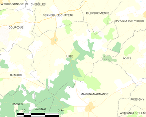
Luzé
- commune in Indre-et-Loire, France
- Country:
- Postal Code: 37120
- Coordinates: 47° 1' 24" N, 0° 27' 9" E
- GPS tracks (wikiloc): [Link]
- Area: 20.3 sq km
- Population: 261


Pussigny
- commune in Indre-et-Loire, France
- Country:
- Postal Code: 37800
- Coordinates: 46° 59' 33" N, 0° 34' 12" E
- GPS tracks (wikiloc): [Link]
- Area: 8.48 sq km
- Population: 172


Vellèches
- commune in Vienne, France
- Country:
- Postal Code: 86230
- Coordinates: 46° 56' 32" N, 0° 31' 55" E
- GPS tracks (wikiloc): [Link]
- Area: 19.64 sq km
- Population: 377
Mondion
- commune in Vienne, France
- Country:
- Postal Code: 86230
- Coordinates: 46° 56' 14" N, 0° 29' 4" E
- GPS tracks (wikiloc): [Link]
- Area: 8.91 sq km
- Population: 102


Ports
- commune in Indre-et-Loire, France
- Country:
- Postal Code: 37800
- Coordinates: 47° 0' 56" N, 0° 33' 14" E
- GPS tracks (wikiloc): [Link]
- Area: 11.01 sq km
- Population: 350
- Web site: [Link]


Jaulnay
- commune in Indre-et-Loire, France
- Country:
- Postal Code: 37120
- Coordinates: 46° 56' 54" N, 0° 24' 51" E
- GPS tracks (wikiloc): [Link]
- Area: 14.76 sq km
- Population: 257