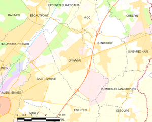
Saint-Saulve (Saint-Saulve)

- commune in Nord, France
- Country:

- Postal Code: 59880
- Coordinates: 50° 22' 11" N, 3° 33' 17" E


- GPS tracks (wikiloc): [Link]
- Area: 12.06 sq km
- Population: 11176
- Web site: http://www.ville-saint-saulve.fr
- Wikipedia en: wiki(en)
- Wikipedia: wiki(fr)
- Wikidata storage: Wikidata: Q1101167
- Wikipedia Commons Category: [Link]
- Freebase ID: [/m/03qfm77]
- Freebase ID: [/m/03qfm77]
- GeoNames ID: Alt: [2977058]
- GeoNames ID: Alt: [2977058]
- SIREN number: [215905449]
- SIREN number: [215905449]
- BnF ID: [15267116s]
- BnF ID: [15267116s]
- VIAF ID: Alt: [235684010]
- VIAF ID: Alt: [235684010]
- GND ID: Alt: [4687970-5]
- GND ID: Alt: [4687970-5]
- PACTOLS thesaurus ID: [pcrthZWAWWKH3a]
- PACTOLS thesaurus ID: [pcrthZWAWWKH3a]
- MusicBrainz area ID: [a941089b-86d5-4369-933f-89db3deb508b]
- MusicBrainz area ID: [a941089b-86d5-4369-933f-89db3deb508b]
- INSEE municipality code: 59544
- INSEE municipality code: 59544
Shares border with regions:


Bruay-sur-l'Escaut
- commune in Nord, France
- Country:
- Postal Code: 59860
- Coordinates: 50° 23' 54" N, 3° 32' 22" E
- GPS tracks (wikiloc): [Link]
- Area: 6.7 sq km
- Population: 11643
- Web site: [Link]

Onnaing
- commune in Nord, France
- Country:
- Postal Code: 59264
- Coordinates: 50° 23' 16" N, 3° 35' 53" E
- GPS tracks (wikiloc): [Link]
- Area: 12.97 sq km
- Population: 8726
- Web site: [Link]

Valenciennes
- commune in Nord, France
- Country:
- Postal Code: 59300
- Coordinates: 50° 21' 33" N, 3° 31' 30" E
- GPS tracks (wikiloc): [Link]
- AboveSeaLevel: 42 м m
- Area: 13.82 sq km
- Population: 44043
- Web site: [Link]


Estreux
- commune in Nord, France
- Country:
- Postal Code: 59990
- Coordinates: 50° 21' 3" N, 3° 35' 39" E
- GPS tracks (wikiloc): [Link]
- Area: 5.3 sq km
- Population: 954


Marly
- commune in Nord, France
- Country:
- Postal Code: 59770
- Coordinates: 50° 20' 56" N, 3° 32' 39" E
- GPS tracks (wikiloc): [Link]
- Area: 8.04 sq km
- Population: 11590
- Web site: [Link]