Marseillan (Marseillan)

- commune in Hérault, France
- Country:

- Postal Code: 34340
- Coordinates: 43° 21' 23" N, 3° 31' 40" E


- GPS tracks (wikiloc): [Link]
- Area: 51.71 sq km
- Population: 7808
- Web site: http://www.ville-marseillan.fr
- Wikipedia en: wiki(en)
- Wikipedia: wiki(fr)
- Wikidata storage: Wikidata: Q694955
- Wikipedia Commons Gallery: [Link]
- Wikipedia Commons Category: [Link]
- Freebase ID: [/m/0czjw7]
- Freebase ID: [/m/0czjw7]
- GeoNames ID: Alt: [6432546]
- GeoNames ID: Alt: [6432546]
- SIREN number: [213401508]
- SIREN number: [213401508]
- BnF ID: [15256751h]
- BnF ID: [15256751h]
- Twitter username: Alt: [VilleMarseillan]
- Twitter username: Alt: [VilleMarseillan]
- INSEE municipality code: 34150
- INSEE municipality code: 34150
Shares border with regions:


Florensac
- commune in Hérault, France
- Country:
- Postal Code: 34510
- Coordinates: 43° 22' 58" N, 3° 27' 54" E
- GPS tracks (wikiloc): [Link]
- Area: 35.71 sq km
- Population: 4921
- Web site: [Link]

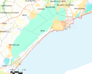
Sète
- commune in Hérault, France
- Country:
- Postal Code: 34200
- Coordinates: 43° 24' 16" N, 3° 41' 48" E
- GPS tracks (wikiloc): [Link]
- Area: 24.21 sq km
- Population: 43620
- Web site: [Link]
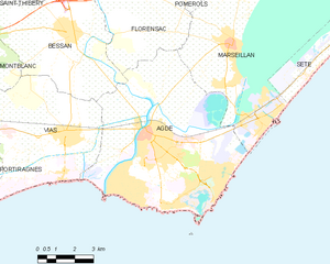
Agde
- commune in Hérault, France
- Country:
- Postal Code: 34300
- Coordinates: 43° 18' 36" N, 3° 28' 31" E
- GPS tracks (wikiloc): [Link]
- AboveSeaLevel: 110 м m
- Area: 50.81 sq km
- Population: 26946
- Web site: [Link]


Pomérols
- commune in Hérault, France
- Country:
- Postal Code: 34810
- Coordinates: 43° 23' 27" N, 3° 29' 55" E
- GPS tracks (wikiloc): [Link]
- Area: 11.01 sq km
- Population: 2243


Mèze
- commune in Hérault, France
- Country:
- Postal Code: 34140
- Coordinates: 43° 25' 36" N, 3° 36' 19" E
- GPS tracks (wikiloc): [Link]
- AboveSeaLevel: 20 м m
- Area: 34.59 sq km
- Population: 11537
- Web site: [Link]