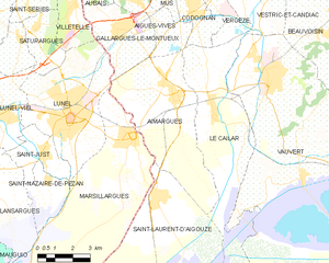
Marsillargues (Marsillargues)

- commune in Hérault, France
- Country:

- Postal Code: 34590
- Coordinates: 43° 39' 52" N, 4° 10' 37" E


- GPS tracks (wikiloc): [Link]
- Area: 42.71 sq km
- Population: 6207
- Web site: http://www.marsillargues.fr
- Wikipedia en: wiki(en)
- Wikipedia: wiki(fr)
- Wikidata storage: Wikidata: Q1408439
- Wikipedia Commons Category: [Link]
- Freebase ID: [/m/03h0qmb]
- Freebase ID: [/m/03h0qmb]
- GeoNames ID: Alt: [2995456]
- GeoNames ID: Alt: [2995456]
- SIREN number: [213401516]
- SIREN number: [213401516]
- BnF ID: [15256752v]
- BnF ID: [15256752v]
- Library of Congress authority ID: Alt: [n91000112]
- Library of Congress authority ID: Alt: [n91000112]
- PACTOLS thesaurus ID: [pcrtMTAdPuI7zl]
- PACTOLS thesaurus ID: [pcrtMTAdPuI7zl]
- WOEID: [610269]
- WOEID: [610269]
- INSEE municipality code: 34151
- INSEE municipality code: 34151
Shares border with regions:


Lansargues
- commune in Hérault, France
- Country:
- Postal Code: 34130
- Coordinates: 43° 39' 5" N, 4° 4' 23" E
- GPS tracks (wikiloc): [Link]
- Area: 18.39 sq km
- Population: 3085
- Web site: [Link]


Saint-Nazaire-de-Pézan
- commune in Hérault, France
- Country:
- Postal Code: 34400
- Coordinates: 43° 38' 36" N, 4° 7' 8" E
- GPS tracks (wikiloc): [Link]
- Area: 5.66 sq km
- Population: 622
- Web site: [Link]


Aigues-Mortes
- commune in Gard, France
- Country:
- Postal Code: 30220
- Coordinates: 43° 34' 0" N, 4° 11' 33" E
- GPS tracks (wikiloc): [Link]
- AboveSeaLevel: 3 м m
- Area: 57.78 sq km
- Population: 8385
- Web site: [Link]

Aimargues
- commune in Gard, France
- Country:
- Postal Code: 30470
- Coordinates: 43° 41' 5" N, 4° 12' 31" E
- GPS tracks (wikiloc): [Link]
- Area: 26.48 sq km
- Population: 5413
- Web site: [Link]


Lunel
- commune in Hérault, France
- Country:
- Postal Code: 34400
- Coordinates: 43° 40' 37" N, 4° 8' 7" E
- GPS tracks (wikiloc): [Link]
- Area: 23.9 sq km
- Population: 25178
- Web site: [Link]


Mauguio
- commune in Hérault, France
- Country:
- Postal Code: 34130
- Coordinates: 43° 36' 59" N, 4° 0' 27" E
- GPS tracks (wikiloc): [Link]
- Area: 49.56 sq km
- Population: 17219
- Web site: [Link]


Saint-Laurent-d'Aigouze
- commune in Gard, France
- Country:
- Postal Code: 30220
- Coordinates: 43° 38' 4" N, 4° 11' 44" E
- GPS tracks (wikiloc): [Link]
- Area: 89.81 sq km
- Population: 3458
- Web site: [Link]