Massieu (Massieu)

- commune in Isère, France
 Hiking in Massieu
Massieu is a beautiful area located in the French Alps, offering stunning views and diverse hiking opportunities. Here are some key points to know about hiking in Massieu:
1. :
- The region boasts numerous well-marked trails that cater to different skill levels, from beginners to experienced hikers.
- Popular routes often showcase picturesque landscapes, including alpine meadows, forests, and mountain panoramas.
2. :
- The optimal hiking seasons are typically from late spring to early fall (May to October). Summer months provide the best weather and trail conditions.
- Be aware that snow may linger on higher trails well into June, so check local conditions before heading out.
3. :
- The area is rich in biodiversity, and hikers may encounter various wildlife, including deer, ibex, and a variety of bird species.
- In spring and summer, the trails are adorned with vibrant wildflowers, making hikes particularly enjoyable.
4. :
- Massieu is accessible from various major cities in the region. Local transport can take you to trailheads, but it’s advisable to have a map or GPS app for navigation.
- Certain trails may start from established parks or visitor centers, providing facilities and information for hikers.
5. :
- Always check the weather forecast before heading out and be prepared for sudden changes in conditions.
- Carry enough water, snacks, and a first-aid kit. Hiking poles can also be beneficial for rough terrain.
- If you’re hiking in a group, ensure everyone is equipped properly and understands the plan.
6. :
- Familiarize yourself with local regulations regarding wildlife and nature preservation, as some areas might have restrictions to protect the environment.
- Stay on marked trails to minimize your impact on the local ecosystem.
7. :
- Besides the natural beauty, you may encounter historical sites and charming villages along the way, making for an enriching hiking experience.
Conclusion:
Hiking in Massieu offers both adventure and tranquility, making it a perfect destination for nature lovers. Whether you’re looking for vigorous hikes or leisurely walks, you’ll find trails that provide a memorable experience amidst the stunning alpine scenery. Always remember to plan accordingly and respect nature as you explore this beautiful region.
- Country:

- Postal Code: 38620
- Coordinates: 45° 26' 23" N, 5° 35' 47" E


- GPS tracks (wikiloc): [Link]
- Area: 10.46 sq km
- Population: 738
- Web site: http://www.massieu38.fr
- Wikipedia en: wiki(en)
- Wikipedia: wiki(fr)
- Wikidata storage: Wikidata: Q962418
- Wikipedia Commons Category: [Link]
- Freebase ID: [/m/03nvhxx]
- GeoNames ID: Alt: [6433235]
- SIREN number: [213802226]
- BnF ID: [152580365]
- INSEE municipality code: 38222
Shares border with regions:

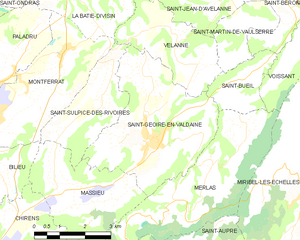
Saint-Geoire-en-Valdaine
- commune in Isère, France
Hiking in Saint-Geoire-en-Valdaine
Saint-Geoire-en-Valdaine is a picturesque commune located in the Isère department in the Auvergne-Rhône-Alpes region of southeastern France. The area is rich in natural beauty and offers various opportunities for hiking and outdoor activities....
- Country:
- Postal Code: 38620
- Coordinates: 45° 27' 25" N, 5° 38' 7" E
- GPS tracks (wikiloc): [Link]
- Area: 16.73 sq km
- Population: 2417
- Web site: [Link]


Saint-Nicolas-de-Macherin
- commune in Isère, France
Hiking in Saint-Nicolas-de-Macherin
Saint-Nicolas-de-Macherin is a charming village located in the Auvergne-Rhône-Alpes region of France. While it may not be as well-known as some larger hiking destinations, it offers plenty of opportunities for outdoor enthusiasts to explore natural beauty, scenic landscapes, and local wildlife....
- Country:
- Postal Code: 38500
- Coordinates: 45° 23' 54" N, 5° 36' 24" E
- GPS tracks (wikiloc): [Link]
- Area: 10.6 sq km
- Population: 913
- Web site: [Link]


Saint-Sulpice-des-Rivoires
- commune in Isère, France
Hiking in Saint-Sulpice-des-Rivoires
Saint-Sulpice-des-Rivoires is a charming commune located in the Isère department of the Auvergne-Rhône-Alpes region in southeastern France. The area is known for its beautiful landscapes and outdoor activities, including hiking. Here are some key points to consider if you're planning to hike in and around Saint-Sulpice-des-Rivoires:...
- Country:
- Postal Code: 38620
- Coordinates: 45° 28' 8" N, 5° 36' 34" E
- GPS tracks (wikiloc): [Link]
- Area: 7.16 sq km
- Population: 435


Merlas
- commune in Isère, France
Hiking in Merlas
Mereis, located in Portugal, is known for its beautiful natural landscapes and hiking opportunities. Here are some tips and information about hiking in the area:...
- Country:
- Postal Code: 38620
- Coordinates: 45° 26' 41" N, 5° 39' 46" E
- GPS tracks (wikiloc): [Link]
- Area: 15.64 sq km
- Population: 499

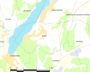
Bilieu
- commune in Isère, France
Hiking in Bilieu
Bilieu is a charming village located in the Auvergne-Rhône-Alpes region of France, near the shores of Lake Paladru. It offers a variety of hiking opportunities that cater to different skill levels, allowing both beginners and experienced hikers to explore the natural beauty of the area. Here are some highlights of hiking in Bilieu:...
- Country:
- Postal Code: 38850
- Coordinates: 45° 26' 55" N, 5° 32' 59" E
- GPS tracks (wikiloc): [Link]
- Area: 6.71 sq km
- Population: 1503
- Web site: [Link]


Chirens
- commune in Isère, France
Hiking in Chirens
Chirens is a charming village located in the Isère department in the Auvergne-Rhône-Alpes region of southeastern France. It’s surrounded by beautiful natural landscapes, making it a great destination for hiking enthusiasts. Here are some highlights for hiking in and around Chirens:...
- Country:
- Postal Code: 38850
- Coordinates: 45° 24' 50" N, 5° 33' 21" E
- GPS tracks (wikiloc): [Link]
- AboveSeaLevel: 876 м m
- Area: 17.53 sq km
- Population: 2342
- Web site: [Link]