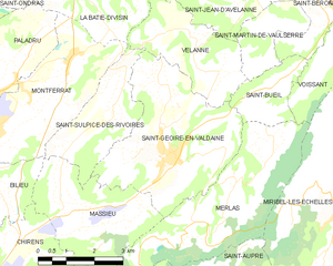
Saint-Geoire-en-Valdaine (Saint-Geoire-en-Valdaine)
- commune in Isère, France
 Hiking in Saint-Geoire-en-Valdaine
Saint-Geoire-en-Valdaine is a picturesque commune located in the Isère department in the Auvergne-Rhône-Alpes region of southeastern France. The area is rich in natural beauty and offers various opportunities for hiking and outdoor activities.
Hiking in Saint-Geoire-en-Valdaine
-
Scenic Trails: The region around Saint-Geoire-en-Valdaine features a mix of flat and hilly terrains, with scenic views of the Chartreuse and Vercors mountains. Trails often wind through forests, meadows, and along rivers, providing a variety of landscapes.
-
Local Guides and Maps: You can find local hiking maps and guides at tourist information centers in Saint-Geoire-en-Valdaine or the surrounding towns. These resources can help you choose trails that match your skill level and interests.
-
Popular Hiking Routes:
- Le Mont Chaud: A relatively accessible trail that offers stunning views of the surrounding countryside and provides a good spot for picnics.
- Les Balcons de Chartreuse: A trail that can be accessed from nearby areas, leading you to the slopes of the Chartreuse mountains with panoramic views.
-
Wildlife and Flora: As you hike, keep an eye out for local wildlife and diverse plant life. The region is home to various species of birds, deer, and other animals, as well as a rich array of flowers that change with the seasons.
-
Winter Hiking: During the winter months, some trails may be suitable for snowshoeing and cross-country skiing. Be sure to check local conditions and any required permits.
-
Safety Tips: Always check the weather before heading out, inform someone of your hiking plans, carry a map and compass or a GPS device, wear appropriate footwear, and bring enough water and snacks.
-
Local Attractions: After a day of hiking, you might want to explore the local culture, such as visiting historic buildings, trying regional cuisine, or enjoying local artisanal products.
Whether you’re a seasoned hiker or a beginner looking for a peaceful stroll, the trails around Saint-Geoire-en-Valdaine offer something for everyone.
- Country:

- Postal Code: 38620
- Coordinates: 45° 27' 25" N, 5° 38' 7" E


- GPS tracks (wikiloc): [Link]
- Area: 16.73 sq km
- Population: 2417
- Web site: http://www.saint-geoire-en-valdaine.com/fr/accueil/
- Wikipedia en: wiki(en)
- Wikipedia: wiki(fr)
- Wikidata storage: Wikidata: Q1002688
- Wikipedia Commons Category: [Link]
- Freebase ID: [/m/03nvhcq]
- GeoNames ID: Alt: [2979976]
- SIREN number: [213803869]
- BnF ID: [152581969]
- VIAF ID: Alt: [234266925]
- GND ID: Alt: [4280266-0]
- Library of Congress authority ID: Alt: [nb2014014560]
- PACTOLS thesaurus ID: [pcrt0DMX363KeG]
- INSEE municipality code: 38386
Shares border with regions:


Saint-Sulpice-des-Rivoires
- commune in Isère, France
 Hiking in Saint-Sulpice-des-Rivoires
Saint-Sulpice-des-Rivoires is a charming commune located in the Isère department of the Auvergne-Rhône-Alpes region in southeastern France. The area is known for its beautiful landscapes and outdoor activities, including hiking. Here are some key points to consider if you're planning to hike in and around Saint-Sulpice-des-Rivoires:...
- Country:

- Postal Code: 38620
- Coordinates: 45° 28' 8" N, 5° 36' 34" E


- GPS tracks (wikiloc): [Link]
- Area: 7.16 sq km
- Population: 435


Merlas
- commune in Isère, France
Mereis, located in Portugal, is known for its beautiful natural landscapes and hiking opportunities. Here are some tips and information about hiking in the area:...
- Country:

- Postal Code: 38620
- Coordinates: 45° 26' 41" N, 5° 39' 46" E


- GPS tracks (wikiloc): [Link]
- Area: 15.64 sq km
- Population: 499


Saint-Bueil
- commune in Isère, France
Saint-Bueil is a charming village located in the Isère department of the Auvergne-Rhône-Alpes region in southeastern France. While it may not be as widely recognized as some other hiking destinations in the area, it offers beautiful landscapes and opportunities for outdoor activities, including hiking....
- Country:

- Postal Code: 38620
- Coordinates: 45° 28' 38" N, 5° 41' 23" E


- GPS tracks (wikiloc): [Link]
- Area: 3.81 sq km
- Population: 702


Velanne
- commune in Isère, France
Velanne is a charming village located in the French Alps, nestled within the picturesque Isère department. While not as widely known as some of its neighboring areas, it offers access to beautiful landscapes and hiking opportunities perfect for outdoor enthusiasts....
- Country:

- Postal Code: 38620
- Coordinates: 45° 29' 18" N, 5° 38' 54" E


- GPS tracks (wikiloc): [Link]
- Area: 8.04 sq km
- Population: 524


Massieu
- commune in Isère, France
Massieu is a beautiful area located in the French Alps, offering stunning views and diverse hiking opportunities. Here are some key points to know about hiking in Massieu:...
- Country:

- Postal Code: 38620
- Coordinates: 45° 26' 23" N, 5° 35' 47" E


- GPS tracks (wikiloc): [Link]
- Area: 10.46 sq km
- Population: 738
- Web site: [Link]
