Massignieu-de-Rives (Massignieu-de-Rives)
- commune in Ain, France
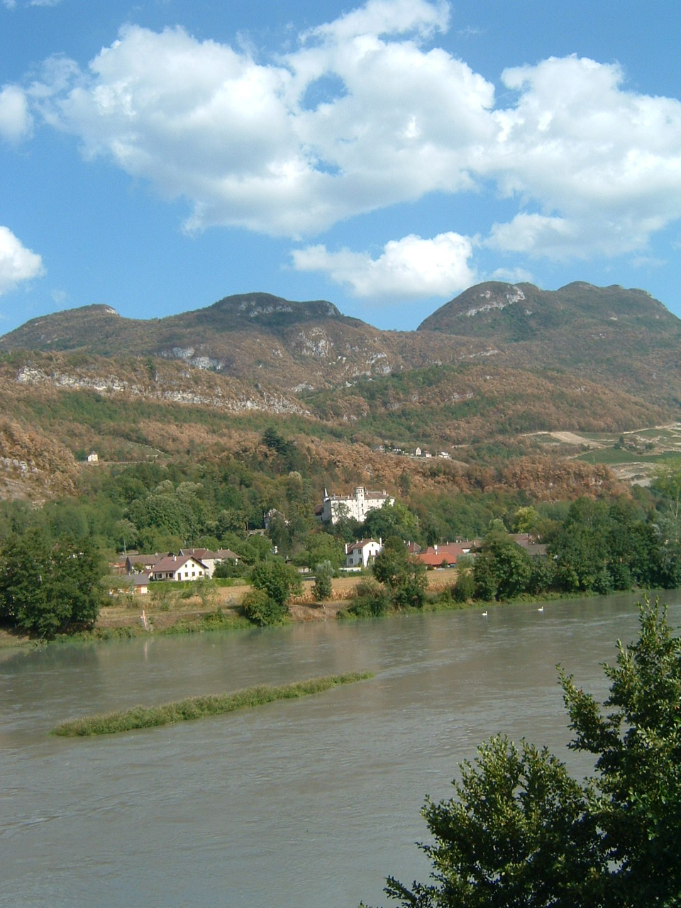
Massignieu-de-Rives is a charming commune located in the Auvergne-Rhône-Alpes region of France, near the beautiful shores of Lake Bourget and surrounded by the natural beauty of the French Alps. Hiking in this area offers a unique opportunity to explore both scenic landscapes and diverse wildlife.
Hiking Opportunities
-
Lake Bourget: The area around Lake Bourget is perfect for hiking, offering trails that provide stunning views of the lake and surrounding mountains. The nearby La Chambotte and Revard offer well-marked trails.
-
Natural Reserves: The nearby Réserve naturelle nationale du Marais de Lavours features trails that wind through wetlands, offering a different ecosystem to explore. Birdwatchers will particularly enjoy this area.
-
Alpine Trails: For those looking for more challenging hikes, the trails leading into the Bauges or Chartreuse mountain ranges provide rigorous hiking with rewarding panoramic views of the Alps.
-
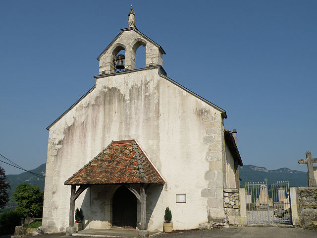
Cultural Hikes: Consider hiking routes that connect to local historical and cultural sites, such as old chapels or traditional farms, which give you insights into the local heritage.
Tips for Hiking in Massignieu-de-Rives
-
Weather Considerations: Always check the weather before heading out, as conditions can change quickly in the mountains.
-
Trail Maps: Use local hiking maps or apps to navigate the trails effectively. Trails are generally well-marked but having a map is always a good safety measure.
-
Preparation: Dress in layers, bring plenty of water, and pack snacks for longer hikes. Consider joining guided hikes if you're unfamiliar with the terrain.
-
Respect Nature: Follow the Leave No Trace Principles to preserve the natural beauty of the area.
-
Wildlife Awareness: Be mindful of local wildlife and maintain a safe distance, especially with larger animals.
Massignieu-de-Rives and its surroundings offer a blend of scenic beauty and outdoor adventure that caters to various skill levels. Whether you're a beginner or an experienced hiker, this region promises an enjoyable experience. Happy hiking!
- Country:

- Postal Code: 01300
- Coordinates: 45° 45' 15" N, 5° 46' 2" E


- GPS tracks (wikiloc): [Link]
- Area: 9.52 sq km
- Population: 624
- Wikipedia en: wiki(en)
- Wikipedia: wiki(fr)
- Wikidata storage: Wikidata: Q838682
- Wikipedia Commons Category: [Link]
- Wikipedia Commons Maps Category: [Link]
- Freebase ID: [/m/0816m9]
- Freebase ID: [/m/0816m9]
- GeoNames ID: Alt: [6612204]
- GeoNames ID: Alt: [6612204]
- SIREN number: [210102398]
- SIREN number: [210102398]
- INSEE municipality code: 01239
- INSEE municipality code: 01239
Shares border with regions:

Parves et Nattages
- commune in Ain, France
Parves-et-Nattages is a charming commune in the Auvergne-Rhône-Alpes region of France, known for its beautiful natural landscapes that appeal to hikers. Here’s what you need to know about hiking in this area:...
- Country:

- Postal Code: 01300
- Coordinates: 45° 44' 38" N, 5° 44' 32" E


- GPS tracks (wikiloc): [Link]
- Area: 15.86 sq km
- Web site: [Link]

Magnieu
- commune in Ain, France
Magnieu is a small commune located in the Auvergne-Rhône-Alpes region of southeastern France. While not as widely known as some of the larger hiking destinations in the area, it offers opportunities for outdoor enthusiasts to explore the beautiful countryside and nearby natural landscapes....
- Country:

- Postal Code: 01300
- Coordinates: 45° 46' 32" N, 5° 43' 10" E


- GPS tracks (wikiloc): [Link]
- Area: 6.23 sq km
- Population: 473

Cressin-Rochefort
- commune in Ain, France
Cressin-Rochefort is located in the Rhône-Alpes region of France, nestled in the Savoie department. This area is characterized by stunning natural landscapes, including the nearby Jura and the majestic Alps. If you're considering hiking in Cressin-Rochefort, here are some key points to keep in mind:...
- Country:

- Postal Code: 01350
- Coordinates: 45° 47' 9" N, 5° 45' 48" E


- GPS tracks (wikiloc): [Link]
- Area: 7.93 sq km
- Population: 389
- Web site: [Link]


Yenne
- commune in Savoie, France
Yenne, located in the Savoie region of France, offers some delightful hiking opportunities, particularly because of its picturesque landscapes that include valleys, rivers, and mountains. The nearby Chartreuse and Bauges mountains provide various trails ranging from easy to challenging levels, suitable for hikers of all experiences....
- Country:

- Postal Code: 73170
- Coordinates: 45° 42' 15" N, 5° 45' 32" E


- GPS tracks (wikiloc): [Link]
- Area: 23.36 sq km
- Population: 2981
- Web site: [Link]


Parves
- former commune in Ain, France
Parves, located in the Auvergne-Rhône-Alpes region of France, is a beautiful destination for hiking enthusiasts. The area is characterized by its stunning landscapes, which include lush forests, mountainous terrain, and picturesque valleys. Here are some highlights and tips for hiking in Parves:...
- Country:

- Postal Code: 01300
- Coordinates: 45° 44' 39" N, 5° 44' 27" E


- GPS tracks (wikiloc): [Link]
- Area: 5.53 sq km
- Population: 371


Lucey
- commune in Savoie, France
Lucey is a small commune located in the Savoie department in the Auvergne-Rhône-Alpes region of southeastern France. While it may not be as widely known for hiking as some of its neighboring areas, there are still ample opportunities for outdoor enthusiasts to explore the beautiful landscapes of the surrounding region....
- Country:

- Postal Code: 73170
- Coordinates: 45° 45' 7" N, 5° 47' 14" E


- GPS tracks (wikiloc): [Link]
- Area: 6.14 sq km
- Population: 317


Jongieux
- commune in Savoie, France
Jongieux is a charming commune located in the Savoie department in the Auvergne-Rhône-Alpes region of southeastern France. It's situated in a picturesque area near the foothills of the Alps, making it an excellent destination for hiking enthusiasts. Here are some key points about hiking in Jongieux:...
- Country:

- Postal Code: 73170
- Coordinates: 45° 44' 20" N, 5° 47' 54" E


- GPS tracks (wikiloc): [Link]
- Area: 6.43 sq km
- Population: 306

Nattages
- former commune in Ain, France
Nattages, nestled in the breathtaking landscapes, offers a fantastic setting for hiking enthusiasts. While detailed information about specific trails may vary since my last update, here's an overall guide for hiking in this region....
- Country:

- Postal Code: 01300
- Coordinates: 45° 43' 41" N, 5° 45' 26" E


- GPS tracks (wikiloc): [Link]
- Area: 10.33 sq km
- Population: 567

Saint-Champ
- commune in Ain, France
Saint-Champ is a charming village in the Auvergne region of France, nestled in the Puy-de-Dôme department. While it may not be as widely recognized for hiking as some larger destinations, the surrounding area offers beautiful landscapes and various trails that can be quite appealing to hikers....
- Country:

- Postal Code: 01300
- Coordinates: 45° 47' 2" N, 5° 43' 51" E


- GPS tracks (wikiloc): [Link]
- Area: 5.14 sq km
- Population: 162
