canton of Belley (canton de Belley)
- canton of France
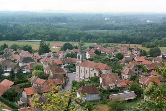
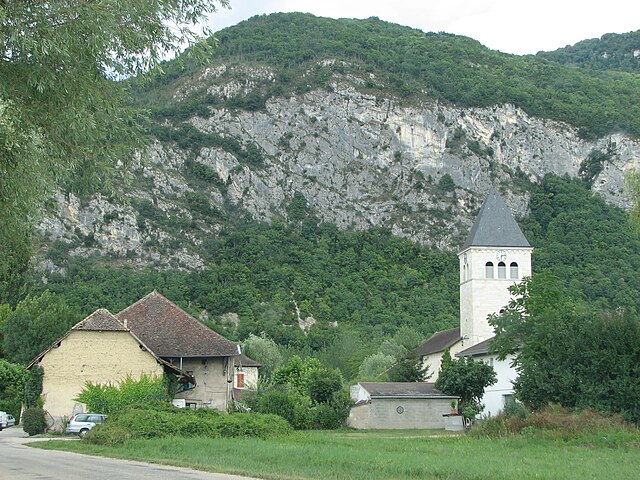
The Canton of Belley, located in the Ain department of the Auvergne-Rhône-Alpes region in southeastern France, offers a variety of beautiful hiking opportunities. This region is known for its stunning natural landscapes, with rolling hills, forests, and proximity to the Alps, making it a great destination for outdoor enthusiasts.
Key Highlights of Hiking in Canton of Belley:
-
Scenic Trails: The area boasts numerous well-marked hiking trails that cater to various skill levels. Whether you are a beginner or an experienced hiker, there are options for everyone. Trails often feature breathtaking views of the surrounding mountains and valleys.
-
Nature Parks: The nearby Bugey Regional Nature Park provides a fantastic backdrop for hiking. The park is rich in biodiversity and offers various routes that allow hikers to experience the local flora and fauna.
-
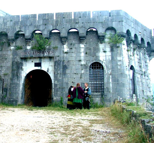
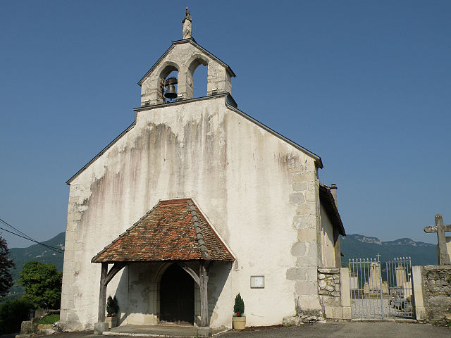
Historical Landmarks: Many hiking trails in the Canton of Belley pass by historical sites, including ancient churches and charming villages. Exploring these landmarks can add cultural depth to your hiking experience.
-
Lac du Bourget: While not directly in the Canton, nearby Lac du Bourget is one of the largest natural lakes in France, providing additional opportunities for hiking along its shores, as well as opportunities for swimming and picnicking.
-
Guided Tours: If you prefer to hike with a guide, local companies often offer guided tours that can provide insights into the natural and cultural heritage of the region.
-
Seasonal Considerations: Hiking in the Canton of Belley can be enjoyed year-round, but it's essential to check trail conditions and weather forecasts, especially in the winter months when snow can affect accessibility.
Tips for Hiking in Canton of Belley:
- Stay Hydrated: Carry enough water, especially on warmer days.
- Wear Proper Footwear: Good hiking boots are essential for navigating diverse terrain.
- Check the Weather: Be prepared for changing weather conditions, and dress in layers.
- Respect Nature: Follow the Leave No Trace principles to protect the environment.
Hiking in the Canton of Belley can be a memorable experience, combining physical activity with the opportunity to immerse yourself in nature and local culture. Whether you're looking for a short day hike or a more extended trek, this region has much to offer.
- Country:

- Capital: Belley
- Coordinates: 45° 45' 33" N, 5° 41' 21" E


- GPS tracks (wikiloc): [Link]
- Population: 24398
- Wikipedia en: wiki(en)
- Wikipedia: wiki(fr)
- Wikidata storage: Wikidata: Q1724443
- Wikipedia Commons Category: [Link]
- Freebase ID: [/m/02q97c8]
- Library of Congress authority ID: Alt: [nr96005714]
- INSEE canton code: [0104]
Includes regions:

Belley
- commune in Ain, France
Belley, located in the Auvergne-Rhône-Alpes region of France, is surrounded by beautiful landscapes that offer a variety of hiking opportunities. The area is particularly known for its stunning natural scenery, including rolling hills, vineyards, and the nearby mountains of the Bauges and Chartreuse ranges....
- Country:

- Postal Code: 01300
- Coordinates: 45° 45' 33" N, 5° 41' 17" E


- GPS tracks (wikiloc): [Link]
- Area: 22.42 sq km
- Population: 9058
- Web site: [Link]


Ambléon
- commune in Ain, France
Ambléon is a charming village situated in the Auvergne-Rhône-Alpes region of France, nestled in the foothills of the French Alps. The area is known for its stunning landscapes, offering a variety of hiking opportunities that cater to different skill levels....
- Country:

- Postal Code: 01300
- Coordinates: 45° 44' 58" N, 5° 36' 5" E


- GPS tracks (wikiloc): [Link]
- Area: 5.88 sq km
- Population: 109


Arbignieu
- former commune in Ain, France
Arbignieu is a charming village in the Ain department of the Auvergne-Rhône-Alpes region in southeastern France. The area surrounding Arbignieu offers various hiking opportunities, showcasing beautiful landscapes, forests, and the peaceful ambiance of the French countryside....
- Country:

- Postal Code: 01300
- Coordinates: 45° 43' 42" N, 5° 39' 2" E


- GPS tracks (wikiloc): [Link]
- Area: 13.07 sq km
- Population: 491


Andert-et-Condon
- commune in Ain, France
Andert-et-Condon is a charming commune located in the Auvergne-Rhône-Alpes region of France, nestled in the natural beauty of the French countryside. While this area may not be as widely recognized as some of the more famous hiking spots in the Alps or the Pyrenees, it offers a unique and tranquil hiking experience for those looking to explore rural France....
- Country:

- Postal Code: 01300
- Coordinates: 45° 47' 41" N, 5° 39' 19" E


- GPS tracks (wikiloc): [Link]
- Area: 6.94 sq km
- Population: 342

Brens
- commune in Ain, France
Brens, located in the Ain department of the Auvergne-Rhône-Alpes region in France, offers a beautiful setting for hiking enthusiasts. The area is characterized by its picturesque landscapes, rolling hills, and lush greenery, making it a great destination for outdoor activities....
- Country:

- Postal Code: 01300
- Coordinates: 45° 43' 7" N, 5° 41' 41" E


- GPS tracks (wikiloc): [Link]
- Area: 6.9 sq km
- Population: 1171
- Web site: [Link]

Brégnier-Cordon
- commune in Ain, France
Brégnier-Cordon is a charming village located in the Auvergne-Rhône-Alpes region of France, surrounded by stunning natural landscapes, making it an excellent destination for hiking enthusiasts. Here are some key points to consider when hiking in and around Brégnier-Cordon:...
- Country:

- Postal Code: 01300
- Coordinates: 45° 38' 56" N, 5° 37' 11" E


- GPS tracks (wikiloc): [Link]
- Area: 11 sq km
- Population: 856
- Web site: [Link]

Conzieu
- commune in Ain, France
Conzieu is a small village located in the Ain department of the Auvergne-Rhône-Alpes region in France. While it may not be as widely known as some other hiking destinations in the Alps, it offers various opportunities for nature lovers and hikers to explore its beautiful landscapes....
- Country:

- Postal Code: 01300
- Coordinates: 45° 43' 34" N, 5° 36' 26" E


- GPS tracks (wikiloc): [Link]
- Area: 7.2 sq km
- Population: 146

Chazey-Bons
- former commune in Ain, France
Chazey-Bons is a small commune located in the Auvergne-Rhône-Alpes region of France, nestled in the scenic countryside. While it may not be as widely recognized as some major hiking destinations, it can offer a charming experience for hikers seeking tranquility and nature....
- Country:

- Postal Code: 01300
- Coordinates: 45° 48' 11" N, 5° 40' 54" E


- GPS tracks (wikiloc): [Link]
- Area: 10.59 sq km
- Population: 902
- Web site: [Link]

Arboys-en-Bugey
- commune in Ain, France
Arboys-en-Bugey, located in the Ain department of the Auvergne-Rhône-Alpes region in southeastern France, offers a scenic and diverse landscape that is great for hiking enthusiasts. The area is characterized by its rolling hills, forests, and stunning views of the surrounding mountains, making it an excellent spot for both casual walkers and experienced hikers....
- Country:

- Postal Code: 01300
- Coordinates: 45° 43' 46" N, 5° 39' 4" E


- GPS tracks (wikiloc): [Link]
- Area: 22.49 sq km
- Web site: [Link]

Parves et Nattages
- commune in Ain, France
Parves-et-Nattages is a charming commune in the Auvergne-Rhône-Alpes region of France, known for its beautiful natural landscapes that appeal to hikers. Here’s what you need to know about hiking in this area:...
- Country:

- Postal Code: 01300
- Coordinates: 45° 44' 38" N, 5° 44' 32" E


- GPS tracks (wikiloc): [Link]
- Area: 15.86 sq km
- Web site: [Link]

Groslée-Saint-Benoit
- commune in Ain, France
 Hiking in Groslée-Saint-Benoit
Groslée-Saint-Benoît is a picturesque commune located in the Auvergne-Rhône-Alpes region of France. Known for its stunning natural landscapes, it offers a variety of hiking opportunities that attract outdoor enthusiasts....
- Country:

- Postal Code: 01680; 01300
- Coordinates: 45° 41' 42" N, 5° 35' 14" E


- GPS tracks (wikiloc): [Link]
- Area: 28.92 sq km

Izieu
- commune in Ain, France
Izieu, located in the Auvergne-Rhône-Alpes region of France, is known for its beautiful landscapes and rich natural surroundings. While Izieu itself is a small village with historical significance, especially related to the WWII events that took place there, it also serves as a great starting point for hiking enthusiasts looking to explore the surrounding areas. Here’s what you should know about hiking in Izieu:...
- Country:

- Postal Code: 01300
- Coordinates: 45° 39' 17" N, 5° 38' 37" E


- GPS tracks (wikiloc): [Link]
- Area: 7.67 sq km
- Population: 239

Murs-et-Gélignieux
- commune in Ain, France
Murs-et-Gélignieux is a charming commune located in the Auvergne-Rhône-Alpes region of France, surrounded by beautiful landscapes that make it an ideal spot for hiking enthusiasts. When exploring this area, you'll encounter diverse terrains, scenic views, and rich natural beauty....
- Country:

- Postal Code: 01300
- Coordinates: 45° 38' 29" N, 5° 39' 43" E


- GPS tracks (wikiloc): [Link]
- Area: 6.46 sq km
- Population: 256
- Web site: [Link]


Parves
- former commune in Ain, France
Parves, located in the Auvergne-Rhône-Alpes region of France, is a beautiful destination for hiking enthusiasts. The area is characterized by its stunning landscapes, which include lush forests, mountainous terrain, and picturesque valleys. Here are some highlights and tips for hiking in Parves:...
- Country:

- Postal Code: 01300
- Coordinates: 45° 44' 39" N, 5° 44' 27" E


- GPS tracks (wikiloc): [Link]
- Area: 5.53 sq km
- Population: 371

Virignin
- commune in Ain, France
Virignin, located in the Auvergne-Rhône-Alpes region of France, is surrounded by beautiful landscapes that offer various hiking opportunities. The area is not as well-known as some other hiking destinations in France, making it a serene choice for outdoor enthusiasts....
- Country:

- Postal Code: 01300
- Coordinates: 45° 43' 2" N, 5° 42' 47" E


- GPS tracks (wikiloc): [Link]
- Area: 7.88 sq km
- Population: 1064
- Web site: [Link]

Pollieu
- commune in Ain, France
Pollieu is a picturesque area located in the Auvergne-Rhône-Alpes region of France, nestled in the heart of the French Alps. The region offers a range of hiking opportunities, catering to both novice hikers and seasoned trekkers....
- Country:

- Postal Code: 01350
- Coordinates: 45° 47' 59" N, 5° 44' 30" E


- GPS tracks (wikiloc): [Link]
- Area: 3.71 sq km
- Population: 159

Saint-Bois
- former commune in Ain, France
Saint-Bois is a small village located in the Vosges department in northeastern France. While it may not be as widely known as some other hiking destinations, the surrounding areas offer beautiful landscapes and a variety of trails that cater to hikers of all skill levels....
- Country:

- Postal Code: 01300
- Coordinates: 45° 41' 58" N, 5° 38' 7" E


- GPS tracks (wikiloc): [Link]
- Area: 9.42 sq km
- Population: 146

Nattages
- former commune in Ain, France
Nattages, nestled in the breathtaking landscapes, offers a fantastic setting for hiking enthusiasts. While detailed information about specific trails may vary since my last update, here's an overall guide for hiking in this region....
- Country:

- Postal Code: 01300
- Coordinates: 45° 43' 41" N, 5° 45' 26" E


- GPS tracks (wikiloc): [Link]
- Area: 10.33 sq km
- Population: 567

Colomieu
- commune in Ain, France
Colomieu is a small commune located in the Auvergne-Rhône-Alpes region of France, known for its beautiful natural landscapes and outdoor activities. While it may not be as widely recognized as some larger hiking destinations, it offers various opportunities for those seeking to explore the great outdoors in a picturesque environment....
- Country:

- Postal Code: 01300
- Coordinates: 45° 43' 59" N, 5° 37' 19" E


- GPS tracks (wikiloc): [Link]
- Area: 5.96 sq km
- Population: 130
- Web site: [Link]

Lavours
- commune in Ain, France
Hiking in Lavours, a charming area in the Auvergne-Rhône-Alpes region of France, offers a delightful blend of stunning landscapes, rich flora and fauna, and the opportunity to experience the natural beauty of the French countryside. Lavours is particularly known for its beautiful trails that wind through the rolling hills and along the Rhone River....
- Country:

- Postal Code: 01350
- Coordinates: 45° 48' 33" N, 5° 46' 21" E


- GPS tracks (wikiloc): [Link]
- Area: 6.3 sq km
- Population: 129

Massignieu-de-Rives
- commune in Ain, France
Massignieu-de-Rives is a charming commune located in the Auvergne-Rhône-Alpes region of France, near the beautiful shores of Lake Bourget and surrounded by the natural beauty of the French Alps. Hiking in this area offers a unique opportunity to explore both scenic landscapes and diverse wildlife....
- Country:

- Postal Code: 01300
- Coordinates: 45° 45' 15" N, 5° 46' 2" E


- GPS tracks (wikiloc): [Link]
- Area: 9.52 sq km
- Population: 624

Prémeyzel
- commune in Ain, France
Prémeyzel is a charming Alpine village located in the Canton of Vaud, Switzerland. It's positioned at an altitude of approximately 1,300 meters (4,265 feet), nestled in the Jura Mountains, which makes it a great spot for hiking enthusiasts. Here are some key aspects to consider when hiking in and around Prémeyzel:...
- Country:

- Postal Code: 01300
- Coordinates: 45° 41' 2" N, 5° 38' 53" E


- GPS tracks (wikiloc): [Link]
- Area: 7.63 sq km
- Population: 238
- Web site: [Link]

Saint-Champ
- commune in Ain, France
Saint-Champ is a charming village in the Auvergne region of France, nestled in the Puy-de-Dôme department. While it may not be as widely recognized for hiking as some larger destinations, the surrounding area offers beautiful landscapes and various trails that can be quite appealing to hikers....
- Country:

- Postal Code: 01300
- Coordinates: 45° 47' 2" N, 5° 43' 51" E


- GPS tracks (wikiloc): [Link]
- Area: 5.14 sq km
- Population: 162

Peyrieu
- commune in Ain, France
Peyrieu is a charming area located in the Ain department in the Auvergne-Rhône-Alpes region of southeastern France. It's known for its beautiful landscapes, scenic views, and a variety of hiking trails that cater to different skill levels. Here are some insights and tips for hiking in Peyrieu:...
- Country:

- Postal Code: 01300
- Coordinates: 45° 40' 36" N, 5° 40' 39" E


- GPS tracks (wikiloc): [Link]
- Area: 14.13 sq km
- Population: 850
- Web site: [Link]
