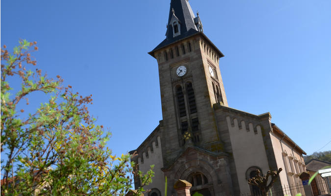
Mazerulles (Mazerulles)

- commune in Meurthe-et-Moselle, France
- Country:

- Postal Code: 54280
- Coordinates: 48° 45' 33" N, 6° 22' 54" E


- GPS tracks (wikiloc): [Link]
- Area: 6.38 sq km
- Population: 266
- Web site: http://mairie.mazerulles.free.fr/
- Wikipedia en: wiki(en)
- Wikipedia: wiki(fr)
- Wikidata storage: Wikidata: Q1101371
- Wikipedia Commons Category: [Link]
- Freebase ID: [/m/03qdlk8]
- Freebase ID: [/m/03qdlk8]
- GeoNames ID: Alt: [6436742]
- GeoNames ID: Alt: [6436742]
- SIREN number: [215403585]
- SIREN number: [215403585]
- BnF ID: [15264427j]
- BnF ID: [15264427j]
- INSEE municipality code: 54358
- INSEE municipality code: 54358
Shares border with regions:


Champenoux
- commune in Meurthe-et-Moselle, France
- Country:
- Postal Code: 54280
- Coordinates: 48° 44' 34" N, 6° 20' 57" E
- GPS tracks (wikiloc): [Link]
- Area: 10.99 sq km
- Population: 1307
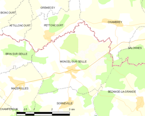
Moncel-sur-Seille
- commune in Meurthe-et-Moselle, France
- Country:
- Postal Code: 54280
- Coordinates: 48° 45' 55" N, 6° 25' 18" E
- GPS tracks (wikiloc): [Link]
- AboveSeaLevel: 206 м m
- Area: 12.41 sq km
- Population: 507
- Web site: [Link]


Sornéville
- commune in Meurthe-et-Moselle, France
- Country:
- Postal Code: 54280
- Coordinates: 48° 44' 53" N, 6° 25' 0" E
- GPS tracks (wikiloc): [Link]
- Area: 9.22 sq km
- Population: 346

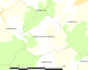
Erbéviller-sur-Amezule
- commune in Meurthe-et-Moselle, France
- Country:
- Postal Code: 54280
- Coordinates: 48° 43' 48" N, 6° 23' 7" E
- GPS tracks (wikiloc): [Link]
- Area: 4.45 sq km
- Population: 79


Amance
- commune in Meurthe-et-Moselle, France
- Country:
- Postal Code: 54770
- Coordinates: 48° 45' 15" N, 6° 16' 47" E
- GPS tracks (wikiloc): [Link]
- Area: 13.5 sq km
- Population: 333


Brin-sur-Seille
- commune in Meurthe-et-Moselle, France
- Country:
- Postal Code: 54280
- Coordinates: 48° 46' 44" N, 6° 21' 17" E
- GPS tracks (wikiloc): [Link]
- Area: 11.71 sq km
- Population: 800