Mazet-Saint-Voy (Mazet-Saint-Voy)

- commune in Haute-Loire, France
- Country:

- Postal Code: 43520
- Coordinates: 45° 2' 49" N, 4° 14' 39" E


- GPS tracks (wikiloc): [Link]
- Area: 45.02 sq km
- Population: 1119
- Web site: http://www.mazet-st-voy.com
- Wikipedia en: wiki(en)
- Wikipedia: wiki(fr)
- Wikidata storage: Wikidata: Q1689963
- Wikipedia Commons Category: [Link]
- Freebase ID: [/m/03ntn3s]
- GeoNames ID: Alt: [2994856]
- SIREN number: [214301301]
- BnF ID: [152600353]
- INSEE municipality code: 43130
Shares border with regions:


Champclause
- commune in Haute-Loire, France
- Country:
- Postal Code: 43260
- Coordinates: 45° 1' 21" N, 4° 10' 33" E
- GPS tracks (wikiloc): [Link]
- Area: 22.27 sq km
- Population: 200


Le Chambon-sur-Lignone
- commune in Haute-Loire, France
- Country:
- Postal Code: 43400
- Coordinates: 45° 3' 40" N, 4° 18' 9" E
- GPS tracks (wikiloc): [Link]
- Area: 41.71 sq km
- Population: 2521

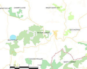
Fay-sur-Lignon
- commune in Haute-Loire, France
- Country:
- Postal Code: 43430
- Coordinates: 44° 59' 11" N, 4° 13' 35" E
- GPS tracks (wikiloc): [Link]
- Area: 13.24 sq km
- Population: 374


Araules
- commune in Haute-Loire, France
- Country:
- Postal Code: 43200
- Coordinates: 45° 5' 23" N, 4° 10' 24" E
- GPS tracks (wikiloc): [Link]
- Area: 31.1 sq km
- Population: 598


Saint-Jeures
- commune in Haute-Loire, France
- Country:
- Postal Code: 43200
- Coordinates: 45° 5' 46" N, 4° 12' 18" E
- GPS tracks (wikiloc): [Link]
- Area: 34.14 sq km
- Population: 962
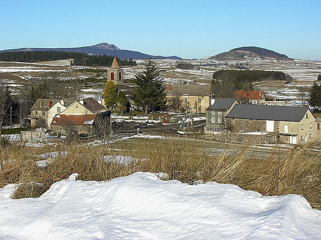

Les Vastres
- commune in Haute-Loire, France
- Country:
- Postal Code: 43430
- Coordinates: 44° 59' 21" N, 4° 15' 40" E
- GPS tracks (wikiloc): [Link]
- AboveSeaLevel: 1100 м m
- Area: 30.34 sq km
- Population: 199


Tence
- commune in Haute-Loire, France
- Country:
- Postal Code: 43190
- Coordinates: 45° 6' 51" N, 4° 17' 28" E
- GPS tracks (wikiloc): [Link]
- Area: 52.12 sq km
- Population: 3106