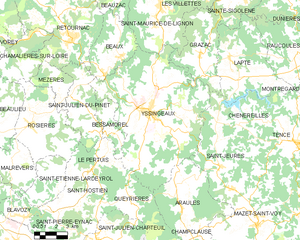
Saint-Jeures (Saint-Jeures)

- commune in Haute-Loire, France
- Country:

- Postal Code: 43200
- Coordinates: 45° 5' 46" N, 4° 12' 18" E


- GPS tracks (wikiloc): [Link]
- Area: 34.14 sq km
- Population: 962
- Wikipedia en: wiki(en)
- Wikipedia: wiki(fr)
- Wikidata storage: Wikidata: Q275992
- Wikipedia Commons Category: [Link]
- Freebase ID: [/m/03ntp4f]
- GeoNames ID: Alt: [6454146]
- SIREN number: [214301996]
- BnF ID: [15260103r]
- INSEE municipality code: 43199
Shares border with regions:
Chenereilles
- commune in Haute-Loire, France
- Country:
- Postal Code: 43190
- Coordinates: 45° 8' 0" N, 4° 15' 7" E
- GPS tracks (wikiloc): [Link]
- Area: 14.42 sq km
- Population: 325


Grazac
- commune in Haute-Loire, France
- Country:
- Postal Code: 43200
- Coordinates: 45° 11' 15" N, 4° 11' 0" E
- GPS tracks (wikiloc): [Link]
- Area: 21.66 sq km
- Population: 1038


Mazet-Saint-Voy
- commune in Haute-Loire, France
- Country:
- Postal Code: 43520
- Coordinates: 45° 2' 49" N, 4° 14' 39" E
- GPS tracks (wikiloc): [Link]
- Area: 45.02 sq km
- Population: 1119
- Web site: [Link]

Yssingeaux
- commune in Haute-Loire, France
- Country:
- Postal Code: 43200
- Coordinates: 45° 8' 34" N, 4° 7' 25" E
- GPS tracks (wikiloc): [Link]
- AboveSeaLevel: 840 м m
- Area: 80.57 sq km
- Population: 7122
- Web site: [Link]


Lapte
- commune in Haute-Loire, France
- Country:
- Postal Code: 43200
- Coordinates: 45° 11' 9" N, 4° 13' 1" E
- GPS tracks (wikiloc): [Link]
- Area: 30.75 sq km
- Population: 1704
- Web site: [Link]


Araules
- commune in Haute-Loire, France
- Country:
- Postal Code: 43200
- Coordinates: 45° 5' 23" N, 4° 10' 24" E
- GPS tracks (wikiloc): [Link]
- Area: 31.1 sq km
- Population: 598


Tence
- commune in Haute-Loire, France
- Country:
- Postal Code: 43190
- Coordinates: 45° 6' 51" N, 4° 17' 28" E
- GPS tracks (wikiloc): [Link]
- Area: 52.12 sq km
- Population: 3106