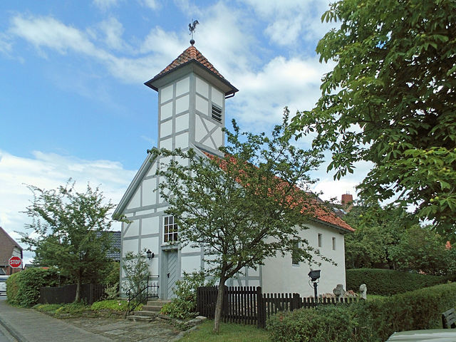
Meine (Meine)

- A district and municipality of Germany
 Hiking in Meine
Hiking in Meine, a small village in Lower Saxony, Germany, offers scenic views and a tranquil experience for nature enthusiasts. While it's not widely known as a hiking destination, the surrounding areas feature several trails and natural attractions that can be appreciated.
Nearby Hiking Opportunities:
-
Lüneburg Heath (Lüneburger Heide): Just a short drive from Meine, this expansive heathland is a popular hiking destination known for its purple heather, unique flora, and fauna. You can find well-marked trails that range from easy to moderate difficulty.
-
Elm-Lappwald Nature Park: Located to the west, this area has many trails through lush forests, hills, and picturesque landscapes that can be explored by hikers of all levels.
-
Routes Along Rivers: The Aller River and nearby waterways provide additional hiking opportunities, with trails that follow the riverbanks, allowing for peaceful walks amidst nature.
Tips for Hiking in Meine:
-
Trail Maps: Before heading out, check local resources or hiking apps for trail maps and conditions.
-
Preparation: Wear suitable footwear and clothing for varying weather conditions. The terrain can be uneven in some areas.
-
Safety: Always carry water, snacks, and a first aid kit. Let someone know your hiking plan and estimated return time.
-
Wildlife: Be respectful of wildlife and adhere to local regulations regarding trail use and camping.
Local Facilities:
While facilities in Meine may be limited, you can find cozy accommodations, local eateries, and supermarkets within the village or in nearby towns for provisions before you set out on your hike.
If you're looking for a peaceful hiking experience away from the tourist crowds, exploring the trails around Meine can be a rewarding choice.
- Country:

- Postal Code: 38527
- Local Dialing Code: 05307; 05304
- Licence Plate Code: GF
- Coordinates: 52° 23' 0" N, 10° 32' 0" E


- GPS tracks (wikiloc): [Link]
- AboveSeaLevel: 79 м m
- Area: 38.74 sq km
- Population: 8744
- Web site: https://www.gemeinde-meine.de/
- Wikipedia en: wiki(en)
- Wikipedia: wiki(de)
- Wikidata storage: Wikidata: Q502807
- Wikipedia Commons Category: [Link]
- Freebase ID: [/m/0279rlm]
- Freebase ID: [/m/0279rlm]
- GeoNames ID: Alt: [6552311]
- GeoNames ID: Alt: [6552311]
- VIAF ID: Alt: [124993622]
- VIAF ID: Alt: [124993622]
- OSM relation ID: [1363524]
- OSM relation ID: [1363524]
- GND ID: Alt: [4128438-0]
- GND ID: Alt: [4128438-0]
- MusicBrainz area ID: [1be4d9da-ea16-4927-a925-f8adefafd934]
- MusicBrainz area ID: [1be4d9da-ea16-4927-a925-f8adefafd934]
- WOEID: [674606]
- WOEID: [674606]
- TGN ID: [1040294]
- TGN ID: [1040294]
- Historical Gazetteer (GOV) ID: [MEIINEJO52GJ]
- Historical Gazetteer (GOV) ID: [MEIINEJO52GJ]
- German municipality key: 03151016
- German municipality key: 03151016
- GNS Unique Feature ID: -1824590
- GNS Unique Feature ID: -1824590
Shares border with regions:


Brunswick
- city in Lower Saxony, Germany
Hiking in Brunswick
Braunschweig, located in Lower Saxony, Germany, offers a variety of hiking options that allow you to explore its natural beauty, historical sites, and charming landscapes. Here's an overview of what you can expect when hiking in and around Braunschweig:...
- Country:
- Postal Code: 38114; 38126; 38100; 38100–38126
- Local Dialing Code: 05341; 0531; 05309; 05307; 05300
- Licence Plate Code: BS
- Coordinates: 52° 16' 9" N, 10° 31' 16" E
- GPS tracks (wikiloc): [Link]
- AboveSeaLevel: 75 м m
- Area: 192.70 sq km
- Population: 248667
- Web site: [Link]

Vordorf
- A district and municipality in Germany
Hiking in Vordorf
Vordorf, a small village in Lower Saxony, Germany, may not be as widely recognized as some major hiking destinations, but it offers a peaceful setting for outdoor enthusiasts. Here are some points of interest and things to consider when hiking in and around Vordorf:...
- Country:
- Postal Code: 38533
- Local Dialing Code: 05304
- Licence Plate Code: GF
- Coordinates: 52° 22' 0" N, 10° 31' 0" E
- GPS tracks (wikiloc): [Link]
- AboveSeaLevel: 83 м m
- Area: 19.26 sq km
- Population: 3032
- Web site: [Link]

Rötgesbüttel
- A district and municipality in Germany
Hiking in Rötgesbüttel
Rötgesbüttel is a small village located in Lower Saxony, Germany, near the city of Gifhorn. While it may not be as well-known as some larger hiking destinations, it offers a variety of opportunities for outdoor exploration and hiking through the picturesque landscapes characteristic of this region....
- Country:
- Postal Code: 38531
- Local Dialing Code: 05304
- Licence Plate Code: GF
- Coordinates: 52° 25' 0" N, 10° 32' 0" E
- GPS tracks (wikiloc): [Link]
- AboveSeaLevel: 67 м m
- Area: 10.83 sq km
- Population: 2363
- Web site: [Link]
Calberlah
- A district and municipality in Germany
Hiking in Calberlah
Calberlah is a small village located in Lower Saxony, Germany, close to the larger city of Wolfsburg. The region offers a tranquil environment, although it's not as well-known for hiking compared to Germany's famous national parks and mountains. However, there are still some opportunities for outdoor activities, including hiking, that you can explore in and around Calberlah....
- Country:
- Postal Code: 38547
- Local Dialing Code: 05374
- Licence Plate Code: GF
- Coordinates: 52° 25' 29" N, 10° 36' 59" E
- GPS tracks (wikiloc): [Link]
- AboveSeaLevel: 67 м m
- Area: 27.65 sq km
- Population: 4996

Wasbüttel
- A district and municipality in Germany
Hiking in Wasbüttel
Wasbüttel is a small village located in Lower Saxony, Germany, and while it may not be as well-known as some larger hiking destinations, the surrounding area offers opportunities for outdoor activities, including hiking....
- Country:
- Postal Code: 38553
- Local Dialing Code: 05374
- Licence Plate Code: GF
- Coordinates: 52° 24' 48" N, 10° 35' 37" E
- GPS tracks (wikiloc): [Link]
- AboveSeaLevel: 67 м m
- Area: 6.58 sq km
- Population: 1889
- Web site: [Link]

Isenbüttel
- A district and municipality in Germany
Hiking in Isenbüttel
Isenbüttel is a small village located in Lower Saxony, Germany, not far from the town of Wolfsburg. While it may not be famous for hiking trails, the surrounding areas offer some enjoyable walking and hiking opportunities, particularly through scenic landscapes and natural settings....
- Country:
- Postal Code: 38550
- Local Dialing Code: 05374
- Licence Plate Code: GF
- Coordinates: 52° 26' 0" N, 10° 35' 0" E
- GPS tracks (wikiloc): [Link]
- AboveSeaLevel: 68 м m
- Area: 18.65 sq km
- Population: 6411
- Web site: [Link]