Menetou-Salon (Menetou-Salon)

- commune in Cher, France
- Country:

- Postal Code: 18510
- Coordinates: 47° 13' 55" N, 2° 29' 11" E


- GPS tracks (wikiloc): [Link]
- Area: 37.66 sq km
- Population: 1627
- Wikipedia en: wiki(en)
- Wikipedia: wiki(fr)
- Wikidata storage: Wikidata: Q829724
- Wikipedia Commons Category: [Link]
- Freebase ID: [/m/03mfd9k]
- GeoNames ID: Alt: [2994585]
- SIREN number: [211801451]
- BnF ID: [15249491f]
- VIAF ID: Alt: [127014861]
- Library of Congress authority ID: Alt: [no2003090088]
- INSEE municipality code: 18145
Shares border with regions:


Achères
- commune in Cher, France
- Country:
- Postal Code: 18250
- Coordinates: 47° 16' 42" N, 2° 26' 55" E
- GPS tracks (wikiloc): [Link]
- Area: 12.75 sq km
- Population: 378

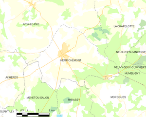
Henrichemont
- commune in Cher, France
- Country:
- Postal Code: 18250
- Coordinates: 47° 18' 11" N, 2° 31' 28" E
- GPS tracks (wikiloc): [Link]
- Area: 25.27 sq km
- Population: 1795
Soulangis
- commune in Cher, France
- Country:
- Postal Code: 18220
- Coordinates: 47° 11' 12" N, 2° 31' 3" E
- GPS tracks (wikiloc): [Link]
- Area: 13.76 sq km
- Population: 479
- Web site: [Link]
Quantilly
- commune in Cher, France
- Country:
- Postal Code: 18110
- Coordinates: 47° 13' 27" N, 2° 26' 41" E
- GPS tracks (wikiloc): [Link]
- Area: 12.69 sq km
- Population: 464
Parassy
- commune in Cher, France
- Country:
- Postal Code: 18220
- Coordinates: 47° 13' 59" N, 2° 32' 51" E
- GPS tracks (wikiloc): [Link]
- Area: 26.02 sq km
- Population: 420
Vignoux-sous-les-Aix
- commune in Cher, France
- Country:
- Postal Code: 18110
- Coordinates: 47° 11' 11" N, 2° 27' 51" E
- GPS tracks (wikiloc): [Link]
- Area: 14.94 sq km
- Population: 706