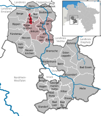
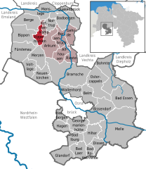
Menslage (Menslage)
- municipality of Germany
Menslage is a small village located in Lower Saxony, Germany, and while it may not be as well-known as major hiking destinations, there are opportunities for outdoor activities in and around the area. Here are some points of interest if you're considering hiking in and near Menslage:
-
Scenic Nature: The surrounding landscape of Menslage offers a mix of rural scenery, forests, and fields. You can find trails that take you through agricultural areas and woodlands, providing a peaceful hiking experience.
-
Local Trails: While specific well-marked trails may not be as abundant as in larger national parks, you can explore local footpaths. It's advisable to consult local resources or maps for the best hiking routes in the vicinity.
-
Nearby Hiking Areas: Consider venturing to nearby nature reserves or forests, like the Rhauderfehn Nature Reserve or the forests in the vicinity of the Sollinger Wald, where you’ll find marked trails and more structured hiking experiences.
-
Wildlife and Nature: The area around Menslage can be a great spot for birdwatching and observing wildlife. Bring binoculars for a chance to see various local species.
-
Accessibility: Menslage is well connected by road, making it easier to access nearby forests and natural reserves for hiking. If you have a vehicle, consider traveling to nearby towns that might offer better hiking facilities and routes.
-
Season Considerations: The best time for hiking in this region is typically during the spring and summer months when the weather is more favorable. However, autumn can also be beautiful with fall foliage.
-
Local Amenities: After a day of hiking, explore the village for local cuisine or cozy cafes to relax and enjoy the scenery.
As always, make sure to prepare adequately for your hike, carry enough water and snacks, and check the weather conditions before heading out. Enjoy your hiking adventure in Menslage!
- Country:

- Postal Code: 49637
- Local Dialing Code: 05437; 05436; 05431
- Licence Plate Code: OS
- Coordinates: 52° 41' 0" N, 7° 49' 0" E


- GPS tracks (wikiloc): [Link]
- AboveSeaLevel: 23 м m
- Area: 65.18 sq km
- Population: 2441
- Web site: http://www.menslage.de
- Wikipedia en: wiki(en)
- Wikipedia: wiki(de)
- Wikidata storage: Wikidata: Q651619
- Wikipedia Commons Category: [Link]
- Freebase ID: [/m/02rzbvd]
- GeoNames ID: Alt: [2871889]
- BnF ID: [12203704t]
- VIAF ID: Alt: [130617827]
- OSM relation ID: [1808583]
- GND ID: Alt: [4221514-6]
- Library of Congress authority ID: Alt: [nr89011333]
- German municipality key: 03459025
Shares border with regions:


Quakenbrück
- human settlement in Germany
Quakenbrück, located in Lower Saxony, Germany, offers a variety of hiking opportunities suited to different levels of experience and fitness. Although it's a small town, its surrounding areas provide access to scenic landscapes, forests, and paths ideal for hiking....
- Country:

- Postal Code: 49610
- Local Dialing Code: 05431
- Licence Plate Code: OS
- Coordinates: 52° 40' 38" N, 7° 57' 27" E


- GPS tracks (wikiloc): [Link]
- AboveSeaLevel: 24 м m
- Area: 17.95 sq km
- Population: 13366
- Web site: [Link]


Löningen
- municipality of Germany
Löningen is a picturesque town located in Lower Saxony, Germany, which offers some lovely hiking opportunities. The surrounding area is characterized by a mix of woodlands, heathlands, and agricultural fields, making it perfect for nature enthusiasts....
- Country:

- Postal Code: 49624
- Local Dialing Code: 05964; 05962; 05437; 05434; 05432
- Licence Plate Code: CLP
- Coordinates: 52° 43' 0" N, 7° 46' 0" E


- GPS tracks (wikiloc): [Link]
- AboveSeaLevel: 24 м m
- Area: 143 sq km
- Population: 13366
- Web site: [Link]


Nortrup
- municipality of Germany
Nortrup is a small town in the Lower Saxony region of Germany, known for its picturesque countryside and scenic landscapes. While it may not be a widely recognized hiking destination, there are opportunities for outdoor enthusiasts to explore the natural beauty of the area. Here are some key points to consider when hiking in and around Nortrup:...
- Country:

- Postal Code: 49638
- Local Dialing Code: 05436
- Licence Plate Code: OS
- Coordinates: 52° 36' 0" N, 7° 53' 0" E


- GPS tracks (wikiloc): [Link]
- AboveSeaLevel: 31 м m
- Area: 27.08 sq km
- Population: 2963
- Web site: [Link]


Badbergen
- municipality of Germany
Badbergen is a small municipality located in Lower Saxony, Germany, and while it may not be as well-known as some larger hiking destinations, it offers a variety of beautiful landscapes and trails that are ideal for outdoor enthusiasts....
- Country:

- Postal Code: 49635
- Local Dialing Code: 05433
- Licence Plate Code: OS
- Coordinates: 52° 38' 0" N, 7° 59' 0" E


- GPS tracks (wikiloc): [Link]
- AboveSeaLevel: 29 м m
- Area: 79.11 sq km
- Population: 4564
- Web site: [Link]


Kettenkamp
- municipality of Germany
Kettenkamp is a scenic area known for its natural beauty and hiking opportunities, particularly in Germany. While it's not as widely recognized as some major hiking destinations, it offers trails that can be enjoyed by both novice and experienced hikers....
- Country:

- Postal Code: 49577
- Local Dialing Code: 05436
- Licence Plate Code: OS
- Coordinates: 52° 35' 0" N, 7° 50' 0" E


- GPS tracks (wikiloc): [Link]
- AboveSeaLevel: 47 м m
- Area: 52.6 sq km
- Population: 1765
- Web site: [Link]


Eggermühlen
- municipality of Germany
Eggermühlen is a quaint village located in Lower Saxony, Germany, that offers a tranquil setting for hiking and enjoying nature. Nestled within picturesque landscapes, it serves as a great starting point for various hiking trails that cater to different skill levels....
- Country:

- Postal Code: 49577
- Local Dialing Code: 05462
- Licence Plate Code: OS
- Coordinates: 52° 34' 0" N, 7° 49' 0" E


- GPS tracks (wikiloc): [Link]
- AboveSeaLevel: 53 м m
- Area: 27.41 sq km
- Population: 1734
- Web site: [Link]

