Mereto di Tomba (Mereto di Tomba)
.svg)
- Italian comune
 Hiking in Mereto di Tomba
Mereto di Tomba, located in the Friuli Venezia Giulia region of Italy, is a charming area that offers various hiking opportunities, especially for those looking to explore the natural beauty of northern Italy. The landscape is characterized by rolling hills, vineyards, and views of the surrounding mountains, making it a picturesque spot for outdoor activities.
Hiking Trails
While specific trails may not be extensively documented, the region generally has several paths that cater to different skill levels. Here are a few things to consider when planning a hiking trip:
-
Scenic Routes: Many trails in the area lead through vineyards and olive groves, allowing hikers to enjoy the local agriculture. The hilly terrain provides stunning panoramic views.
-
Nature Reserves and Parks: Nearby nature reserves, such as the Riserva Naturale Regionale delle Falesie di Duino, can be accessible for longer hikes and offer opportunities to see diverse flora and fauna.
-
Cultural Hikes: Consider trails that also incorporate visits to local historical sites or small villages, enriching your hike with cultural experiences.
Preparation
-
Equipment: Make sure to wear sturdy hiking shoes and bring sufficient water, snacks, and a first-aid kit. A map or GPS is also advisable for navigation.
-
Season: The best times to hike in this region are usually in spring (April to June) and autumn (September to October) when the weather is mild and the scenery is particularly beautiful.
-
Local Guides: For those unfamiliar with the area, hiring a local guide can enhance the experience, providing insights into both the natural and cultural history of the region.
Safety
- Always check weather conditions before heading out, as they can change rapidly.
- Inform someone about your hiking plans, especially if you are going on a less traveled route.
Conclusion
Hiking in Mereto di Tomba can be a rewarding experience for nature lovers and those looking to explore the rich landscape of northeastern Italy. Whether you're looking for leisurely walks or more challenging hikes, the area has plenty to offer. Enjoy your adventure!
- Country:

- Postal Code: 33036
- Local Dialing Code: 0432
- Licence Plate Code: UD
- Coordinates: 46° 3' 0" N, 13° 2' 0" E


- GPS tracks (wikiloc): [Link]
- AboveSeaLevel: 98 м m
- Area: 27.30 sq km
- Population: 2606
- Web site: http://www.comune.mereto-di-tomba.ud.it/
- Wikipedia en: wiki(en)
- Wikipedia: wiki(it)
- Wikidata storage: Wikidata: Q53283
- Wikipedia Commons Category: [Link]
- Freebase ID: [/m/0gk98j]
- GeoNames ID: Alt: [6536687]
- VIAF ID: Alt: [248319043]
- OSM relation ID: [79138]
- TGN ID: [7056449]
- UN/LOCODE: [ITMTB]
- ISTAT ID: 030058
- Italian cadastre code: F144
Shares border with regions:
Basiliano
- Italian comune
Hiking in Basiliano
Basiliano is a charming municipality located in the Friuli Venezia Giulia region of northern Italy. Although it may not be as well-known for hiking as some other areas in Italy, it offers a variety of beautiful landscapes, local trails, and access to the surrounding natural parks and hills. Here are some things to consider for hiking in and around Basiliano:...
- Country:
- Postal Code: 33031
- Local Dialing Code: 0432
- Licence Plate Code: UD
- Coordinates: 46° 1' 0" N, 13° 6' 0" E
- GPS tracks (wikiloc): [Link]
- AboveSeaLevel: 77 м m
- Area: 43.05 sq km
- Population: 5345
- Web site: [Link]
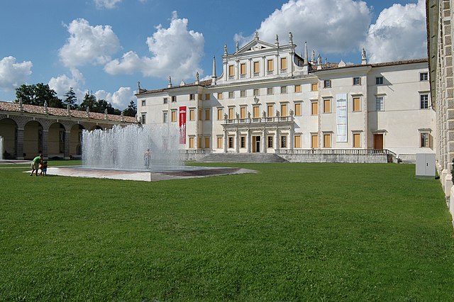

Codroipo
- Italian comune
Hiking in Codroipo
Codroipo, located in the Friuli Venezia Giulia region of northeastern Italy, offers a unique experience for hikers. The area is characterized by a mix of flat plains and gentle hills, making it suitable for hikers of all skill levels. While Codroipo itself may not be a well-known hiking destination, it's surrounded by beautiful landscapes and trails that can appeal to nature lovers....
- Country:
- Postal Code: 33033
- Local Dialing Code: 0432
- Licence Plate Code: UD
- Coordinates: 45° 57' 41" N, 12° 58' 39" E
- GPS tracks (wikiloc): [Link]
- AboveSeaLevel: 43 м m
- Area: 75.22 sq km
- Population: 16165
- Web site: [Link]


Coseano
- Italian comune
Hiking in Coseano
Coseano is a quaint town located in the Friuli-Venezia Giulia region of northeastern Italy. The area is known for its picturesque landscapes and proximity to various hiking opportunities. While Coseano itself might not be a major hiking hub, it serves as a gateway to several nearby hiking trails and natural attractions....
- Country:
- Postal Code: 33030
- Local Dialing Code: 0432
- Licence Plate Code: UD
- Coordinates: 46° 6' 0" N, 13° 1' 0" E
- GPS tracks (wikiloc): [Link]
- AboveSeaLevel: 121 м m
- Area: 23.8 sq km
- Population: 2181
- Web site: [Link]


Fagagna
- Italian comune
Hiking in Fagagna
Fagagna is a charming village located in the Friuli-Venezia Giulia region of northeastern Italy. It's surrounded by beautiful landscapes, making it a great spot for hiking enthusiasts. Here are some details to consider for hiking in and around Fagagna:...
- Country:
- Postal Code: 33034
- Local Dialing Code: 0432
- Licence Plate Code: UD
- Coordinates: 46° 7' 0" N, 13° 5' 0" E
- GPS tracks (wikiloc): [Link]
- AboveSeaLevel: 177 м m
- Area: 37.19 sq km
- Population: 6296
- Web site: [Link]


Pasian di Prato
- Italian comune
Hiking in Pasian di Prato
Pasian di Prato is a municipality located in the Friuli Venezia Giulia region of northeastern Italy, known for its beautiful natural landscapes and proximity to the Julian Alps. While it may not be the most widely recognized hiking destination, it offers several trails and opportunities for outdoor enthusiasts....
- Country:
- Postal Code: 33037
- Local Dialing Code: 0432
- Licence Plate Code: UD
- Coordinates: 46° 3' 0" N, 13° 12' 0" E
- GPS tracks (wikiloc): [Link]
- AboveSeaLevel: 106 м m
- Area: 15.41 sq km
- Population: 9363
- Web site: [Link]
San Vito di Fagagna
- Italian comune
Hiking in San Vito di Fagagna
San Vito di Fagagna, located in the Friuli Venezia Giulia region of northeastern Italy, offers a variety of hiking opportunities amidst beautiful landscapes and rich cultural history. The area is characterized by rolling hills, vineyards, and scenic views of the surrounding countryside and the nearby Alps....
- Country:
- Postal Code: 33030
- Local Dialing Code: 0432
- Licence Plate Code: UD
- Coordinates: 46° 5' 0" N, 13° 4' 0" E
- GPS tracks (wikiloc): [Link]
- AboveSeaLevel: 135 м m
- Area: 8.57 sq km
- Population: 1661
- Web site: [Link]


Sedegliano
- Italian comune
Hiking in Sedegliano
Sedegliano is a charming town located in the Friuli Venezia Giulia region of northeastern Italy. While it may not be widely known as a hiking destination, the surrounding areas offer some beautiful landscapes and opportunities for walking and hiking enthusiasts. Here’s what you need to know about hiking near Sedegliano:...
- Country:
- Postal Code: 33039
- Local Dialing Code: 0432
- Licence Plate Code: UD
- Coordinates: 46° 0' 50" N, 12° 58' 29" E
- GPS tracks (wikiloc): [Link]
- AboveSeaLevel: 84 м m
- Area: 50.53 sq km
- Population: 3766
- Web site: [Link]