Metzeral (Metzeral)
- commune in Haut-Rhin, France
- Country:

- Postal Code: 68380
- Coordinates: 48° 0' 44" N, 7° 4' 13" E


- GPS tracks (wikiloc): [Link]
- Area: 30.43 sq km
- Population: 1081
- Web site: http://www.metzeral.fr
- Wikipedia en: wiki(en)
- Wikipedia: wiki(fr)
- Wikidata storage: Wikidata: Q121642
- Wikipedia Commons Category: [Link]
- Freebase ID: [/m/03m4lh2]
- Freebase ID: [/m/03m4lh2]
- GeoNames ID: Alt: [2994157]
- GeoNames ID: Alt: [2994157]
- SIREN number: [216802041]
- SIREN number: [216802041]
- BnF ID: [15271906f]
- BnF ID: [15271906f]
- VIAF ID: Alt: [144458536]
- VIAF ID: Alt: [144458536]
- GND ID: Alt: [4812126-5]
- GND ID: Alt: [4812126-5]
- Library of Congress authority ID: Alt: [n2005058344]
- Library of Congress authority ID: Alt: [n2005058344]
- WOEID: [611322]
- WOEID: [611322]
- INSEE municipality code: 68204
- INSEE municipality code: 68204
Shares border with regions:


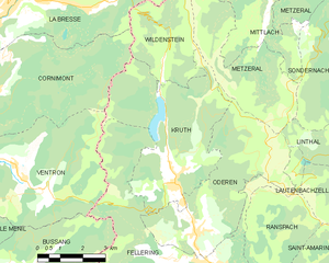
Kruth
- commune in Haut-Rhin, France
- Country:

- Postal Code: 68820
- Coordinates: 47° 55' 51" N, 6° 57' 50" E


- GPS tracks (wikiloc): [Link]
- Area: 22.06 sq km
- Population: 946
- Web site: [Link]


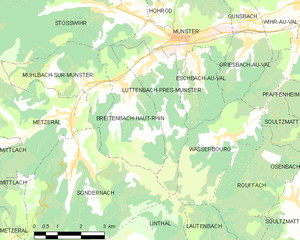
Luttenbach-près-Munster
- commune in Haut-Rhin, France
- Country:

- Postal Code: 68140
- Coordinates: 48° 1' 56" N, 7° 7' 9" E


- GPS tracks (wikiloc): [Link]
- Area: 7.86 sq km
- Population: 738


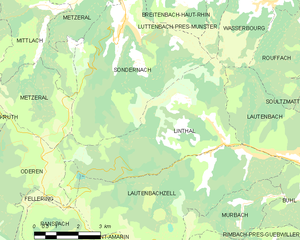
Linthal
- commune in Haut-Rhin, France
- Country:

- Postal Code: 68610
- Coordinates: 47° 56' 48" N, 7° 7' 49" E


- GPS tracks (wikiloc): [Link]
- AboveSeaLevel: 463 м m
- Area: 20.84 sq km
- Population: 621


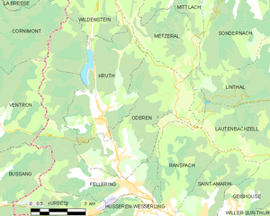
Oderen
- commune in Haut-Rhin, France
- Country:

- Postal Code: 68830
- Coordinates: 47° 54' 33" N, 6° 58' 31" E


- GPS tracks (wikiloc): [Link]
- Area: 19.12 sq km
- Population: 1287
- Web site: [Link]


Mittlach
- commune in Haut-Rhin, France
- Country:

- Postal Code: 68380
- Coordinates: 48° 0' 15" N, 7° 1' 50" E


- GPS tracks (wikiloc): [Link]
- AboveSeaLevel: 530 м m
- Area: 11.39 sq km
- Population: 339
- Web site: [Link]


Muhlbach-sur-Munster
- commune in Haut-Rhin, France
- Country:

- Postal Code: 68380
- Coordinates: 48° 1' 32" N, 7° 5' 1" E


- GPS tracks (wikiloc): [Link]
- Area: 7.88 sq km
- Population: 752


Wildenstein
- commune in Haut-Rhin, France
- Country:

- Postal Code: 68820
- Coordinates: 47° 58' 38" N, 6° 57' 39" E


- GPS tracks (wikiloc): [Link]
- Area: 9.86 sq km
- Population: 181


Sondernach
- commune in Haut-Rhin, France
- Country:

- Postal Code: 68380
- Coordinates: 47° 59' 50" N, 7° 4' 26" E


- GPS tracks (wikiloc): [Link]
- Area: 24.72 sq km
- Population: 632
- Web site: [Link]


Stosswihr
- commune in Haut-Rhin, France
- Country:

- Postal Code: 68140
- Coordinates: 48° 3' 14" N, 7° 6' 15" E


- GPS tracks (wikiloc): [Link]
- Area: 26.4 sq km
- Population: 1344


La Bresse
- commune in Vosges, France
- Country:

- Postal Code: 88250
- Coordinates: 48° 0' 21" N, 6° 52' 33" E


- GPS tracks (wikiloc): [Link]
- Area: 57.94 sq km
- Population: 4243
- Web site: [Link]
