Oderen (Oderen)

- commune in Haut-Rhin, France
- Country:

- Postal Code: 68830
- Coordinates: 47° 54' 33" N, 6° 58' 31" E


- GPS tracks (wikiloc): [Link]
- Area: 19.12 sq km
- Population: 1287
- Web site: http://www.oderen.net/
- Wikipedia en: wiki(en)
- Wikipedia: wiki(fr)
- Wikidata storage: Wikidata: Q148086
- Wikipedia Commons Category: [Link]
- Freebase ID: [/m/03nphl1]
- Freebase ID: [/m/03nphl1]
- GeoNames ID: Alt: [2989747]
- GeoNames ID: Alt: [2989747]
- SIREN number: [216802470]
- SIREN number: [216802470]
- BnF ID: [15271949q]
- BnF ID: [15271949q]
- INSEE municipality code: 68247
- INSEE municipality code: 68247
Shares border with regions:


Metzeral
- commune in Haut-Rhin, France
- Country:
- Postal Code: 68380
- Coordinates: 48° 0' 44" N, 7° 4' 13" E
- GPS tracks (wikiloc): [Link]
- Area: 30.43 sq km
- Population: 1081
- Web site: [Link]

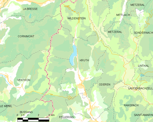
Kruth
- commune in Haut-Rhin, France
- Country:
- Postal Code: 68820
- Coordinates: 47° 55' 51" N, 6° 57' 50" E
- GPS tracks (wikiloc): [Link]
- Area: 22.06 sq km
- Population: 946
- Web site: [Link]

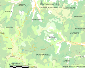
Linthal
- commune in Haut-Rhin, France
- Country:
- Postal Code: 68610
- Coordinates: 47° 56' 48" N, 7° 7' 49" E
- GPS tracks (wikiloc): [Link]
- AboveSeaLevel: 463 м m
- Area: 20.84 sq km
- Population: 621


Ranspach
- commune in Haut-Rhin, France
- Country:
- Postal Code: 68470
- Coordinates: 47° 53' 8" N, 7° 0' 32" E
- GPS tracks (wikiloc): [Link]
- Area: 11.4 sq km
- Population: 841


Fellering
- commune in Haut-Rhin, France
- Country:
- Postal Code: 68470
- Coordinates: 47° 53' 46" N, 6° 59' 11" E
- GPS tracks (wikiloc): [Link]
- Area: 21.29 sq km
- Population: 1636