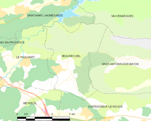
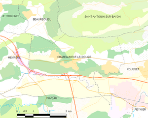
Meyreuil (Meyreuil)
- commune in Bouches-du-Rhône, France
Meyreuil is a charming commune located near Aix-en-Provence in the Provence-Alpes-Côte d'Azur region of France. It's an excellent starting point for hiking enthusiasts because of its beautiful natural landscapes and proximity to the Sainte-Victoire mountain.
Here are some highlights and tips for hiking in the Meyreuil area:
Hiking Trails
-
Sainte-Victoire Mountain: The most famous hiking destination near Meyreuil is the iconic Sainte-Victoire mountain. There are several trails of varying difficulty that lead to stunning viewpoints, including the Col de la Croix and the Pic des Mouches. The routes can be rocky and steep, so make sure you're prepared for a challenging hike.
-
Local Trails: Within and around Meyreuil, there are numerous smaller trails that offer a chance to explore the local flora and fauna. Some trails also lead to vineyards and olive groves, providing a taste of the region’s agricultural heritage.
-
Leisure Parks: The area has parks with easier walking paths, suitable for families or those looking for a leisurely stroll. Parks like the Parc de la Bastide and nearby green spaces make for great walks intertwined with nature.
Preparation Tips
- Footwear: Wear sturdy hiking boots or shoes with good grip as many trails can be rocky and uneven.
- Weather: Check the weather forecast before you head out. The region can get quite hot in summer, so early morning hikes can be more pleasant.
- Hydration: Bring enough water, especially if you plan to hike during warmer months.
- Maps and Navigation: While many trails are marked, bringing a map or using a hiking app can be helpful, particularly on less obvious paths.
Other Activities
In addition to hiking, the area offers opportunities for rock climbing, mountain biking, and even tasting local wines if you visit the vineyards.
Local Tips
- Best Times to Hike: Spring (April to June) and autumn (September to November) are ideal for hiking in this region due to mild temperatures and blooming flora.
- Respect Nature: As always, be mindful of nature, stick to marked paths, and follow local guidelines to preserve the beauty of the area.
Whether you're a seasoned hiker or a casual walker, Meyreuil and the surrounding region offer beautiful landscapes, charming views, and a wonderful hiking experience!
- Country:

- Postal Code: 13590
- Coordinates: 43° 29' 10" N, 5° 29' 44" E


- GPS tracks (wikiloc): [Link]
- Area: 20.13 sq km
- Population: 5417
- Web site: http://www.ville-meyreuil.fr
- Wikipedia en: wiki(en)
- Wikipedia: wiki(fr)
- Wikidata storage: Wikidata: Q675912
- Wikipedia Commons Category: [Link]
- Freebase ID: [/m/02rpcsc]
- GeoNames ID: Alt: [2994068]
- SIREN number: [211300603]
- BnF ID: [15247342g]
- INSEE municipality code: 13060
Shares border with regions:

Gardanne
- commune in Bouches-du-Rhône, France
Gardanne, located in the Provence-Alpes-Côte d'Azur region of France, offers various hiking opportunities that showcase the beautiful landscapes and rich natural heritage of the area. Here are some details about hiking in Gardanne:...
- Country:

- Postal Code: 13120
- Coordinates: 43° 27' 16" N, 5° 28' 34" E


- GPS tracks (wikiloc): [Link]
- Area: 27.02 sq km
- Population: 19749
- Web site: [Link]


Beaurecueil
- commune in Bouches-du-Rhône, France
Beaurecueil is a charming village located near Aix-en-Provence in the Provence-Alpes-Côte d'Azur region of southern France. It offers several hiking opportunities, surrounded by beautiful natural landscapes that include rolling hills, forests, and panoramic views of the Sainte-Victoire Mountain, which is renowned for its striking beauty and significance in the works of painter Paul Cézanne....
- Country:

- Postal Code: 13100
- Coordinates: 43° 30' 38" N, 5° 32' 40" E


- GPS tracks (wikiloc): [Link]
- Area: 9.86 sq km
- Population: 578


Châteauneuf-le-Rouge
- commune in Bouches-du-Rhône, France
 Hiking in Châteauneuf-le-Rouge
Châteauneuf-le-Rouge, located in the Provence-Alpes-Côte d'Azur region of France, offers some beautiful hiking opportunities characterized by its picturesque landscapes, Mediterranean climate, and natural beauty. Here are some aspects to consider when hiking in and around Châteauneuf-le-Rouge:...
- Country:

- Postal Code: 13790
- Coordinates: 43° 29' 23" N, 5° 34' 11" E


- GPS tracks (wikiloc): [Link]
- AboveSeaLevel: 345.0 м m
- Area: 13.15 sq km
- Population: 2172
- Web site: [Link]


Aix-en-Provence
- commune in Bouches-du-Rhône, France
Aix-en-Provence, located in the Provence region of southern France, is surrounded by beautiful landscapes that offer excellent hiking opportunities. Here's what you can expect when hiking in and around Aix-en-Provence:...
- Country:

- Postal Code: 13540; 13290; 13100; 13090; 13080
- Coordinates: 43° 31' 40" N, 5° 26' 44" E


- GPS tracks (wikiloc): [Link]
- AboveSeaLevel: 173 м m
- Area: 186.08 sq km
- Population: 142668
- Web site: [Link]


Fuveau
- commune in Bouches-du-Rhône, France
Fuveau is a charming commune located in the Bouches-du-Rhône department of the Provence-Alpes-Côte d'Azur region in southeastern France. It's surrounded by beautiful landscapes that offer a variety of hiking opportunities....
- Country:

- Postal Code: 13710
- Coordinates: 43° 27' 8" N, 5° 33' 42" E


- GPS tracks (wikiloc): [Link]
- Area: 30.02 sq km
- Population: 9756
- Web site: [Link]


Le Tholonet
- commune in Bouches-du-Rhône, France
Le Tholonet is a picturesque village located near Aix-en-Provence in the southeastern part of France. It offers some beautiful hiking opportunities, with trails that showcase stunning views of the surrounding landscape, including the iconic Mont Sainte-Victoire, which has been a muse for many artists, including Cézanne....
- Country:

- Postal Code: 13100
- Coordinates: 43° 31' 18" N, 5° 30' 40" E


- GPS tracks (wikiloc): [Link]
- Area: 10.82 sq km
- Population: 2376
