Meyronnes (Meyronnes)
- former commune in Alpes-de-Haute-Provence, France
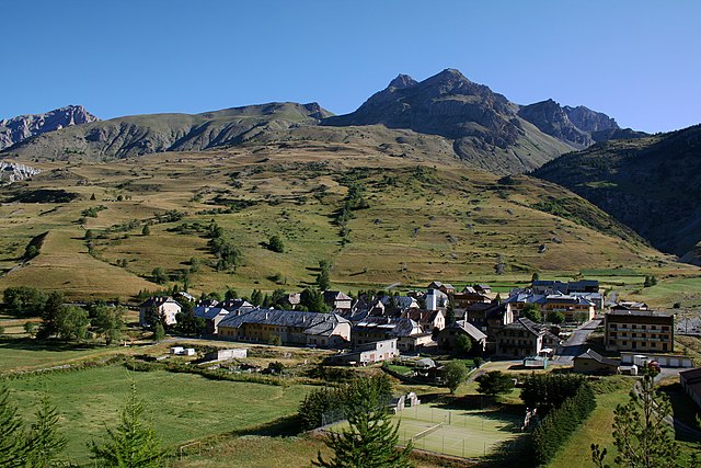
Meyronnes is a picturesque village located in the Alpes-de-Haute-Provence region of southeastern France. Nestled in the Mercantour National Park, it offers a range of hiking opportunities that cater to different skill levels, making it an excellent destination for nature lovers and outdoor enthusiasts.
Key Highlights of Hiking in Meyronnes:
-
Scenic Trails: The area is known for its stunning landscapes, which include rugged mountains, lush valleys, and alpine meadows. You'll often encounter dramatic views and diverse flora and fauna.
-
Mercantour National Park: Being so close to the park, you have access to numerous well-marked trails. The park is home to unique wildlife, including chamois and ibex, and offers exceptional biodiversity.
-
Trail Options: There are various trails ranging from easy walks to more challenging treks. Popular routes include:
- Vallee des Merveilles: Famous for its prehistoric rock engravings, this area offers a great hiking experience with breathtaking vistas.
- Lac des Neiges: A moderate hike leading to a beautiful alpine lake.
-
Seasonal Considerations: Summer months are ideal for hiking, while spring and autumn can also be pleasant. Winter hiking is possible, but it's essential to check weather conditions and avalanche risks.
-
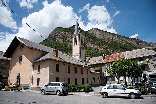
Local Culture: As you hike, take the time to explore Meyronnes itself, known for its charming architecture and local cuisine. It's a great place to experience traditional mountain life.
-
Preparation: Always prepare adequately for your hike. Bring sufficient water, snacks, and gear appropriate for the conditions. It's also advisable to have a map or a GPS device to navigate the trails effectively.
-
Guided Tours: If you're unfamiliar with the area or prefer guided experiences, consider joining a local hiking group or hiring a guide who can provide insights about the local environment and history.
Remember to follow Leave No Trace principles to minimize your impact on nature and ensure that these beautiful trails remain pristine for future hikers. Enjoy your hiking adventure in Meyronnes!
- Country:

- Postal Code: 04530
- Coordinates: 44° 28' 35" N, 6° 47' 57" E


- GPS tracks (wikiloc): [Link]
- Area: 40.59 sq km
- Population: 60
- Wikipedia en: wiki(en)
- Wikipedia: wiki(fr)
- Wikidata storage: Wikidata: Q1018613
- Wikipedia Commons Category: [Link]
- Freebase ID: [/m/03m7ww_]
- Freebase ID: [/m/03m7ww_]
- GeoNames ID: Alt: [2994058]
- GeoNames ID: Alt: [2994058]
- INSEE municipality code: 04120
- INSEE municipality code: 04120
Shares border with regions:

Larche
- former commune in Alpes-de-Haute-Provence, France
L'Arche, located in the Alpes-de-Haute-Provence region of France, is a fantastic destination for hiking enthusiasts. The area is characterized by its stunning landscapes, varied terrain, and the rich natural beauty of the French Alps. Here are some key highlights about hiking in Larche:...
- Country:

- Postal Code: 04540
- Coordinates: 44° 27' 5" N, 6° 50' 48" E


- GPS tracks (wikiloc): [Link]
- Area: 68.86 sq km
- Population: 55
Acceglio
- Italian comune
Acceglio is a beautiful village located in the Piedmont region of Italy, nestled in the stunning Susa Valley of the Cottian Alps. Known for its picturesque landscape, rich flora and fauna, and traditional alpine architecture, it serves as an excellent base for hiking enthusiasts....
- Country:

- Postal Code: 12021
- Local Dialing Code: 0171
- Licence Plate Code: CN
- Coordinates: 44° 29' 0" N, 6° 59' 0" E


- GPS tracks (wikiloc): [Link]
- AboveSeaLevel: 1200 м m
- Area: 151.53 sq km
- Population: 155
- Web site: [Link]

Jausiers
- commune in Alpes-de-Haute-Provence, France
Jausiers is a charming village located in the Alpes-de-Haute-Provence region of France. It's nestled in the heart of the French Alps and offers attractive hiking opportunities for outdoor enthusiasts. Here are some highlights about hiking in and around Jausiers:...
- Country:

- Postal Code: 04850
- Coordinates: 44° 25' 4" N, 6° 43' 50" E


- GPS tracks (wikiloc): [Link]
- Area: 107.73 sq km
- Population: 1133
- Web site: [Link]

La Condamine-Châtelard
- commune in Alpes-de-Haute-Provence, France
 Hiking in La Condamine-Châtelard
La Condamine-Châtelard is a picturesque village located in the Alpes-Maritimes region of France, near the Italian border. It's a part of the larger area of the French Alps, known for its stunning natural landscapes and outdoor recreational opportunities, including hiking....
- Country:

- Postal Code: 04530
- Coordinates: 44° 27' 29" N, 6° 44' 45" E


- GPS tracks (wikiloc): [Link]
- AboveSeaLevel: 1305 м m
- Area: 56.08 sq km
- Population: 172

Saint-Paul-sur-Ubaye
- commune in Alpes-de-Haute-Provence, France
 Hiking in Saint-Paul-sur-Ubaye
Saint-Paul-sur-Ubaye is a charming commune in the Alpes-de-Haute-Provence region of France, nestled in the Ubaye Valley. It's an excellent destination for hiking enthusiasts due to its stunning natural landscapes, alpine scenery, and rich biodiversity. Here’s what you can expect when hiking in this area:...
- Country:

- Postal Code: 04530
- Coordinates: 44° 31' 0" N, 6° 45' 0" E


- GPS tracks (wikiloc): [Link]
- Area: 205.55 sq km
- Population: 200
- Web site: [Link]